Download
1 / 25
250 likes | 396 Views
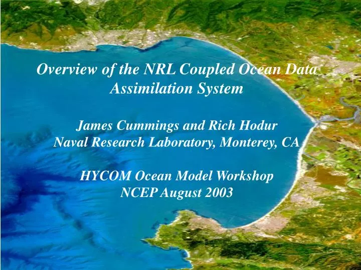
Overview of the NRL Coupled Ocean Data Assimilation System James Cummings and Rich Hodur Naval Research Laboratory, Monterey, CA HYCOM Ocean Model Workshop NCEP August 2003. NRL Coupled Ocean Data Assimilation System. Advanced DA Technique Based on Optimal Estimation Theory

E N D
Overview of the NRL Coupled Ocean Data Assimilation System James Cummings and Rich Hodur Naval Research Laboratory, Monterey, CA HYCOM Ocean Model Workshop NCEP August 2003
NRL Coupled Ocean Data Assimilation System Advanced DA Technique Based on Optimal Estimation Theory • oceanographic version of MVOI method used in NWP systems Lorenc (1981), Daley (1991) • simultaneous analysis of five ocean variables: temperature, salinity, geopotential, and u-v velocity components (T, S, F, u, v) • developed as part of the coupled modeling projects at NRL MRY (COAMPS and NOGAPS/POP) Flexible System • supports variety of map projections • performs multi-scale analyses on nested, successively higher resolution grids • initialize/update ocean forecast model or run stand-alone • 2D analyses of sea ice and SST (NWP boundary conditions) • 3D temperature and salinity analysis (geostrophic currents) • 3D MVOI sequential incremental update cycle
NRL Coupled Ocean Data AssimilationSequential Incremental Update CycleAnalysis-Forecast-Analysis Ocean Obs MCSST GOES SST LAC SST Ship SST Buoy SST XBT, CTD PALACE Float Fixed Buoy Drift Buoy Altim SSHA SSM/I Sea Ice Ocean QC Innovations 3D MVOI Increments Ocean Model First Guess Forecast Fields Prediction Errors Forecast fields and prediction errors can be used in the QC of new data
Background Error Covariances Error covariances are separated into an error variance and an error correlation • background error variances • vary by position, depth and analysis variable • evolve with time, updated continuously using OmF innovations • background error correlations • separable formulation, correlations are a product of a horizontal and a vertical correlation • horizontal correlations are multivariate in geopotential and velocity, non-homogenous and anisotropic • vertical correlations are computed from the background vertical density gradients, and evolve with time • length scales are large (small) when the stratification is weak (strong)
Multivariate Horizontal Correlations geopotential <FF> and velocity cross correlations <Fu>, <Fv> u,v velocity <uu>, <vv> and cross correlations <uv> warm colors are positive correlations - cool colors are negative correlations
Horizontal Correlation Length Scales Default geopotential, temperature and salinity correlation length scales are computed proportional to Rossby radius of deformation. ~10 km at poles >200 km at equator (Chelton et. al. (1998), J. Phys. Oceanogr. 28: 433-460)
Vertical Correlation Length Scales Mixed Layer Thermocline Isothermal Layer Example of vertical correlations computed from vertical density gradients. Length scales are large in weakly stratified surface mixed and deep isothermal layers, and small in the more highly stratified main thermocline.
Integrated Analysis and Ocean Data Quality Control System Quality Control is Fully Automated and Performed in Stages Stage I : sensibility checks • land/sea boundary checks (400 m database resolution) • location (speed) test for drifters and ship (aircraft) observations • exact and near-dup duplicate tests • observations failing sensibility checks are removed from the system Stage II : gross error checks • instrumentation error, vertical gradient, static stability checks • cross validation checks (e.g. SST vs sea ice) • background field checks against climate, previous analysis/forecast • buoy (float) sensor drift • satellite SST large scale aerosol/dust bias detection • outcome is in the form of a probability of gross error plus QC flags • all gross error checks performed before decision to accept/reject is made Stage III : consistency checks • innovation error checks performed within analysis
Operational Ocean Observation Data Sources • AVHRR GAC Satellite SST~800,000 obs/day • 8-km resolution (NOAA 16,17 day, night, relaxed day retrievals) • AVHRR LAC Satellite SST~3,200,000 obs/day • 2-km resolution (NOAA 16,17 day, night retrievals) • GOES Satellite SST~3,700,000 obs/day • 12-km resolution (GOES 10 day, night retrievals) • In Situ SST/SSS~15,000 obs/day • surface ship, fixed and drifting buoys, CMAN, TRACKOB • Subsurface Temperature and Salinity Profiles~1000 profiles/day • XBTs, CTDs (TESACS), PALACE floats • fixed buoys (TAO, PIRATA), thermistor chain drifting buoys • Sea Surface Height Anomaly (SSHA)~100,000 obs/day • altimeter (GFO, Jason), XBTs, CTDs, PALACE Floats • Sea Ice Concentration~1,000,000 obs/day • SSM/I (DMSP F13, F14, F15)
Approaches to Altimeter SSH Assimilation • 1. Direct assimilation (modified form of Cooper Haines method) • adjusts model density profile to be consistent with change in model forecast sea surface height measured by the altimeter • temperature and salinity adjustments are computed simultaneously, water mass properties on subsurface isopycnals are conserved • 2. MODAS synthetic BTs • computes temperature at depth from SSHA using stored regressions of anomalies of climatological temperature and dynamic height • salinity is computed from the synthetic temperatures using climatological temperature-salinity relationships • In both approaches, synthetic profiles are generated where the change in SSH exceeds altimeter measurement errors (~2 cm) • Synthetic profiles are assimilated with “real” observations, but unique observation errors are specified
Altimeter Data Assimilation - Synthetic Profile Sampling Sampling pattern of synthetic profiles (blue) generated to capture observed changes in SSH. Synthetic profiles are not generated near in situ profiles. Analyzed change in SSH (cm) measured by satellite altimeters. Changes greater than +/- 2 cm are considered significant and are shown as color filled contours.
Analysis Code Structure • Analysis system consists of three executables • innovation prep - includes pre-processing observations (OpenMP) • MVOI analysis (MPI) • post processing - includes validation and verification procedures (OpenMP) • Analysis can be run on different horizontal grid than forecast model • innovation prep and post processing are executed on model grid, analysis is executed on model grid or a reduced horizontal resolution grid (2:1 or any reduction ratio) • allows for increased efficiency on very high resolution model grids • Problem solved in overlapping analysis volumes • number and size of analysis volumes change with data density and background correlation length scales to ensure smooth increments
Satellite SSTs (n=295,715) In Situ SSTs (n=8,686) Load balance of global sea ice and SST analysis using 32 processors on a SGI O2K. The analysis grid is 1/9 deg Mercator projection (12 km at equator) and has been cycled using a 12 hr update cycle. SST analysis residual RMS error = 0.19 oC. Number of sea ice analysis volumes is 2,196 and the number of SST analysis volumes is 3,295. 1 16 32
9 km 27 km 81 km COAMPS SST Analyses for Triply-Nested Eastern Pacific Area Valid Time: 0000 UTC 1 July 1999
Status and Plans Status • quality control operational at FNMOC • 2D SST and sea ice analyses operational at FNMOC for Navy NWP systems • 3D temperature salinity analysis at FNMOC (OPTEST 1QFY04) • quality control at NAVOCEANO (OPTEST 3QFY04) • data assimilation upgrade to SWAFS model at NAVOCEANO (OPTEST 3QFY04) Plans • wave model data assimilation (Wave Watch III) at FNMOC • conversion to 3DVAR algorithm, leverage NAVDAS solver • implement limited 4D capabilities in 3DVAR • flow dependent correlations • non-separable background error correlations • generalize vertical coordinate for innovations and analysis z (POP), sigma (SWAFS), hybrid (HYCOM)
Overview of the NRL Coupled Ocean Data Assimilation System James Cummings and Rich Hodur Naval Research Laboratory, Monterey, CA HYCOM Ocean Model Workshop NCEP August 2003 The End
Global Wave Model Data Assimilation – 20 June 2003 18Z Analyzed SWH Increment (M) Altimeter SWH Observations Forecast Model SWH (M) Corrected Model SWH (M)
Flow Dependent Correlations Example of flow dependent correlations from simple use of density rather pressure as vertical coordinate in the analysis. Observation is located at the surface in the frame on the left, and at 300 meters in the frame on the right. Geopotential <FF> correlations (color shaded) drop off rapidly when temperature contours (1oC) are crossed.
Following slides give examples of analysis on 18 km Lambert grid in western North Pacific. Analysis has been cycling on itself for ~2 months.
In Situ SST Satellite SST SSH Change Temp/Salt Profiles MVOI Analysis 30 July 2002 00Z
Temperature Increment Salinity Increment Geopotential Increment Velocity Increment
Temperature 100 M Salinity Velocity Geopotential
Parameterization, Monitoring, Validation Routine Monitoring and Validation Built into Analysis System Statistic Files • RMS and mean bias for analysis variables and observing systems • Jmin diagnostics for analysis variables and observing systems • statistics are saved for 240 update cycles in a sliding time window Innovation Vector Files • observation-minus-forecast (OmF) innovations • compute model errors, forecast skill at update cycle • derive statistical parameters needed in the OI analysis • observation-minus-analysis (OmA) residuals • monitor analysis system performance • determine fit of the analysis to observations and observing systems • observation-minus-climatology (OmC) anomalies • innovation vector files are saved every update cycle
Operational Ocean Data Assimilation Issues • system is run in real-time • timeliness of receipt of observations is critical • efficient, robust ocean QC and DA methods are required • quality control • error statistics represent average rather than extreme conditions • rejecting good, but extreme, data can miss important events • need for adaptive methods as in NWP systems • sparse ocean observations require good gross error checks • skill / usefulness of ocean models in QC still a big unknown • biases, resolution, lack of variability are key issues • analysis / model • improve knowledge of priors (error covariances) • determine ocean model forecast skill, model biases