Download
1 / 36
0 likes | 1 Views
<br>GSSCORE- Topic-wise current affairs on geography are vital for UPSC and GSSCORE due to their role in enhancing candidates' understanding of geographical concepts and trends. These thematic current affairs, like the ones found on Topic Wise Current Affairs Georaphy, provide in-depth knowledge, aiding aspirants in tackling geography-related questions in competitive exams effectively. Stay updated for success.Register Now!!<br><br>

E N D
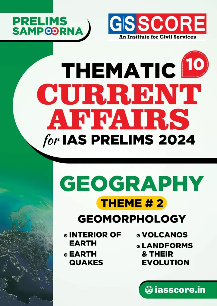
Content Content 1. INTERIOR OF EARTH .................................................................01-11 Mantle and related phenomenon ........................................................... 01 New map of Earth’s tectonic plates ........................................................ 04 Earth’s inner core stopped spinning and reversing .............................. 05 Earth’s tilt & impact on cold days ........................................................... 06 NISAR satellite to map Himalayas’ Seismic Zones ................................ 07 Scientists discover “Pontus plate” .......................................................... 09 2. EARTHQUAKES .........................................................................12-18 Turkey & its relation to earthquakes ...................................................... 13 Earthquakes in Afghanistan .................................................................... 14 Earthquakes in Indonesia ........................................................................ 15 Massive Earthquake tremors in Delhi .................................................... 16 Micro-earthquakes event in India ........................................................... 17 Udhampur gets earthquake observatory .............................................. 18 3. VOLCANOS ...............................................................................19-26 Volcanoes are to blame for Mass Extinction Cycles: Scientists ........... 19 Ring of Fire ................................................................................................ 20 Vanuatu islands ......................................................................................... 21 Mayon volcanic Eruption .......................................................................... 22 Kilauea volcano ......................................................................................... 22 Mauna Loa Volcano ................................................................................... 23 Borealis Mud Volcano ............................................................................... 24 4. LANDFORMS & THEIR EVOLUTION .............................................27-29 Coastal Red Sand Dunes ........................................................................... 27 Land Creep in Joshimath .......................................................................... 28
THEMATIC CURRENT AFFAIRS UPSC CSE Prelims exam requires a candidate to link and interlink Current Affairs with the syllabus and the static concepts. It’s important to note that simply compiling current affairs won’t suffi ce; it’s crucial to learn how to utilize and link them effectively. To aid in this process, we have categorized the entire UPSC prelims syllabus into actionable and easy-to-understand themes, and current affairs have been blended into these themes. Thematic Current Affairs will help you in: Division of entire syllabus- theme wise Revision of concepts and current affairs together Developing the skill to interlink theory and contemporary developments Concise and precise information for quick coverage Join our Telegram Channel for Peer to Peer Discussion Prelims Sampoorna 2024 UPSC CSE Current Affairs
1 Interior of Earth CONTEXT Researchers trying to uncover the secrets of Earth’s geology have revealed the fi fth layer of the planet. Seismic waves generated by earthquakes have revealed new insights about the deepest parts of Earth’s inner core. About: The Earth has four layers namely: The solid crust on the outside The mantle The core — split between the outer core and the inner core. The everything can see and study directly. crust is we The thinnest layer of the Earth, the crust still measures about 40 km on average, ranging from 5–70 km (~3–44 miles) in depth. But at the scale of the planet, that’s less than the skin of an apple. There are two types of crust: Continental and Oceanic crust. Geomorphology
Oceanic crust can be found at the bottom of the oceans or below the continental crust; it is generally harder and deeper, consisting of denser rocks like basalt, while continental crust contains granite-type rocks and sediments. The continental crust is thicker on land. Key highlights of the study: The mantle: The research has revealed that the mantle normally is a 2,900 km thick layer of solid rock sandwiched between the Earth’s upper crust and lower core — has been hiding two layers inside it. One is the “low viscosity” zone in the upper mantle, roughly 100 kilometres in thickness. The other layer is the ‘low-velocity zone’, which is also a part of the upper mantle. The low viscosity zone coincides with the transition zone between the upper and the lower mantle. It was also found that mantle covers the largest area inside the earth of about 44% of the earth. What are Seismic Waves? Seismic waves are caused by the sudden movement of materials within the Earth, such as slip along a fault during an earthquake. Volcanic eruptions, explosions, landslides, avalanches, and even rushing rivers can also cause seismic waves. Seismic waves travel through and around the Earth and can be recorded with seismometers. Earthquote energy travels as seismic waves through the Earth. These are the three main types of seismic waves Types of seismic waves: There are three basic types of seismic waves – P-waves, S-waves and surface waves. P-waves and S-waves are sometimes collectively called body waves. P-waves: known as or pressure waves, travel at the greatest velocity through the Earth. When they travel through air, they take the form of sound waves – they travel at the speed of sound (330 ms-1) through air but may travel at 5000 ms-1 in granite. S-waves: S-waves, also known as secondary waves, shear waves or shaking waves, are transverse waves that travel slower than P-waves. S-waves cannot travel through air or water but are more destructive than P-waves because of their larger amplitudes. Surface waves: Surface waves are similar in nature to water waves and travel just under the Earth’s surface. They are typically generated when the source of the earthquake is close to the Earth’s surface. (Secondary waves) follow, moving only through rock and oscillating up and down or side to side. (Primary waves) are the initial waves detected, pushing and pulling as they travel through rock and fl uids. P-waves, primary also waves Surface waves (come after P and S waves) cause the msot damage as they travel along the earth’s surface. These include Love waves (fast, side-to-side ground movement) and Rayleign waves (rolling like waves on water) Geomorphology
Explainer: Earth — layer by layer The earth is made up of three different layers: the crust, the mantle and the core. Earth Crust The outermost surface part of earth is called earth crust. It is also known as Lithosphere. It is subdivided into three parts, viz., Continental Crust, Oceanic Crust, and Crust of transitional type. Continental Crust is the part of continental region of the earth surface. Main rock forming substances of continental crust are Silica and Aluminium, hence it is called ‘Sial’. Oceanic Crust refers the part of oceanic region under the continental crust, with a depth of about 5 to 7 km. Main rock forming substances of oceanic crust are Silica and Magnesium for which it is also called as ‘Sima’. The upper portion of oceanic crust is developed by sedimentary rocks, and the lower portion is with Basalt. EARTH’S LITHOSPHERE CONTINENTAL CRUST OCEANIC CRUST Crust of transitional type refers to an intermediate region of aforementioned two divisions, having a mixed characteristics of both of that. This includes the continental shelf regions, islands etc. Mantle Mantle is the middle part of earth crust and centrosphere. It is divided into two parts, e.g. Upper Mantle, and Lower Mantle. The mantle is about 2,900 kilometers (1,802 miles) thick, and makes up a whopping 84 percent of Earth’s total volume. Upper Mantle Lower Mantle About It begins at the Moho boundary, which marks the point deep in the earth where the crust transitions into the mantle. It begins at around 660 kilometres below the surface of the earth. Dynamics It extends from the crust to a depth of about 410 kilometers (255 miles). It extends from 1,000 km. to 2,900 km. Chromium (Si), Magnesium (Mg). Hence it is called 'Crofesima'. (Cr), Iron (Fe), Silica Nickel (Ni), Iron (Fe), Silica (Si), Magnesium (Mg). So this layer is called 'Nifesima'. Composition Geomorphology
Atmosphere Crust Mohorovicic discontinnuity Upper mantle Lower mantle Mantle Outer core Inner core Centrosphere It is the core of earth. Earth’s core is the deepest, hottest layer. Centrosphere occupies the 17% to total volume, and 34% of total mass of earth. Centrosphere is divided into two parts: Outer Core, and Inner Core. Aspect Outer Core Inner Core State of Matter Liquid Solid Composition Chromium (Cr), and Iron (Fe). Thenceforth it is called 'Crofe'. Nickel (Ni), and Iron (Fe). Hence it is called 'Nife'. Dynamics It starts at around 1,800 miles (2,900 kilometers) deep and ends at 3,200 miles (5,150 km) beneath the surface It is estimated to be about 1221 km in radius (2442 km in diameter). CONTEXT Researchers have carried out a new study that includes an updated map of the earth’s tectonic plates. It sheds light on how past continents were formed by tectonic movements; new micro plates have been added with existing plates. Geomorphology
What is plate tectonics? 15 major Tectonic Plates: African Plate Antarctic Plate Arabian Plate Australian Plate Caribbean Plate Cocos Plate Eurasian Plate Indian Plate Juan de Fuca Plate Nazca Plate North American Plate Pacifi c Plate Philippine Plate Scotia Plate South American Plate In plate tectonics the outermost part of the Earth – the crust and uppermost mantle – are viewed as acting as a single mechanical layer, the lithosphere. The lithosphere is divided into separate “plates” that move relative to each other on the underlying, relatively weak asthenosphere in a process ultimately driven by the continuous loss of heat from the Earth’s interior. There are three main types of plate boundaries: Divergent, where plates move apart from each other and new lithosphere is formed in the process of sea-fl oor spreading; Transform, where plates slide past each other, and Convergent, where plates converge and lithosphere is “consumed” by the process of Subduction. Lithosphere Continental Crust Mid-Ocean Ridge The lithosphere is the outermost layer of Earth, composed of the crust and the brittle part of the upper mantle. Lithosphere Oceanic Crust Lab Mantle Asthenosphere The lithosphere can be divided into two varieties: oceanic and continental. Outer Core Core Oceanic crust is relatively thin and dense. It is mainly composed of basalt rock rich in silica and magnesium. Continental crust, on the other hand, is mainly composed of granite rocks rich in silica and aluminum and can reach thicknesses of up to 190 miles (300 km). Asthenosphere is a zone of Earth's mantle lying beneath the lithosphere. CONTEXT According to a new research, published in the journal ‘Nature Geoscience’, the inner core of Earth seems to have stopped spinning in the same direction as the rest of the planet. Geomorphology
Key-fi ndings of the Study Earth’s inner core, seems to have been spinning in the opposite direction in comparison to the rest of the planet. The rotation of the inner core that is the hot iron ball, which is around the size of Pluto “came to near halt around 2009 and then turned in an opposite direction. According to Researchers, the inner core rotates, relative to the Earth’s surface, back and forth, just like a swing. One cycle of the swing is of around seven decades. This means that it changes direction after every 35 years. It changed its direction earlier in the early 1970s and the same may happen again in the mid-2040s. This rotation lines up with changes in what is called the “length of day”, the small variations in the exact time it takes the Earth to rotate on its axis. Crust Mantle About Earth’s inner core Outer core Earth’s inner core is the fourth layer inside the Earth. It is a solid metallic ball made mainly of iron. Inner core Although the inner core is very hot (7200-8500 degree F), it is not liquid like the outer core. The inner core is very solid due to the pressure caused by the weight put on it by the Earth’s other three layers (crust, mantle and the outer core). CONTEXT Above the equator, winter offi cially begins in December, but in many areas, January is when it really takes hold which is mainly due to the earth’s tilt and it seems to be different for different locations on earth. About the earth’s axial tilt: Earth’s axial tilt (also known as the obliquity of the eclip? c) is about 5 degrees. Due to this axial tilt, the sun shines on different latitudes at different angles throughout the year. The earth’s spin axis is ? lted with respect to its orbital plane. This is what causes the seasons. When the earth’s axis points towards the sun, it is summer for that hemisphere. When the earth’s axis points away, winter can be expected. Geomorphology
How does the Earth’s orbit infl uence our daylight and temperatures? As the Earth orbits the sun, it spins around an axis from the North Pole to the South Pole. During the 24 hours that it takes for the Earth to rotate once around its axis, every point on its surface faces toward the Sun for part of the time and away from it for part of the time. This is what causes daily changes in sunlight and temperature. There are two other important factors: First, the Earth is round, although it’s not a perfect sphere. Second, its axis is ? lted about 23.5 degrees relative to its path around the Sun. As a result, light falls directly on its equator but strikes the North and South poles at angles. When one of the poles points more toward the Sun than the other pole, that half of the planet gets more sunlight than the other half, and it’s summer in that hemisphere. When that pole tilts away from the Sun, that half of the Earth gets less sunlight and it’s winter there. CONTEXT NISAR satellite is going to map the most earthquake-prone regions in the Himalayas with unprecedented regularity and aims to build an advance warning system of land subsidence and earthquakes. NISAR satellite was jointly developed by the Indian Space Research Organisation (ISRO) and the National Aeronautics and Space Administration (NASA) of the U.S. NISAR is expected to be launched in January 2024 from Satish Dhawan Space Centre into a near-polar orbit. About the map: Need of the ini? a? ve: A large section of the Himalayan region falls in Zone V, implying the highest risk of strong earthquakes. Strain Strain refers to the deformation that occurs in rocks when it is under pressure from other rocks, usually due to movements of continental plates that are sliding, colliding, or subducting against each other. The Indian Plate, for instance, collided into the Eurasian plate forming the Himalayas and continues to incrementally push it upwards. The NISAR satellite will use two frequency bands: the L-band and S-band to image the Himalayan region. Geomorphology
The geoscience community can use this to determine how strain is building up in various parts of the Himalayas. These two frequency bands will together provide high-resolu? on, all-weather data from the satellite that is expected to follow a sun-synchronous orbit and will be launched in January 2024. About NISAR: NISAR stands for NASA-ISRO Synthe? c Aperture Radar. It is an Earth observa? on satellite. The 2,800 kilograms satellite consists of both L-band and S-band synthe? c aperture radar (SAR) instruments, which makes it a dual-frequency imaging radar satellite. NASA has provided the L-band radar, GPS, a high-capacity solid-state recorder to store data, and a payload data subsystem. And the ISRO has provided the S-band radar, the GSLV launch system and spacecraft. Another important component of the satellite is its large 39-foot stationary antenna refl ector It is made of a gold-plated wire mesh, the refl ector will be used to focus the radar signals emitted and received by the upward-facing feed on the instrument structure. Emergence of Himalayas: About 225 million years ago, India was a large island still situated off the Australian coast, and a vast ocean (called Tethys Sea) separated India from the Asian continent. When Pangaea broke apart about 200 million years ago, India began to forge northward. By studying the history -- and ultimately the closing-- of the Tethys, scientists have reconstructed India’s northward journey. About 80 million years ago, India was located roughly 6,400 km south of the Asian continent, moving northward at a rate of about 9 m a century. When India rammed into Asia about 40 to 50 million years ago, its northward advance slowed by about half. The collision and associated decrease in the rate of plate movement are interpreted to mark the beginning of the rapid uplift of the Himalayas. Himalayas and vulnerability: The Himalaya is a fragile mountain range that is still rising as the Indian plate continues to push into the Asian plate. The mountains are mainly the shale upwelling of the sea, which makes them quite unstable. In fact, they are largely held together by the forests that they support. Geomorphology
CONTEXT Scientists discover a long-lost tectonic plate ‘Pontus’, an ancient mega-plate that disappeared 20 million years ago. What is Pontus (Key-Findings)? Pontus is a tectonic plate that existed around 150 million years ago in the western Pacifi c. Size: Called Pontus, the ‘mega-plate’ was once 15 million square miles, about a quarter the size of the Pacifi c Ocean today. But over time it was subducted into Earth’s mantle and eventually lost. Name game: Scientists have dubbed it the “Pontus plate” because at the time of its existence, it sat under an ocean known as the Pontus Ocean. Location: The plate is known only from a few rock fragments from the mountains of Borneo and the ghostly remnants of its huge slab detected deep in Earth’s mantle. In addition to northern Borneo, Pontus plate relics were found in Palawan, an island in the Western Philippines, and the South China Sea. The study was published in the journalGondwana Research. Why did it disappear? Pontus has been gradually subducted beneath the earth over the last millions of years. Scientists believe this gravitational force came from a neighboring plate. In the ancient geological past, large plates have since disappeared into Earth’s mantle by means of ‘subduction’. Subduction Subduction is the geologic process in which one edge of one lithospheric plate is forced below the edge of another – and over time an entire plate can be lost. Crucially, a sub-ducted plate leaves behind traces when it 'sinks' into Earth's mantle – namely, fragments of rock hidden in mountain belts. It is an ongoing process. Geomorphology
What led to the discovery? Background: Scientists predicted the existence of the Pontus about a decade ago. The prediction came after they discovered fragments of old tectonic plates deep in the Earth’s mantle. In the current study, scientists reconstructed the lost plates by combining fi eld research with extensive investigations of Japan, Borneo, the Philippines, New Guinea, and New Zealand Mountain belts. These areas were believed to be the “most complicated plate tectonic region.” What are Tectonic Plates? Plate tectonics is a scientifi c theory that explains how major landforms are created as a result of Earth’s subterranean movements. The theory, which solidifi ed in the 1960s, transformed the earth sciences by explaining many phenomena, including mountain building events, volcanoes, and earthquakes. In plate tectonics, Earth’s outermost layer, or lithosphere—made up of the crust and upper mantle—is broken into large rocky plates. These plates lie on top of a partially molten layer of rock called the asthenosphere. Due to the convection of the asthenosphere and lithosphere, the plates move relative to each other at different rates, from two to 15 centimeters (one to six inches) per year. This interaction of tectonic plates is responsible for many different geological formations such as the Himalaya mountain range in Asia, the East African Rift, and the San Andreas Fault in California, United States. Convergent Boundaries A convergent plate boundary is formed by tectonic plates crashing into each other. Convergent often the heavier plate slips under the lighter plate, creating a deep trench. This subduction the dense mantle into buoyant magma, which rises through the crust to Earth’s surface. Over millions of years, the rising magma creates a series of active volcanoes known as a volcanic arc. boundaries zones, are subduction where changes material Divergent Boundaries A divergent boundary is formed by tectonic plates pulling apart from each other. Geomorphology
Transform Boundaries A transform boundary is formed as tectonic plates slide horizontally past each other. Parts of these plates get stuck at the places where they touch. Stress builds in those areas as the rest of the plates continue to move. This stress causes the rock to break or slip, suddenly lurching the plates forward and causing earthquakes. These areas of breakage or slippage are called faults. Geomorphology
2 Earthquakes Brushing Basics (Earthquake) An earthquake is the shaking of the surface of the Earth, resulting from the sudden release of energy in the Earth‘s lithosphere that creates seismic waves. Earthquake is the form of energy of wave motion transmitted through the surface layer of the earth. It may be due to faulting, folding, plate movement, eruptions and factors like dams and reservoirs. According to the National Disaster Management Authority, happens due to the release of the transmitted pressure of moving lithospheric or crustal plates. According to seismic zoning mapping, earthquake zones are divided on the basis of the estimation of the intensity of the earthquake. India is divided into 4 Zones: Zone 2, Zone 3, Zone 4, and Zone 5. While Zone 2 is the least dangerous, Zone 5 is the most dangerous. Nearly, 59% of India’s land area is under a moderate to severe seismic hazard warning, which means that India is prone to earthquakes of magnitude 7 and above. volcanic anthropogenic this Geomorphology
CONTEXT Recently, Turkey witnessed a 7.8 magnitude earthquake which is one of the most powerful earthquakes in the past two decades with more than 1,300 people killed and thousands still believed to be trapped under rubble. What makes Turkey a hotbed of seismic activity? Turkey is frequently shaken by earthquakes. Turkey’s proneness to earthquakes comes from its tectonic loca? on. Turkey, a hotbed of seismic activity, sits on the Anatolian Plate, which borders two major faults as it grinds northeast against Eurasia. Tectonic plates: The Earth’s outermost layer comprises some 15 major slabs, called tectonic plates. The boundaries between these plates are a system of faults – fractures between two blocks of rocks. Any sudden movement along these faults can cause earthquakes. The North Anatolian fault traverses the country from west to east, and the East Anatolian fault, rests in the country’s south-eastern region. The North Anatolian fault (NAF) line, the meeting point of the Eurasian and Anatolian tectonic plates — is known to be “par? cularly devasta? ng”. The NAF, one of the best-understood fault systems in the world, stretches from the south of Istanbul to north-eastern Turkey and has caused catastrophic earthquakes in the past. The loca? on: Turkey is a country that occupies a unique geographic position, lying partly in Asia and partly in Europe. Throughout its history it has acted as both a barrier and a bridge between the two continents. Turkey is situated at the crossroads of the Balkans, Caucasus, Middle East, and eastern Mediterranean. It is among the larger countries of the region in terms of territory and population, and its land area is greater than that of any European state. The country has a north-south extent that Geomorphology
ranges from about 300 to 400 miles (480 to 640 km), and it stretches about 1,000 miles from west to east. The capital is Ankara, and its largest city and seaport is Istanbul. Turkey is bounded on the north by the Black Sea, on the northeast by Georgia and Armenia, on the east by Azerbaijan and Iran, on the southeast by Iraq and Syria, on the southwest and west by the Mediterranean Sea and the Aegean Sea, and on the northwest by Greece and Bulgaria. Occurrence of Earthquakes: Types of earthquakes: An earthquake is the shaking of the earth. It is a natural event. Tectonic earthquakes Volcanic earthquakes It is caused due to release of energy, which generates waves that travel in all directions. Human-induced earthquakes The vibrations called seismic waves are generated from earthquakes that travel through the Earth and are recorded on instruments called The location below the earth’s surface where the earthquake starts is called the hypocenter, and the location directly above it on the surface of the earth is called the epicenter. CONTEXT Over 2,000 people lost their lives, after a powerful earthquake hit western Afghanistan, near the Iranian border. What Makes Afghanistan, the Epicenter of Earthquakes? Afghanistan is located in a region where several tectonic plates meet, making it susceptible to seismic activity. As it is located in the mountainous Hindu Kush region, part of the Alpide Belt, the second most seismically active region in the world after the Pacifi c Ring of Fire, it stretches from the Mediterranean to Southeast Asia. This belt is formed by the collision of the Eurasian and African plates in the west and the Indo- Australian and Eurasian plates in the east. As these plates move, they create pressure and tension that eventually result in earthquakes. The region is situated on the boundary between the Indian, Eurasian & Arabian tectonic plates. The Indian plate moves northwards and is pushed against the Eurasian plate, causing it to move westwards. This movement results in the formation of the Hindu Kush mountain range, which runs through Afghanistan and Pakistan. The collision of these plates creates seismic waves, that results in earthquakes. Geomorphology
What is Epicentre? Epicentre is the location just above the hypocentre on the earth. Hypocentre is the location below the earth’s surface where the earthquake starts. CONTEXT The recent Earthquake (Magnitude 5.6) in West Java province of Indonesia led to massive devastation in the island country. The Location: The Island is prone to frequent earth quakes, Tsunamis, volcanic eruptions. West Java is a province of Indonesia on the western part of the island of Java, with its provincial capital in Bandung. West Java is bordered by the country’s capital region of Jakarta to the west, the Java Sea to the north, the province of Central Java to the east and the Indian Ocean to the south. Tectonics and seismicity of Jakarta and adjacent areas is highly infl uenced by the convergence of the Australian Plate toward the Eurasian Plate. Geographic factors Responsible for Earthquakes in the region: Ring of fi re: Indonesia is on the arc of volcanoes and fault lines in the Pacifi c Basin known as the ‘Ring of Fire’, it becomes one of the places where a majority of the world’s earthquakes occur. Movement of Fault lines: Due to number of rocks placed inside the island forms fault lines, they are continuously moving with respect to normal rocks. Hence, they can slide over each other easily and are not stiff. Geomorphology
A fault is a place with a long break in the rock that forms the surface of the earth. When an earthquake occurs on one of these faults, the rock on one side of the fault slips with respect to the other. Type of Soil: The Indonesian island is made of basically volcanic soil made up of ashes which is similar to black soil in India. This soil easily gets settled down and is easy to swell and shrink. The Structure holding capacity the soil is also poor. CONTEXT In Nepal, the fi rst quake of magnitude 4.6 struck the west region at a depth of 10 kilometre. Delhi also experienced two tremors. Why Delhi is vulnerable to earthquakes? National Centre for Seismology under Ministry of Earth Sciences is the nodal agency of Government of India (GoI), for monitoring earthquakes in and around the country. India is subdivided by the Bureau of Indian Standards (BIS) into four major seismic zones -- Zone V (high intensity) to Zone II (low intensity). Delhi-NCR falls in Zone IV, which is severe intensity zone. Delhi is located near three active seismic fault lines: Sohna, Mathura and Delhi-Moradabad. Gurugram is the riskiest area in Delhi-NCR as it is situated on seven fault lines. If these get active, a quake of high intensity is imminent. Such a quake would wreak havoc. Seismic zoning map Zone V is seismically the most active region Zone IV is called the High Damage Risk Zone Zone III is classifi ed as a Moderate Damage Risk Zone Zone II is the least * No area of India is classifi ed as Zone I. Distribution A total of 59% of the land mass of India (covering all states of India) is prone to earthquakes of different intensities. Geomorphology
11% area of the country falls in zone V 18% in zone IV 30% in zone III and remaining in zone II CONTEXT Micro tremors have been helping release tectonic stress and protecting India from a devastating event, experts said and asserted that the country has seen a paradigm shift towards effective response and mitigation. About India is witnessing micro tremors regularly which, in turn, is helping release tectonic stress and offering protection from the possibility of a devastating event. The triple junction on India’s western side near the border with Pakistan is continuously releasing stress due to the occurrence of micro-level earthquakes. There are a few earthquakes of magnitude 4 and 5 as well. Triple Junction A triple junction is a point where three tectonic plates meet and interact. These are important areas of geological activity and can be sites of signifi cant seismic and volcanic activity. The movement of the plates can cause a signifi cant build-up of stress and strain in the Earth's crust that is eventually released in the form of earthquakes. How prone is India to earthquakes? India is located in a seismically active region. India is divided into four seismic zones based on the potential for earthquake activity in each region. According to the Ministry of Earth Sciences, 59 per cent of India’s land mass is prone to earthquakes. Zone V is seismically the most active region, while Zone II is the least. Around 11 per cent of the country’s area falls in Zone V, 18 per cent in Zone IV and 30 per cent in Zone III and the remaining in Zone II. The zones are used to guide building codes and construction practices. Zone 5 is the zone where the most intense earthquakes occur, while the least intense quakes take place in zone 2. Approximately 11% of the country's area falls in Zone 5, 18% in zone 4, 30% in zone 3 and the remaining in zone 2. Geomorphology
CONTEXT The government recently inaugurated a seismological observatory in Udhampur, Jammu and Kashmir. About The National Centre for Seismology (NCS) in the Ministry of Earth Sciences (MoES) has initiated several new measures to upgrade and strengthen the infrastructural facilities. They aim to provide better scientifi c inputs required for improving disaster mitigation and preparedness measures. It has installed 152 permanent observatories throughout the country with and plans to install 100 more in the next fi ve years. It is part of an effort titled Seismic Microzona? on, which aims to generate vital geotechnical and seismological parameters for developing earthquake risk resilient building design codes for structures and infrastructures. What are earthquake observatories? eqServer is an automatic data management, real-time display and earthquake notifi cation system. About the Earthquake management Forecasting a probable timing, location, magnitude and other important features of a forthcoming seismic event is called earthquake predic? on. Various attempts have been made by seismologists and others to create effective systems for precise earthquake predic? ons, including the VAN method. Seismological instruments can generate large amounts of data. Systems for processing such data include: CUSP (Caltech-USGS Seismic Processing) RadExPro seismic software SeisComP3 Other earthquake observatories in India Currently, India has only 115 earthquake observatories. Some of them are: National Geophysical Research Institute (NGRI), Hyderabad Wadia Institute of Himalayan Geology (WIHG), Dehradun North East Institute of Science & Technology (NEIST), Jorhat Geomorphology
3 Volcanos CONTEXT Climate change that has occurred over the past 260 million years and brought about mass extinctions of life during these periods was due to massive volcanic eruptions and subsequent environmental crises, a team of scientists concludes. How volcanoes erupt? Volcanic eruptions occur as a result of heat moving under Earth’s surface. They often begin with an accumulation of gas-rich magma (molten underground rock) in reservoirs near Earth’s surface, though they may be preceded by emissions of steam and gas from small vents in the ground. A volcano starts to form when molten rock rises from a crack in the Earth’s surface, which often emerge along tectonic plate boundaries. Magma rises to the Earth’s surface because it’s lighter than rock. When it surfaces or erupts, it’s referred to as lava. Types of Volcanoes Shield Volcanoes Shield volcanoes are built slowly, from low-viscosity lava that spreads far and quick. The lava eventually dries to form a thin, wide sheet, and after repeated eruptions, a mount starts to form. From the top, these types of volcanoes look like a shield, hence the name. While these volcanoes take a while to form, they aren’t necessarily low. In fact, the world’s tallest active volcano, Mauna Kea in Hawaii, is a shield volcano. Geomorphology
Stratovolcanoes Also known as composite volcanoes, stratovolcanoes are built relatively fast, at least compared to shield volcanoes. This is because, in between lava eruptions, composite volcanoes emit ash and rock, which helps add structure to the mound rather quickly. Some well-known composite volcanoes are Mount Fuji in Japan, Mount St. Helens in Washington, and Mount Cotopaxi in Ecuador. Volcanic Domes Opposite to shield volcanoes, volcanic domes are formed when lava is highly-viscous. Because the thick lava can’t travel very far, it starts to pool around the volcano’s vent. This can sometimes create a pressure build-up, meaning dome volcanoes are prone to explosive eruptions. Cinder Cones These types of volcanoes typically don’t release lava. Rather, their eruptions typically emit volcanic ash and rocks, known as pyroclastic products. Cinder cones are characterized by a bowl-shaped crater at the top, and usually don’t exceed 400 m (1,312 ft) in height. CONTEXT Most of Earth’s volcanoes and earthquakes occur in regions that skirt the Pacifi c Ocean, known as the Ring of Fire. What is Ring of Fire? The Ring of Fire is a string of volcanoes and sites of seismic activity, or earthquakes, around the edges of the Pacifi c Ocean. Roughly 90 percent of all earthquakes occur along the Ring of Fire, and the ring is dotted with 75 percent of all active volcanoes on Earth. A string of 452 volcanoes stretches from the southern tip of South America, up along the coast of North America, across the Bering Strait, down through Japan, and into New Zealand. Important active volcanoes: Mount Ruapehu (New Zealand), Krakatau (Indonesia), Mount Fuji (Japan), Popocatépetl, Aleutian Islands Geography behind Ring of Fire The Ring of Fire is the result of plate tectonics. Tectonic plates are huge slabs of Earth’s crust, which fi t together like pieces of a puzzle. Geomorphology
The plates are not fi xed but are constantly moving atop a layer of solid and molten rock called the mantle. Sometimes these plates collide (convergent plate boundary), move apart (divergent boundary), or slide next to each other (transform boundary). Most tectonic activity in the Ring of Fire occurs in these geologically active zones. CONTEXT Vanuatu islands, located between Australia and Fiji, witnessed eruption of an active underwater volcano. Volcanoes in Vanuatu The nation made up of roughly 80 islands that stretch 1300 kilometres has a number of active volcanoes. Vanuatu is in the Pacifi c “Ring of Fire”, where tectonic plates collide. They have shown activity throughout the twentieth and twenty- fi rst century. Geomorphology
CONTEXT In January 2018, the Mayon Volcano experienced its most recent eruption. About The Mayon volcano, situated at the southernmost point of Luzon island, is the Philippines’ most active volcano. Located in the southern part of Luzon about 473 kilometers (294 miles) from Makati Business District of the Philippines, Mount Mayon is the main landmark of the Province of Albay of Bicol Region. Mayon Volcano is a Stratovolcano composite type volcano renowned for its perfect cone shape, can be seen in all eight cities and municipalities of Albay. CONTEXT Hawaii’s Kilauea volcano, one of the world’s most active, erupted again. About Kīlauea is the youngest and most active volcano on the island of Hawaiʻi, and one of the busiest in the world. Kilauea’s frequent eruptions are usually nonexplosive and are contained within Halema‘uma‘u as a boiling lake of active lava. Geomorphology
Kilauea is bordered by Mauna Loa volcano (west and north), the Ka‘ū Desert (southwest), ‘Āinahou Ranch (south), and a tropical fern jungle (north-northeast). CONTEXT Scientists and researchers have alarmed the residents of Hawaii Island as the world’s largest active volcano ‘Mauna Loa’ is at risk of eruption. The Mauna Loa volcano: It is the World’s largest active Volcano in the Island of Hawaii in the U.S. state of Hawaii in the Pacifi c Ocean. The volcano makes up 51% of the Hawaii Island landmass. It is an active shield volcano with relatively gentle slopes, with a volume estimated at 18,000 cubic miles (75,000 km3). Lava eruptions from Mauna Loa are silica-poor and very fl uid, and they tend to be non-explosive. Geomorphology
It last erupted in 1984 which led to destruction on the Island. What is Shield Volcano? A shield volcano is a broad volcano with sloping sides that is formed mainly out of runny lava that fl ows out of its central summit vent. Examples of Shield Volcanoes: are Mauna Loa on the Island of Hawaii, Wolf volcano on the Galapagos Islands, and Nyamuragira in the Democratic Republic of Congo. Characteristics: Basaltic magma is high in temperature, very low on silica, and with low gas content. Basic lava, which is non-acidic and very runny. Gentle sides as the lava fl ow for long distances before it solidifi es. No layers, as the volcano just consists of lava. CONTEXT Geologists have discovered a never-before-seen volcano at the bottom of the Barents Sea off the coast of Norway, which is erupting with mud, fl uids, and gas from the planet’s interior. The volcano has been named The Borealis Mud Volcano. About the new Volcano It is located in the Southwestern Barents Sea at the outer part of Bjornoyrenna (Outer Bear Island Trough). Geomorphology
The volcano has been seen to be erupting with fl uids rich in methane, which is a greenhouse gas responsible for the rising temperature of the planet due to global warming. What is underwater volcano? Most volcanic activity happens beneath the ocean. However, there is no specifi c difference in the formation of submarine (underwater) and subaerial (on land) volcanoes. Volcanoes form when molten rock is produced in the second layer of the Earth's interior — the mostly solid upper mantle — and makes its way through the crust. The collision of two plates can also cause a volcano. If both tectonic plates are beneath the ocean, then the volcano will develop underwater Geomorphology
4 Landforms & their Evolution CONTEXT Geologists have said that the coastal red sand dunes of Vizag have much signifi cance geologically, archaeologically, and anthropologically and it needs to be protected. About Coastal red sand dunes: Coastal red sand dunes are popularly known as Erra Matti Dibbalu. It is dissected and stabilized coastal red sediment mounds, Visakhapatnam and Bheemunipatnam in Andhra Pradesh. located between They have very low water and nutrient retention capacity. The dunes are susceptible to aerodynamic lift. This is the push that lets something move up. It is the force that is the opposite of weight. About Coastal red sand dunes: Coastal red sand dunes are popularly known as Erra Matti Dibbalu. It is dissected and stabilized coastal red sediment mounds, located between Visakhapatnam and Bheemunipatnam in Andhra Pradesh. They have very low water and nutrient retention capacity. The dunes are susceptible to aerodynamic lift. This is the push that lets something move up. It is the force that is the opposite of weight. Geomorphology
Recognition: Other Similar Places: Such sand deposits are rare and have been reported only from three places in the tropical regions in south Asia such as: Teri Sands in Tamil Nadu Erra Matti Dibbalu in Visakhapatnam Pulmoddai Sri Lanka This site was declared a geo-heritage site by the Geological Survey of India (GSI) in 2014. The Andhra Pradesh government listed it under the category of ‘protected sites’ in 2016. CONTEXT Joshimath, the ancient Uttarakhand town has become a cause of concern and was declared a ‘disaster prone region’. Reasons for Vulnerability of region: Joshimath is built on the deposits of an old landslide, which means the slopes can be destabilised even by slight triggers. The town is also in Zone V, denoting highest risk, in India’s seismic zonation scheme. It lies between two thrusts, the Main Central Thrust (MCT) and the Vaikrita Thrust (VT), and thus occupies a seismically active terrain. Main Central Thrust (MCT) line: In simplest terms, the MCT is a crack or geological fault in Himalayas. It is formed due to the collusion of Indo-Australian plate and Eurasian plate. The area underneath the MCT is particularly very fragile due to frequent tectonic activities. And, therefore, seismic activities are very common in MCT areas. Why Himalayan region is susceptible to disasters? The Hindu Kush Himalayan region is prone to numerous types of disasters because of its: Steep terrain fragile geology intense and variable precipitation Common incidents of fl oods and landslides neo-tectonic mountain-building process, like earthquakes, landslides, fl oods, etc Other factors: Overexploitation of the ecosystem(tourism, increased consumerism) Geomorphology
Exploitative development projects: The indiscriminate exploitation of the fragile Himalayan region in the name of development projects has extracted a heavy price in terms of environmental damage. Fragmentation of natural resources: String of hydroelectric and road projects in the Himalayan States have already resulted in the fragmentation of natural systems. Geomorphology