Download
1 / 33
330 likes | 334 Views
Join the CBRFC webinar at 1pm MDT on May 7, 2009 with Brent Bernard for an overview of April weather, current snow states, and water supply forecasts. Explore various web references for more information.

E N D
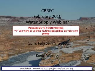
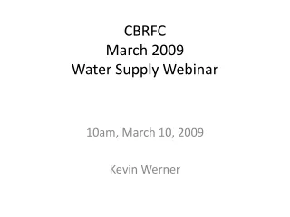
CBRFCMay 2009Water Supply Webinar 1pm MDT, May 7, 2009 Brent Bernard These slides: www.cbrfc.noaa.gov/present/present.cgi
Outline • April Weather Review • Snow States • Current Weather, Climate & Forecasts • Water Supply Forecasts Web Reference: www.cbrfc.noaa.gov/wsup/pub2/map/html/cbrfc.5.2009.html
Web Reference: http://www.cbrfc.noaa.gov/precip/qpe/mapsum/mapsum.cgi??cbrfc?M?2009?02
Current Snow Water Equivalent Conditions Web Reference :http://www.cbrfc.noaa.gov/gmap/gmap.php
Bear and Hams Fork Drainage 7-9k average to above average SWE SWE ~ 7-9K Feet Majority of GB, UC and Lower GN 7-9k SWE is below average. San Juan and Lower GB 9-10k Are below to Much below average SWE ~ 9-10k Feet Web Reference :http://www.cbrfc.noaa.gov/gmap/gmap.php
Overall SWE Above 10000 Feet Elevation The current >10k ft. snowpack is average to above average in the UC and Eastern Green River Basin. The current upper elevation San Juan Snowpack is below to much below average.
Bear River, Weber River, Provo River Headwater SWE Peak SWE ~ 108% Website Link Reference:http://www.cbrfc.noaa.gov/station/sweplot/sweplot.cgi?yrList=avg&yrList=2009&yrList=2008&yrList=1998&stationList=TRLU1&monly=0&tavg=s&hsim=sknn&index=&dbsvr=&indextitle=Untitled
Upper Colorado River Headwaters ~ SWE Peak SWE 2009 ~ 115% Website Link Reference:http://www.cbrfc.noaa.gov/station/sweplot/sweplot.cgi?yrList=avg&yrList=2009&yrList=2008&yrList=1995&stationList=MLDU1&monly=0&tavg=s&hsim=sknn&index=&dbsvr=&indextitle=Untitled
Northern Great Basin SWE Peak SWE ~ 115% Website Link http://www.cbrfc.noaa.gov/station/sweplot/sweplot.cgi?yrList=avg&yrList=2009&yrList=2008&yrList=1995&stationList=MLDU1& monly=0&tavg=s&hsim=sknn&index=&dbsvr=&indextitle=Untitled
San Juan Basin SWE Peak SWE ~ 98% Website Link http://www.cbrfc.noaa.gov/snow/station/sweplot/png/brtc2+cmbc2+cumc2+lpdc2+mdlc2+minc2+mlsc2+rmpc2+spsc2+usjc2+valc2+wcsc2+cscc2.06-21-avg.2009.2008.0.s.0.png
Green River Headwaters SWE Peak SWE ~ 105% Website Link http://www.cbrfc.noaa.gov/snow/station/sweplot/png/bndu1+ekpw4+bbsw4+kllw4+srsw4+stdu1+towc2.06-21-avg.2009.2008.0.s.0.png
First 7 days of May ~ Precipitation Departure from normal was 2 inches in the upper elevations regions Web Reference: http://water.weather.gov
Forecast Precipitation Web References: www.cpc.noaa.gov and www.hpc.noaa.gov
Short Term Temperature Forecasts No Large Ridge Building Forecast, through May 20, 2009. Slow Steady Melts are the norm with these conditions
Climate Forecasts May, June, July Precip. Outlook May Precipitation Outlook http://www.cbrfc.noaa.gov/climate/climoForecasts.cgi
CBRFCOnline PublicationsMay 2009 www.cbrfc.noaa.gov/wsup/pub2/map/html/cbrfc.3.2009.html
Web Publications Evolution Plots Exceedance Probabilities Median Forecasts Web Reference: http://www.cbrfc.noaa.gov/wsup/pub2/outlook.php?region=lp&month=5&year=2009
Gunnison & Dolores River Basins ~ Specifics Median Gunnison, 95% Avg. Median Dolores, 80% Avg.
San Juan Basin Median Forecasts Median May, April Through July Forecast 85% of Average
Great Salt Lake Basin Median Forecasts Median Bear River, 98% Avg. Median Weber Basin, 106% Avg. http://www.cbrfc.noaa.gov/wsup/pub2/outlook.php?region=sl&month=5&year=2009#br.sites
Great Salt Lake Basin Cont’n Forecast Six Creeks,108% Forecast Utah Lake,102%
Beta Water Supply Map http://www.cbrfc.noaa.gov/gmap/gmap.php
San Juan ~ Navajo Reservoir 690kaf http://www.cbrfc.noaa.gov/gmap/gmap.php
Little Snake River ~ Nr Lily 490kaf http://www.cbrfc.noaa.gov/gmap/gmap.php
Green River Basin – Warren Bridge 250kaf http://www.cbrfc.noaa.gov/gmap/gmap.php
Gunnison – Blue Mesa Res. 690kaf http://www.cbrfc.noaa.gov/gmap/gmap.php
Colorado River – Lake Powell 7300kaf http://www.cbrfc.noaa.gov/gmap/gmap.php
Weber River at Oakley 131kaf http://www.cbrfc.noaa.gov/gmap/gmap.php
More Resources • www.cbrfc.noaa.gov • www.nwrfc.noaa.gov/westernwater • No June webinar scheduled… Is there interest? • Fall webinar will be scheduled to review this year’s forecasts, evaluate historical forecasts, and discuss the upcoming forecasts and improvements
Brent Bernard CBRFC Hydrologist Kevin Werner Service Coordination Hydrologist Phone: 801.524.5130 Email: kevin.werner@noaa.gov Feedback, Questions, Concerns always welcome….