Download
1 / 65
650 likes | 655 Views
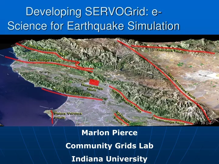
Developing SERVOGrid: e-Science for Earthquake Simulation. Marlon Pierce Community Grids Lab Indiana University. Solid Earth Modeling and Grids. What are the problems that we are trying to solve?.

E N D
Developing SERVOGrid: e-Science for Earthquake Simulation Marlon Pierce Community Grids Lab Indiana University
Solid Earth Modeling and Grids What are the problems that we are trying to solve?
What is the nature of deformation at plate boundaries and what are the implications for earthquake hazards? • How do tectonics and climate interact to shape the Earth’s surface and create natural hazards? • What are the interactions among ice masses, oceans, and the solid Earth and their implications for sea level change? • How do magmatic systems evolve and under what conditions do volcanoes erupt? • What are the dynamics of the mantle and crust and how does the Earth’s surface respond? • What are the dynamics of the Earth’s magnetic field and its interactions with the Earth system? Solid Earth Science Questions From NASA’s Solid Earth Science Working Group Report, Living on a Restless Planet, Nov. 2002
The Solid Earth is:Complex, Nonlinear, and Self-Organizing Relevent questions that Computational technologies can help answer: • How can the study of strongly correlated solid earth systems be enabled by space-based data sets? • What can numerical simulations reveal about the physical processes that characterize these systems? • How do interactions in these systems lead to space-time correlations and patterns? • What are the important feedback loops that mode-lock the system behavior? • How do processes on a multiplicity of different scales interact to produce the emergent structures that are observed? • Do the strong correlations allow the capability to forecast the system behavior in any sense?
Characteristics of Computing for Solid Earth Science • Widely distributed datasets in various formats • GPS, Fault data, Seismic data sets, InSAR satellite data • Many available in state of art tar files that can be FTP’d • Provenance problems: faults have controversial parameters like slip rates which have to be estimated. • Distributed models and expertise • Lots of codes with different regions of validity, ranging from cellular automata to finite element to data mining applications (HMM) • Simplest challenges are just making these codes useable for other researchers. • And hooking this codes to data sources • Some codes also have export or IP restrictions • Other codes are highly specialized to their deployment environments. • Decomposable problems requiring interoperability for linking full models • The fidelity of your fault modeling can vary considerably • Link codes (through data) to support multiple scales
SERVOGrid Requirements • Seamless Access to data repositories and computing resources • Integration of multiple data sources including databases, file systems, sensors, …, with simulation codes. • Core web services for common tasks like command execution and file management. • Meta-data generation, archiving, and access with extending openGIS (Geography as a Web service) standards. • Portalswith component model (portlets) for user interfaces and web control of all capabilities • Basic Grid tools: complex job managementand notification • Collaboration to support world-wide work • “Collaboration” can range from data sharing to Narada-style AV.
SERVOGrid Applications • Codes range from simple “rough estimate” codes to parallel, high performance applications. • Disloc: handles multiple arbitrarily dipping dislocations (faults) in an elastic half-space. • Simplex: inverts surface geodetic displacements for fault parameters using simulated annealing downhill residual minimization. • GeoFEST: Three-dimensional viscoelastic finite element model for calculating nodal displacements and tractions. Allows for realistic fault geometry and characteristics, material properties, and body forces. • VirtualCalifornia: Program to simulate interactions between vertical strike-slip faults using an elastic layer over a viscoelastic half-space • RDAHMM: Time series analysis program based on Hidden Markov Modeling. Produces feature vectors and probabilities for transitioning from one class to another. • Preprocessors, mesh generators: AKIRA suite • Visualization tools: RIVA, GMT, IDL
SERVOGrid Codes, Relationships Elastic Dislocation Inversion Viscoelastic FEM Viscoelastic Layered BEM Elastic Dislocation Pattern Recognizers Fault Model BEM
SERVO Data Sources • Fault Data • Developed as part of the project • QuakeTables: http://infogroup.usc.edu:8080 • Seismic data formats • Available from www.scec.org • SCSN, SCEDC, Dinger-Shearer, Haukkson • GPS data formats • Available from www.scign.org • JPL, SOPAC, USGS
SERVO: Solid Earth Research Virtual Observatory • Framework arose from May 2002 NASA Workshop on Earth Science Computational Technologies • SERVO team members • NASA JPL (lead), UC-Davis, UC-Irvine, USC, Brown, and Indiana University • Team areas of expertise • Geology (Irvine) • Computational earthquake modeling (JPL, Davis, Brown) • Federated database design and semantic modeling (USC) • High performance computing (JPL, Davis) • Grids, Web services, and portals (Indiana)
Building Earthquake Modeling Services What did we do, and what did we learn?
(i)SERVO Web (Grid) Services • Programs: All applications wrapped as Services using proxy strategy • Job Submission: support remote batch and shell invocations • Used to execute simulation codes (VC suite, GeoFEST, etc.), mesh generation (Akira/Apollo) and visualization packages (RIVA, GMT). • File management: • Uploading, downloading, backend crossloading (i.e. move files between remote machines) • Remote copies, renames, etc. • Job monitoring • Workflow: Apache Ant-based remote service orchestration (NCSA) • For coupling related sequences of remote actions, such as RIVA movie generation. • Data services: support remote data bases and query construction • XML data model being adopted for common formats with translation services to “legacy” formats. • Migrating to Geography Markup Language (GML) descriptions. • Metadata Services: for archiving user session information.
What Are Web Services? Once Again… • Web Services are not web pages, CGI, or Servlets • Web Services framework is a way for doing distributed computing with XML. • WSDL: Defines interfaces to functions of remote components. • SOAP: Defines the message format that you exchange between components. • XML provides cross-language support • Suitable for both human and application clients Browser Appl Web Server WSDL SOAP WSDL Web Server WSDL WSDL SOAP JDBC DB
Web Service Architectures • SERVOGrid is built around the Service Oriented Architecture Model. • Constituent pieces • Remotely accessible services • Capabilities are defined through interface definition languages (WSDL). • Accessible through messages and protocols (SOAP). • Implementations may change but interfaces must remain the same. • Client applications access remote services. • Client hosting environments • Web Portals are an example. • Going beyond services • Semantic descriptions for service and information modeling. • Programming/orchestration tools for connecting distributed services.
Browser Interface HTTP(S) User Interface Server WSDL WSDL WSDL WSDL SOAP SOAP WSDL WSDL WSDL WSDL DB Service 1 Job Sub/Mon And File Services Viz Service JDBC DB Operating and Queuing Systems IDL GMT Host 1 Host 2 Host 3
SERVOGrid Required Services • Computing Grid services • Remote command execution/job submission, file transfer, job monitoring. • These services • We may develop these using any number of toolkits • Globus, Apache Axis, GSoap. • Data Grid services • Access data bases and other data sources (faults, GPS, Seismic records). • Information Grid services • Metadata management
Execution Grid Service Examples • You almost always need to perform several remote steps. • “Job management” services • Don’t call it workflow • More interesting combining several services into a single meta-service. • Run Disloc, when done move the output from darya to danube, generate a PDF image of the output using GMT, then pull the output back to the client browser for display. • Simple solution: Apache Ant build tool. • Not a full fledged programming language, but it can do most of the workflow problems I encounter, and is easy to extend. • Tasks are expressible in XML, so you can build authoring tools to hide antisms and validate scripts. • Open source and because it is generally applicable, likely to outlive most workflow tools.
Hot Deploying Applications • One of the challenges we have is that new codes need to be added, applications upgraded, etc. • It would be nice to give more control to the application developer rather than relying on the portal/service/grid folks. • A path fraught with peril, but we forge ahead. • The Ant web service approach enables a few other nice things: • You can assemble remote build.xml templates from libraries of task templates. • And you can map the XML to HTML to generate the new interfaces.
Templating Applications and Generating Interfaces • Users fill in templates through web forms • Execution services then invoke scripts. • Ant is a good way to wrap applications. • Template authoring tools simplify deployment of new wrapped services. • Templates used to automate user interface generation. Author and Publish Template Template Service Service Execute Services Through Generated Interfaces DB Template Storage Service Workflow Execution Service
Good Several built in features that can be used to interact with files, directories and executables. Easy to extend Ant tasks may be web services They may be Java COG calls to grids Or ssh/scp Can be easily templated with properties Bad to Ugly Need an external event model since tasks can take minutes to hours to days to complete. Callback service Reliable messaging Need a way to handle remote failures. Not high performance. Not a full-fledged programming language or workflow engine. Not good for streaming data. www.hpsearch.org Some Ant Web Service Strengths and Weaknesses
Other Lessons Learned • Web service performance is not an issue when used to invoke services that take hours to complete. • Reliability is a larger problem. • Need monitoring/heartbeat services. • Information systems still have a long way to go. • UDDI is part of WS-I but has/had some well known limitations. • WS-Discovery has some interesting concepts but is too specialized to ad-hoc networks. • Peer-to-peer systems provide many useful concepts like discovery and caching. • Semantic Web provides powerful resource descriptions that could be exploited.
GML Data Models and Web Services for GPS and Earthquake Catalogs Using Geographic Information System community standards.
SERVO Applications • Several SERVO codes work directly with observational data. • Examples discussed at ACES include • GeoFEST, VirtualCalifornia, Simplex, and Disloc all depend upon fault models. • RDAHMM and Pattern Informatics codes use seismic catalogs. • RDAHMM primarily used with GPS data • Problem: We need to provide a way to integrate these codes with the online data repositories. • QuakeTables Fault Database was developed • What about GPS and Earthquake Catalogs? • Many formats, data available in tars or files, not searchable, not easy to integrate with applicaitons • Solution: use databases to store catalog data; use XML (GML) as exchange data format; use WebServices for data exchanges, invoking queries, and filtering data.
Geographical Information Service (GIS) Data Formats and Services • OpenGIS Consortium is an international group for defining GIS data formats and services. • Main data format language is the XML-based GML. • Subdivided into schemas for drawing maps, representing features, observations, … • First Step: design GML schemas and build specialized Web Services for GPS and Earthquake data. • OGC also defines services. • Services include Web Features Services, Web Map Services, and similar. • These are currently pre-Web Service, based on HTTP Post, but they are being revised to comply with WS standards. • Next Step: Implement OGC compatible Web Services for this problem. • Also build services to interact with QuakeTables Fault DB.
GML and Existing Data Formats • GPS or seismic data used in this project are retrieved from different URLs and have different text formats. • Seismic data formats • SCSN, SCEDC, Dinger-Shearer, Haukkson • GPS data formats • JPL, SOPAC, USGS • We defined 2 GML Schemas to unify these • http://grids.ucs.indiana.edu/~gaydin/servo • A summary of all supported formats and data sources can also be found there.
So We Built It • First version of the system available • Tried XML databases but performance was awful • Currently database uses MySQL • Download results are in GML, but we can convert to appropriate text formats.
Integration of Other Applications • The screen shot fragments show part of the user interface. • The important thing to note, though, is that the “downloaded results” go to the application, not the user’s desktop. • We do this through a filtering process to convert to the expected file format for that code. • And push data out to the necessary execution host. • A provisional approach. • In moving to a fully GIS-based system, this approach will also allow us to integrate in third party tools.
Fault Quest: QuakeTables+OGC Web Map Service Demo http://rio.ucs.indiana.edu:8080/wmsClient/
Metadata Management • Common problems in computational science: • Where are the input and output files? • When was this created? • What parameters did I use to create this output? • What version of the code? • Is there a validation scenario for this code? • These are all metadata problems.
Context Management Service Client • Metadata may be organized into tree-like structures (see figure). • Context nodes hold one or more leaves and nodes. • Leaves are name/value pairs. • We usually need to create arbitrary trees. • Represent with recursive XML schema. • Search with XPath. • Context data storage and access is retrievable through a web service interface. • Context data storage is implementation dependent but service interface is independent. SOAP/HTTP Axis Servlet Context Manager FS XMLDB
Lessons Learned • Don’t overlook some simple problems • The scientific computing community doesn’t have extensive experience with databases. • XML databases still have a long way to go. • We tried Berkley Sleepycat and Xindice • If you are ambitious, this might be a good research area. • Otherwise, stick with RDBs.
Computing Web Portals Building user interface environments for e-Science
QuakeSim Portal for SERVOGrid • The services we have previously described are headless. • WSDL descriptions are all you need to create client stubs (if not client applications). • The QuakeSim portal effort aggregates these service interfaces into a portal. • Customizable displays, access controls to services, etc. • QuakeSim is just one of many, many such projects. • Challenge is to develop reusable portal components
Computational Web Portal Stack • Web service dream is that core services, service aggregation, and user inteface development decoupled. • How do I manage all those user interfaces? • Use portlets. Aggregate Portals Portlet User Interface Components Application Web Services and Workflow Core Web Services
Portal Architecture Clients (Pure HTML, Java Applet ..) Aggregation and Rendering Portlet Class:WebForm Gateway (IU) Web/Gridservice Computing Remoteor ProxyPortlets Web/Gridservice Data Stores Portlet Class GridPort etc. Portlet Class Web/Gridservice Instruments (Java) COG Kit Portlet Class Hierarchical arrangement Portal Internal Services LocalPortlets Clients Portal Portlets Libraries Services Resources
Why Are Portlets a Good Idea? • You don’t have to reinvent everything • Makes it easy (but not effortless) to share portal components between projects. • So you can pull in portlets from all the other earthquake grid projects. • You can easily combine a wide range of capabilities • Add document managers, collaboration tools, RSS news lists, etc for your portal users.
Lessons Learned: Portals • Developing good user interfaces is a lot of work. • Effort doesn’t scale: how do you simplify this for computational scientists to do it themselves without lots of background in XML, Java, portlets, etc? • Portal interfaces have advantages and disadvantages. • Everyone has a browser. • But it has a limited widget set, a limited event model, limited interactivity. • You can of course overcome a lot of this with applets. • Following the service model, you can in principal use any number of GUIs • Browsers are not the only possible clients. • Web service interoperability means that Java Swing apps, Python, Perl GUIs are all possible, but this has not been fully exploited.
Learning and Using GeoFEST Finite Element Software for Analysis of Tectonic Strain and Stress: An Example to illustrate services.
GeoFEST tutorial • What is GeoFEST? • Geophysical Finite Element Simulation Tool • GeoFEST solves solid mechanics forward models with these characteristics: • 2-D or 3-D irregular domains • 1-D, 2-D or 3-D displacement fields • Static elastic or time-evolving viscoelastic problems • Driven by faults, boundary conditions or distributed loads • GeoFEST runs in a variety of computing environments: • UNIX workstations (including LINUX, Mac OS X, etc.) • Web portal environment • Parallel cluster/supercomputer environment
Models of earthquake cycle and landform development Models of glacial and volcanic loading GeoFEST tutorial • What are the applications of GeoFEST? (continued)
GeoFEST tutorial • What are the applications of GeoFEST? (continued) • Calculation of irregular/heterogeneous Green’s functions for use by other simulation or inversion software • Studies of frictional fault behavior
GeoFEST tutorial • Using the web portal environment to create and run a typical 3-dimensional model • Use web portal to draft domain layers and boundaries • Using portal, add fault(s) to domain • Generate grid points and elements with desired refinement • Provide supplemental information on boundary conditions, material properties, time stepping, etc. • Submit run to GeoFEST for execution • Examine and visualize results
Under the Hood Browser Complexity Quake Tables Kamet (Mesh) Danube GPS GF2 (IDL) Darya … … … Remote DBs Application Hosts Visualization Hosts
GeoFEST tutorial • Select the GeoFEST code in portal Select code Select host
GeoFEST tutorial • Create the desired geometry Enter dimensions and properties Create layer(s) Create faults(s) Create initial mesh Plot results
GeoFEST tutorial • Check the generated geometry Pre-mesh view of layers and faults Zoom and rotate view