Download
1 / 22
220 likes | 310 Views
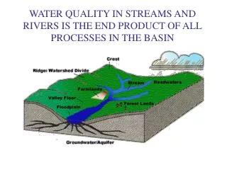
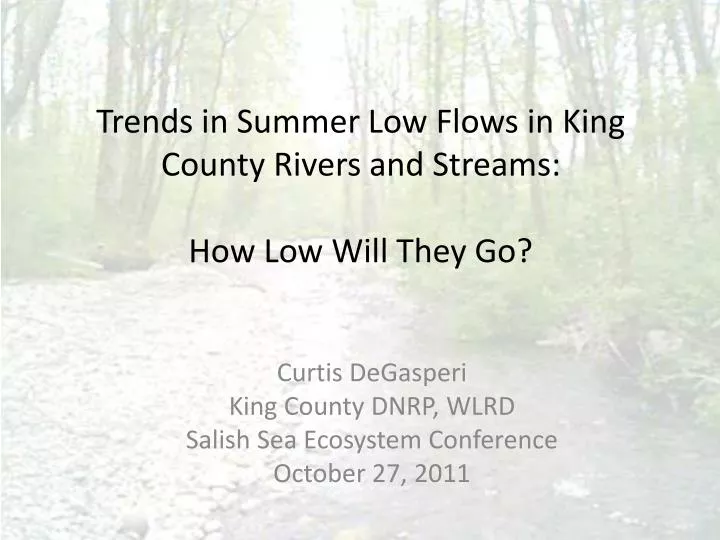
Trends in Summer Low Flows in King County Rivers and Streams: How Low Will They Go?. Curtis DeGasperi King County DNRP, WLRD Salish Sea Ecosystem Conference October 27, 2011. Human Impacts on Water Cycle. Land cover change Forest clearing/Development. ~1880. Human Impacts on Water Cycle.

E N D
Trends in Summer Low Flows in King County Rivers and Streams: How Low Will They Go? Curtis DeGasperi King County DNRP, WLRD Salish Sea Ecosystem Conference October 27, 2011
Human Impacts on Water Cycle • Land cover change • Forest clearing/Development ~1880
Human Impacts on Water Cycle Water management • Surface water and groundwater extraction • Consumptive uses (Irrigation) • Septic vs Wastewater conveyance • Pipeline infiltration/exfiltration
Water Management Water Supply System Imports Exports Withdrawals Precipitation Basin Water Resources Streamflow Evaporation/ Transpiration I & I Return via septic system disposal Wastewater Disposal Exports
Climate Change • Natural Seasonal and Decadal Variability • Human-induced trends or shifts Pacific Decadal Oscillation (PDO) Source: Nate Mantua Joint Institute for the Study of the Atmosphere and Ocean (JISAO)
Another Low Flow Metric? Big Soos Creek (12112600) July – October 2007 July – October Base Flow
Swamp Creek Issaquah Creek Newaukum Creek
Puget SoundJul-OctBase Flow Jul-Oct Base Flow Annual Precip Warm (+PDO) Cool (-PDO) Mote, P.W., A.K. Snover, L. Whitely Binder, A.F. Hamlet, and N.J. Mantua, 2005: Uncertain Future: Climate change and its effects on Puget Sound - Foundation Document. CIG, JISAO, University of Washington. Seattle, WA. 37 p. http://cses.washington.edu/cig/outreach/files/psat1005.shtml PDO
Puget SoundJul-OctBase Flow Jul-Oct Base Flow Annual Precip Warm (+PDO) Cool (-PDO) PDO Source: Nate Mantua Joint Institute for the Study of the Atmosphere and Ocean (JISAO)
Issaquah Creek near mouth Jul-Oct Base Flow ~10 cfs (0.28 cms)
Issaquah Creek near mouth Jul-Oct Base Flow Estimated Losses of 6.5 cfs Land Cover Change: -0.1 cfs Water Management: -6.4 cfs ~8 cfs (0.23 cms)
Swamp Creek at Kenmore Jul-Oct Base Flow ~1 cfs (0.03 cms)
Swamp Creek at Kenmore Jul-Oct Base Flow Estimated Gain of 2.0 cfs! Land Cover Change: -3.8 cfs Water Management: +5.8 cfs ~1 cfs (0.03 cms)
Newaukum Creek at Mouth Jul-Oct Base Flow Estimated Loss of 2.7 cfs Land Cover Change: -0.6 cfs Water Management: -2.1 cfs ~4 cfs (0.11 cms) ~1 cfs
Conclusions • Decadal climate variation appears to have a strong influence on stream base flow • Water management appears to have the potential to influence stream base flow under certain circumstances
Thought • What are the biological consequences?
QUESTIONS? “You never miss your watertill the well runs dry” Curtis DeGasperi King County Water and Land Resources (206) 684-1268 curtis.degasperi@kingcounty.gov
Low flow, 7Q10, values are projected to decrease (i.e. increasing low flow risk) most strongly in rain dominant and transient basins (Figure 7). This pattern is particularly prominent in the lower elevation basins of the eastern Cascades and the mid to lower elevation basins in the western Cascades and in the Olympic Peninsula and the lower elevations on the west slopes of the Rockies. These results support the hypothesis that the intensity of the low flows will rise with increasing temperatures and evapotranspiration, which reduces the soil water moisture and late summer baseflows. Tohver, I. and A. Hamlet. 2010. Chapter 7: Impacts of 21st century climate change on hydrologic extremes in the Pacific Northwest region of North America. Climate Impacts Group, University of Washington, Seattle, WA. http://www.hydro.washington.edu/2860/
Extinction is Not An Option. Statewide Strategy to Recover Salmon. Washington State Joint Natural Resources Cabinet, September 21, 1999. http://www.digitalarchives.wa.gov/governorlocke/gsro/strategy/strategy.htm
Thoughts • What are the biological consequences? • Well designed long-term gauging network • Compilation and access to up-to-date water management data • Good models to synthesize information and extrapolate to ungauged basins