Download
1 / 22
230 likes | 387 Views
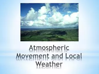
Troposphere’s Pattern of Air Movement & Its Influence on Regional Climates & Local Weather. AICE EM: Atmosphere Key Content 2. Troposphere’s Pattern of Air Movement & Its Influence on Regional Climates & Local Weather. Difference between climate & weather Factors that influence weather

E N D
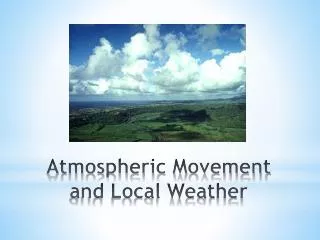
Troposphere’s Pattern of Air Movement & Its Influence on Regional Climates & Local Weather AICE EM: Atmosphere Key Content 2
Troposphere’s Pattern of Air Movement & Its Influence on Regional Climates & Local Weather • Difference between climate & weather • Factors that influence weather • Global insolation • High & low pressure • Global & local wind systems • Effect of land, relief & ocean currents • Formation & characteristics of anticyclones, temperate frontal depressions, and tropical cyclones • Weather forecasting
Difference Between Climate & Weather Weather is… Climate is…
Factors That Influence Weather • Atmosphere: greenhouse effect, latent heat due to water phase changes, water cycle, winds, air mass collisions • Latitude: Direct rays vs. oblique rays, snow creates albedo area • Topography: • Uneven surface ultimately causes winds • rain falls on mountain sides closer to oceans • Water’s heat carrying capacity: range of temperature different for coastal vs. inland at same latitude, • Human Influence: ∆ in topography → less trees → less oxygen, water & more CO2; Burning fuels → adds green house gases to atmosphere, puts particulates in atmosphere
Latitude http://wps.prenhall.com/esm_lutgens_atmosphere_10/48/12402/3174913.cw/index.html
Interrelation Between Water Cycle & the Atmosphere • Cloud condensation nuclei • Natural: Dust storms, volcanic eruptions, pollen, sea salt, respiration, combustion particles (fire) • Anthropogenic: combustion particles • Clouds (water vapor) absorb infrared radiation • Thick clouds reflect solar radiation (albedo) • Evaporation cools surfaces (latent heat of vaporization) heat is absorbed by water molecules • Latent heat of condensation – heat is ______
Cloud & Precipitation Formation Dew point Why? Adiabatic temperature changes – expands – cools; compresses - warms
Four lifting processes Windward side Leeward side
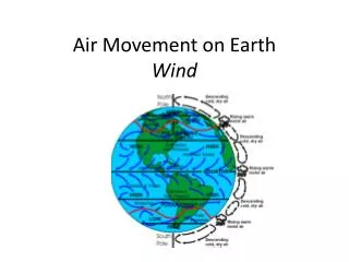
Global & Local Wind Systems • Wind – caused by differences in horizontal air pressure (High to low) • Uneven heating of earth’s surface creates pressure differences • Solar energy basis of wind energy • Wind controlled by • Pressure-gradient force • Coriolis force • Friction
High & Low Pressure • Air pressure – force (Newtons) against a surface due to constant collision of gas molecules. 1 millibar = 1000 N. • Horizontal air pressure compensated to be sea level due to altitudinal differences • Cold air is ______ dense→ ____ pressure: Called _____ • Warm air is ______ dense→ ____ pressure: Called ____ • Water vapor actually reduces density.
Pressure-gradient force • Isobars • Closely spaced – strong pressure gradient with high wind speeds • High speeds generally around Lows
Coriolis Effect on Horizontal Direction Coriolis effect: deflection in northern hemisphere is to _____________; southern hemisphere is to _________ Degree of deflection due to Coriolis forces are stronger at higher latitudes and stronger winds.
The Different Forces That Effect Winds P-G force causes winds to move perpendicular to isobars • Aloft air = Less friction • Wind speeds increase until Coriolis force = pressure-gradient force (geostrophic balance) • Ultimately, winds travel parallel to isobars (geostrophic wind) • Steep pressure gradient = strong winds • IDEALIZED situation
Isobars & wind speeds Can you figure out / remember the relationship between isobars & wind speed?
Recall Device time:Cyclone – Low Pressure center, winds travel to left (same as Earth’s rotation CCW), isobar trough • Circular isobars means winds follow circular path to be parallel to isobars • Notice direction of L and H pressure system in Northern Hemisphere
Friction’s Effect • P-G force causes wind to move . . . • Coriolis force balances wind to move . . . • Frictional force causes wind to move . . .
Which direction is the wind blowing? Why is the cold front “chasing” the warm front? Is this hurricane status? How do you know? What kind of weather is the DC area experiencing? What kind of weather is TN experiencing? Isobars with Fronts
Vertical Airflow for Cyclones & Anticyclones • Low pressure wind pattern at the surface • Causes net upward motion of ~ 1km/day. Thunderstorm updrafts >100 km / hr • ___________ causes cloud formation Low pressure center pushes air up, like converging tectonic plates with similar density.
Isobars are parallel – same pressure, same temperature • Land warms faster than water, so the continental air is warming, and therefore rising. As the air rises, it expands & cools adiabatically, thus creating the high over the land. (Creates divergence aloft) • Convergence occurs aloft over the ocean – the air piles up and becomes a heavier column which is pushed to the surface of the ocean, creating a High.
In other words… LOW PRESSURE HIGH PRESSURE Heat released radiates to space Condensation and precipitation Cool, dry air Rises, expands, cools Falls, is compressed, warms Hot, wet air Warm, dry air Flows toward low pressure, picks up moisture and heat LOW PRESSURE HIGH PRESSURE Moist surface warmed by sun Fig. 7-4, p. 143
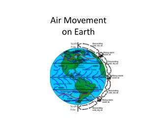
Global Air Circulation 60°N Cold deserts Air cools and descends at lower latitudes. Westerlies Forests 30°N Hot deserts Northeast trades Warm air rises and moves toward the poles. Forests Solar energy 0° Equator Air cools and descends at lower latitudes. Southeast trades Hot deserts 30°S The highest solar energy input is at the equator. Westerlies Forests Cold deserts 60°S Fig. 7-3, p. 142