Download
1 / 37
370 likes | 522 Views
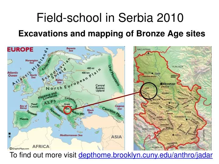
Field-school in Serbia 2010 Excavations and mapping of Bronze Age sites. To find out more visit depthome.brooklyn.cuny.edu/anthro/jadar. The Bronze Age. Period in which bronze was the material predominantly used to make functional parts of implements

E N D
Field-school in Serbia 2010Excavations and mapping of Bronze Age sites To find out more visit depthome.brooklyn.cuny.edu/anthro/jadar
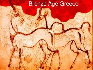
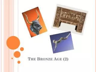
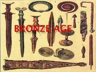
The Bronze Age • Period in which bronze was the material predominantly used to make functional parts of implements • Brings new dynamics between Near East and Europe • Title Bronze Age used for classification to signify a stage in technological evolution
European Bronze Age Chronology – 2200-1050 B.C.E. Early Bronze Age (2200-1600) Middle Bronze Age (1600-1300) Late Bronze Age (1300-1050)
Absolute Chronology markers • Unetice cemetery (near Prague, Czech Republic) • Helmsdorf & Leubingen graves (Germany) • Mycenaean Shaft Graves (Greece ~1650-1450) • Danish coffin graves Dates: Leubingen – 1942+-10 BC Helmsdorf – 1840+-10 BC
Bronze • Made by alloying copper with tin • As a strategic resource bronze quickly becomes fundamental in economic production and social reproduction
From Copper Age to Bronze Age • Abrupt transition to Bronze Age over a large area • COPPER present in many places, but TIN is rare in the Near East • It is still a mystery to archaeologists: where exactly did bronze-smiths get their tin from?
From Copper Age to Bronze Age: Tin • Present in very few places in Europe, but not clear whether it was actually mined by Bronze Age people in any of these: Brittany Cornwall Border between Czech Republic and Germany Iberia Tuscany and Sardinia (many areas didn’t even have copper, let alone tin)
Copper mining and smelting • Earliest evidence in Europe: in the Balkans - in Bulgaria and Serbia (4500 B.C.E.)
Significance • It was important for societies to obtain bronze • Majority of societies had neither copper nor tin, • Which lead to massive increase in exchange, • Exchange systems controlled by emerging elites
Objects made of bronze • Bronze becomes a standard value very quickly (rapid decline in use of other copper alloys) • Bronze artefacts: Melted & recast – adjusting to local style of production = commoditization
Emergence of elites • Control over long-distance trade through series of concentrated settlements (like in the Carpathian mountains) • Later (mid 2nd millenium ) trade concentrates on small-scale networks. • Finds of fragmented bronze, often collected in hoards (like the 1,300kg bronze hoard Uioara de Sus in Romania)
Position of Carpathian Mts Uioara de Sus
Our project studies economic and social significance of metalworking in Europe • Effects of metalworking on small communities • Long-term effects on society in general • Connections and communications
Possible directions of metal trade? • British Isles Central Europe Aegean • Iberian Peninsula Aegean • Serbia Aegean • Central Europe Aegean • Directions shown by study of amber route & Myceneaen (Aegean) import • Bronze becomes a cultural norm in Europe from 1700 B.C.E.
Communications: International routes The Danube Corridor
Communications: International routes connecting north and south of Europe, going through Serbia
Study area: Jadar, region where TIN source is reported
Jadar, Western Serbia NE • Refers to the Jadar river basin, and the area named Jadar in west Serbia. Boundaries: • NE: Cer Mountain • SW: Gučevo Mountain • W: The river Drina. • SE: Flat and open W SE SW
Geological and morphological characteristics of Jadar • Area with the lowest altitude is situated between the Drina river in the west and hills in the east (alluvial plain of the Drina River). • The other alluvial plain is that of the Jadar river; its average width is approximately 1800 meters.
Geological and morphological characteristics • Relief of Jadar around the river is hilly. • Recognized as a major mining area, that has been in use at least since the Roman times. • Despite clearing efforts in the past, this region is for the most part still under forests and under-researched. • South and north boundaries of Jadar are low mountains.
The highest is the Gučevo Mountain. Its summit is at the altitude of 779 meters. • In the north part of Jadar is the Cer Mountain, 687 meters high. • The Iverak Mountain’s (426 m) northern side descends towards the Lešnica river valley.
North of the Jadar plain is the small Lešnica river valley which is situated between the mountains Iverak and Cer. • That is where a tin source is located. Lesnica
Right side of the Lešnica valley (the Cer side) is about three times wider than the left side (the Iverak side). • A consequence of this is that the Cer mountainsides are mostly cleared and populated while the Iverak mountainsides are still under forests and uninhabited.
Spasovine and Belotic Bronze Age sites in Jadar Belotic Cer Spasovine Iverak N Jadar river valley
Roads connecting mining districts with Rome in Ancient times • Ancient Roman road was connecting Salona (center of the province of Dalmatia, today’s Solin, near Split) and Sirmium (center of the province of Pannonia, and once Ancient Roman capital - today’s Sremska Mitrovica).
Focus site Spasovine in the wider context Sirmium Salona Rome Troy Athens
One section of the road also passed through the area of Jadar. • Historical sources mention that the last road station on the road through Jadar was the town Gensis (today’s Jadranska Lešnica near our site Spasovine). • Remains of the described road were visible until the middle 19th Century. (Sirmium) Jadranska Lesnica Koviljaca Zvornik
(Sirmium) • Its entry point was near today’s Zvornik, where the road passes from the Bosnian side. • From Zvornik the road followed the bank of the Drina until today’s Koviljača. • From this place, the road continued along the north of Gučevo Mountain, and then followed the western sides of Iverak, where it went towards Sremska Mitrovica (Ancient Roman Sirmium). Koviljaca Zvornik
Jadranska Lesnica Drina Spasovine Koviljaca Jadar Segment of Ancient Roman road from Zvornik via Jadranska Lesnica to Sirmium Zvornik
Position of the site Spasovine, the only Bronze Age settlement found so far in the wider area
Spasovine may also be the only Bronze Age settlement close to a confirmed tin ore source Tin bearing stream flowing into Lesnica
Goals of the project • Mapping occurrences of minerals, trace metals, and formations • Finding, mapping, surveying, and excavating archaeological sites • Environmental monitoring • Hydrogeology and surface geology • Modeling connections between sites and resources
To find other Bronze Age sites,the project will work on: • magnetometry & electro-resistivity • soil chemistry, • phosphate, and • remote sensing analysis Then combine data from geomorphology, archaeology and geophysics in Geographic Information Systems (GIS).
Vegetation, visibility, position Mapping extant vegetation is vital. Finding out (through GIS) what the points are from which the Bronze Age cemeteries are visible. Identifying places in the survey region where sites may not have been discovered because of poor visibility.
Position of grave mounds at the Bronze Age cemetery Belotic Why are they there?
Modeling • What factors drew prehistoric populations to certain places? (water, clay, stone, copper, tin, ancestors…) • We want to find correlations btw site locations and the proximity of environmental variables • How particular patterns of human land-use will be reflected in the archaeological record? • Maps & GIS • Site-centered modeling – elevation, slope, diversity, human eco-dynamics… • And modeling of whole systems instead of sites only To find out more visit depthome.brooklyn.cuny.edu/anthro/jadar
To find out more visit depthome.brooklyn.cuny.edu/anthro/jadar