Download
1 / 20
200 likes | 318 Views
IGOS Geohazards: Status and perspectives 3rd International Geohazards Workshop Frascati, ESRIN, 6th November 2007 Hormoz Modaressi Director IGOS Geohazards Bureau. 1. Reducing geological risks through Earth Observations. IGOS Geohazards approach.

E N D
IGOS Geohazards:Status and perspectives 3rd International Geohazards WorkshopFrascati, ESRIN, 6th November 2007 Hormoz Modaressi DirectorIGOS Geohazards Bureau
IGOS Geohazards approach Policies focusing on crisis finally save lives, but recovery costs continue to increase • Mitigation policies: • reduce vulnerability of exposed elements, saving lives and costs • contribute to sustainable use of natural resources
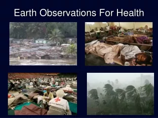
Observations can help: e.g. landslides How do observation help reducing the risks? reducing hazard reducingexposure reducing vulnerability Need of information for the assesment of systemic and physical vulnerabilities Need of information to identify hazards and level of threat Need of input information forLAND USE PLANING Need to collect all available information and data and to use it for multi-risk assessment
Geohazards observations Volcano Topography Seismic monitoring Deformation Gases GPS Seismological stations InSAR images Geological structure Boreholes Geo-referenced data Ground Instability Topography Deformation Hydrogeology Earthquake Seismic monitoring Topography Soil behavior Hydrogeology + Tsunami Topography Bathymetry Seismic monitoring Buoys…
IGOS Geohazards: objectives and strategy • Objective:The IGOS Geohazards initiative intends to respond to the scientific and operational geospatial information needs for the prediction and monitoring of geohazards, namely earthquakes, volcanoes, land instability and tsunamis. • Strategy: involvement within GEO: • GEO Geohazards Community of Practice • Coordination of tasks: • DI-06-03: InSAR and in-situ data integration • DI-06-07: Hazard maps inventory • Involvement within other tasks: • DI-06-08: Multi-hazard approach definition and progressive implementation • DI-06-09: Use of satellites for risk management • DI-06-02: Seismographic networks improvement and coordination
IGOS Geohazards – Members • International Organisations • Space Agencies • Geological Surveys • Scientific organisations • New members (2007): EuroGeoSurveys, IASPEI, German Insurance Association
Transition to GEO Plenary and executive Committee Advice & Recommendations Committees GEO Secretariat Capacity Building & Outreach Director Management and Coordination Team Work Plan Team Architecture & Data Coordination & Facilitation Science & Technology User Interface Inputs Expert Communities of Practice Coordination Dialogue
Some recent publications • IGOS Geohazards Theme Report (2007) • Geohazards Earth Observation Requirements (2007) • GEO South East Asia Geohazards Workshop (2006) Available on www.igosgeohazards.com
Filling the gaps: Key issue: ArchitectureToward a geohazards Earth Observation data clearing house Application layer Open data access and visualization services GEOSS 10 years plan Databases interoperability Access to all data GeoHazData Inventories of data and observing means = Catalogue of Metadata INSPIRE Various databases Data collected by Geological surveys, mapping agencies, space agencies, universities… Databases GPS networks Satellite images Instruments Seismometers Other in-situ instruments
Information Data The Geohazards Communities of Practice (CoP) • Earthquakes CoP • FDSN, Geological surveys, • seismologists • Structure engineers • Building compagnies, geological surveys, • science organisations • Volcano CoP • WOVO, Geological surveys, • volcanologists • Geohazards • Community of Practice • Risk managers • Local national, european authorities, • civil securities, geological surveys • Landslides CoP • ICL, Geological surveys • Space Agencies • Coastal risks CoP • Science organisations, • Geological surveys • Insurance and re-insurance • compagnies • Geophysics CoP • Geological surveys, GGOS, WOVO, • FDSN, ICL, geophysicists
User needs 2 kind of products: Information: hazard maps, risk maps and scenarios are needed to help civil security and land-use planners for disaster mitigation Data: more efficient access to in-situ and space data is needed in order to help scientists to estimate hazard and risk. End Users Groups Public authorities International, national, local level Operational state organisations Civil security Disaster Reduction Organisations Earthquakes Reduction Organisations Geological surveys In-sector Providers Data Process and InterpretationDecision Support Data ProvidersData Acquisition Engineering Level Requirements High Level Requirements Remote Sensing Agencies, In Situ Monitoring Networks Research scientistsandgeological surveys Exposed populations Media, Education, Capacity building, Alert Derived information products Raw data
Requirements Lobbying, funding Geohazards Community of Practice: requirement processes • European Commission • World bank, Islamic bank, • Asian development bank… OGC (Protocols) • Geohazards • Community of Practice Scientific community GEO (Observations) ISDR Integrated risk management UNOOSA/Spider (Space Observations)
Community building: Regional initiatives South East Asia:Objective: enhance regional and international cooperation on geological disasters in South East Asia. GEO Geohazards workshop, June 2006, with support of The Malaysian remote sensing Center (MACRES), the Group on Earth Observation (GEO), NASA, UNESCO and IGOS Geohazards Europe: Eurogeosurveys and the Geohazards Community of Practice support the establishment of the Eurogeosurveys Working Group on Geohazards since january 2007 Africa: Workshop on natural and human made disasters in Africa, Kampala, Uganda, 21-22 July 2007
Conclusions • Need to focus on an easier data provision disaster mitigation • IGOS Geohazards aims at • supporting a multi-disaster approach • increase the exchange of data from various sources • moving toward an open access to data • Involvement within the GEO framework to progress • Cooperation with other organization programmes (GEO, UNESCO, WMO, UNOOSA, UNISDR) is expected to help coordinating the initiative • Workshop IGOS Geohazards: 5-9 Novembre 2007, ESA, ESRIN
Thank you for your attention Contact: H.Modaressi@brgm.fr Tungurahua volcano threatening the city of Banos in Ecuador Arnaud Joëlle and Scholl Pierre-Grégoire