Download
1 / 38
420 likes | 977 Views
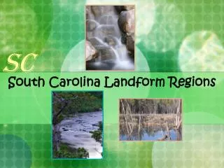
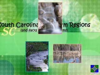
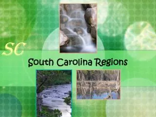
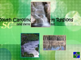
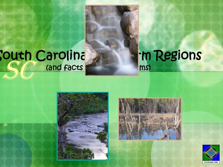
SC. South Carolina Landform Regions (and facts about Landforms). Earth. Where is South Carolina?. SC. North America. United States of America. Here we are! South Carolina borders the Atlantic Ocean. SC. South Carolina Landform Regions Map.

E N D
SC South Carolina Landform Regions(and facts about Landforms)
Earth Where is South Carolina? SC North America United States of America Here we are! South Carolina borders the Atlantic Ocean.
SC South Carolina Landform Regions Map Our state is divided into regions, starting at the mountains and going down to the coast. Do you remember your 3rd grade South Carolina Landform Regions? Can you name these?
Did You Know? Virginia, North Carolina, South Carolina, Georgia The Southern Atlantic States have about the same regions as we do in South Carolina. So, during this study, you will also hear about other states. What you hear about that landform region in Virginia, for example, is much the same in South Carolina.
Blue Ridge Mountains Landform Regions SC The Blue Ridge Mountain Region is only 2% of the South Carolina land mass.
Facts About the Blue Ridge Mountains . . . 1, The Blue Ridge Mountains are part of theAppalachian Mountain Range. 2. Manystreams beginin the mountains. 3. These are theoldest mountainsin America. 4. The Blue Ridge Mountains areFolding Mountains. 5. The Blue Ridge Region takes up only2% of South Carolina’s land mass.
Types of Mountains There are four different types of mountains: Folded Mountains Upwarped Mountains Fault Block Mountains Volcanic Mountains F Y I
Folded Mountains Types of Mountains Folded mountains form when rock layers squeezed from opposite sides buckle and fold. The Appalachians, or Blue Ridge Mountains are Folded mountains. F Y I
Upwarped Mountains Types of Mountains Upwarped mountains form when crust is pushed up by forces inside of the Earth. Examples: Southern Rocky Mountains and Adirondack Mountains F Y I
Adirondack Mountains, NY Yes! There are really mountains in the state of New York!
Fault Block Mountains Types of Mountains Fault-block mountains are made up of huge tilted blocks of rock which are separated from surrounding rock by faults. (Examples: Grand Tetons and Sierra Nevada Mountains.) F Y I
Volcanic Mountains Types of Mountains Volcanic Mountains are cone-shaped mountains created from pile-up of molten materials. (Examples: The Cascade Mountains in Oregon and Washington, and the Hawaiian Islands.) F Y I
Crater Lake, Oregon—see the cone island in the water. The Cascades is a volcanic mountain range in the Northwestern United States. Mt. St. Helens, Washington The water in Crater Lake, Oregon is just this blue! Mt. Ranier, Washington
Greenville Spartanburg Union Greenwood Rock Hill Abbeville Piedmont Landform Regions SC If you could see the Piedmont Region from space and without the foliage, you would notice it is sort of a huge plateau.
Facts About the Piedmont Region . . . 1.The Piedmont is the largest region of South Carolina. 2.The Piedmont is thought to be a largeplateau(raised high land that is usually flat on the top). 3. The Piedmont is NOT flat, but ishilly. 4. The Piedmont containsmany of our largest citiesin South Carolina. 5. The Piedmont is often calledThe Upstate.
What do we know about the Piedmont of the Southeastern Atlantic States? Let’s watch a three minute video showing us about the Piedmont. You will look for information about the “fall line” that divides the higher Piedmont region from the lower, softer, Coastal Plain region. You will find out how early pioneers used the rivers and waterfalls to their advantage.
What do we know about the Piedmont Region of our Southeastern States? The Piedmont of the Southeastern States, StreamlineSC
Movie Follow-Up What IS the fall line? How did the fall line hurt transportation in the early years of our country? What did the settlers build at the fall line so they could use the power from the falls?
Columbia, Our State Capitol Sandhills Landform Regions SC Do you wonder why the Sandhills are so sandy? They used to be the coastline of North America millions of years ago.
Four Facts About the Sandhills Region . . . 1. The Sandhills arecovered with the left over sand duneswhen it was SC’s coastline millions of years ago. 2. The Sandhills arenext to the fall linewhere the land slopes down and the rivers become waterfalls. 3. The Sandhills arehilly. 4. The Sandhills hassofter ground than the Piedmont.
How are sand dunes formed? All sand dunes are formed the same way. Every single one is a pile of sand built up by the wind. Once the sand has been picked up by the wind, it will go wherever the wind carries it. Even though most sand dunes are made of the same material and formed in the same way, they vary widely in appearance. F Y I
Aiken Orangeburg Sumter Florence Coastal Plain Landform Regions SC There is an Inner and Outer Coastal Plain. Can you see the dividing line? This area was once in the ocean millions of years ago.
Facts About The Coastal Plains 1. The Coastal Plains are very wet. 2. The Coastal Plains used to be under the ocean millions of years ago. 3. The Coastal Plains have savannahs, which are wild grass prairies. 4. The Coastal Plains have a lot of swamps and marshlands. 5. Because of sediment that settled in the ocean millions of years ago over the Coastal Plains, there is a lot of Sedimentary Rock in this area. 6. The Coastal Plains are flat in most areas.
What is sediment? Sediment (n.) Material that settles to the bottom of a liquid What kind of sediment settled in the Inner and Outer Coastal Plains millions of years ago when they were covered with oceans? This sediment forms layers of rock called Sedimentary Rock. F Y I
What Happened? What happened to all that sedimentary rock that is supposed to be in the Inner and Outer Coastal Plains? The coastal plains are fairly flat, so the rock has that eroded over the last million or so years has stayed in the same place as soil instead of washing away. There is no new rock exposed from erosion, so you do not see sediment! Don’t you think the sediment must have eroded into soil along time ago?
Flat? Another thing about the Coastal Plains— Geologists have learned that the coastal plain stair-steps down gradually with six flats and seven slopes. They believe that this happened as the ocean receded (moved backward) throughout thousands of years.
Hilton Head Beaufort Charleston Georgetown Myrtle Beach Coastal Zone Landform Regions SC Take a look at the city map of South Carolina. You can name the cities in the Coastal Zone.
Facts About the Coastal Zone 1. It borders the Atlantic Ocean. 2. It has sand dunes. 3. It has marshlands, inlets, bays, barrier islands. 4. It had Palmetto and Palm trees. 5. It has beaches. 6. It is often battered by hurricanes.
How Did Pioneers Use the Coastal Zone? What did the pioneers grow in the Coastal Zone? Why did they grow this crop? Watch a one-minute video to find out.
StreamlineSC Video Name a way that pioneers used the Coastal Zone of South Carolina. Along the Southern Coastline, StreamlineSC
Movie Follow-Up What crop DID the settlers grow in the Coastal Zone? Why was this crop grown in this region?
How did cities begin in South Carolina? Take a look at the South Carolina Cities Map to learn where the main cities are placed. Then look at the Rivers and Streams Map. Can you see learn anything by comparing the two maps? Hint: How were rivers used when the South Carolina colony was beginning to settle?
Remember . . . • There are five landform regions in South Carolina: • Blue Ridge Mountains • Piedmont • Sandhills • Inner Coastal Plain • Outer Coastal Plain • Coastal Zone
South Carolina 5th Grade Science Curriculum Standard Structure of the Earth’s System • Locate and describe the characteristics of South Carolina landform regions such as Blue Ridge, Piedmont, Sandhills, Coastal Plains, and Coastal Zone. • Define constructive forces, which include crustal deformation (folding and faulting), volcanic eruptions, and deposition of sediment.) • Describe how landforms are created as a result of constructive forces.