Download
1 / 25
250 likes | 571 Views
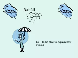
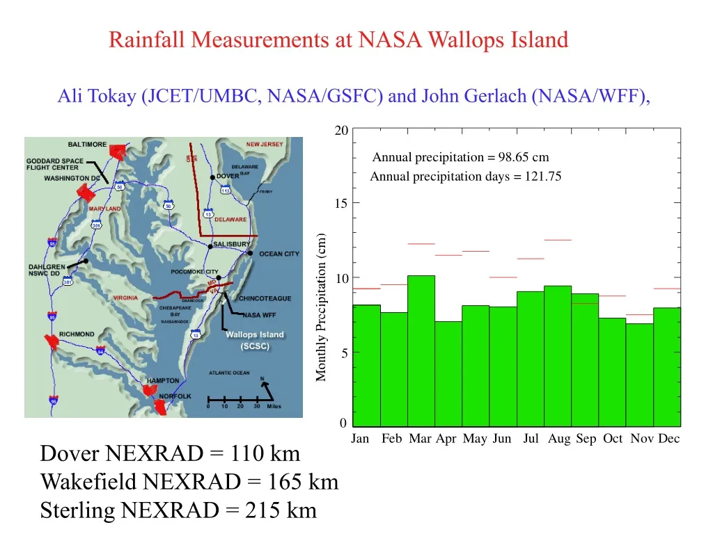
Rainfall Measurements at NASA Wallops Island. Ali Tokay (JCET/UMBC, NASA/GSFC) and John Gerlach (NASA/WFF),. Dover NEXRAD = 110 km Wakefield NEXRAD = 165 km Sterling NEXRAD = 215 km. Wallops Island Precipitation Variability. Wallops Island Precipitation Days. Wallops Island Snowfall.

E N D
Rainfall Measurements at NASA Wallops Island Ali Tokay (JCET/UMBC, NASA/GSFC) and John Gerlach (NASA/WFF), Dover NEXRAD = 110 kmWakefield NEXRAD = 165 kmSterling NEXRAD = 215 km
Wallops Island Precipitation Type • Frontal (Cold, warm, stationary)• Solar heating• Coastal low• Tropical cyclones• Winter storms (dry and wet snow)
Wallops Island Precipitation Type • Frontal (cold, warm, stationary)• Solar heating• Coastal low• Tropical cyclones• Winter storms (dry and wet snow)
Wallops Island Precipitation Type • Frontal (cold, warm, stationary)• Solar heating• Coastal low• Tropical cyclones• Winter storms (dry and wet snow)
Wallops Island - Instruments (NASA) • Radars - S-band Polarimetric radar (NPOL) - S-band Doppler radar (SPANDAR) - C-band Doppler radar (TOGA) - UHF reflector - Dual frequency Microwave Link (R. Rincon) • Precipitation Gauges - Met 1 tipping bucket gauges (14 unit) - Qualimetrics tipping bucket gauges (11 unit) - Geonor weighing bucket gauge - Optical rain gauges (5 unit, R. Rincon) • Disdrometers - Joss-Waldvogel disdrometers (9 unit, 2 for R. Rincon) - Optical (Parsivel) disdrometers (2 unit) - 2-D video disdrometer (1 unit) -Video disdrometer (L. Bliven)
Wallops Island - Instruments (Loan, past & present) • Radars - X-band polarimetric radar (NOAA-ETL, PI: S. Matrosov and B. Martner) - X-band polarimetric radar (Greek Met. Service, PI: E. Anagnostou) - S-band profiler (NOAA-AL, PI: K. Gage) - 24.5 GHz profiler (Metek) • Precipitation Gauges - Hydrological services tipping bucket gauges (2 unit) - Geonor weighing bucket gauge - Drop counting gauge (RL, PI: C. Wilson) • Disdrometers - Pludix (Nubila, PI: F. Prodi) - POSS (2 unit, Canadian Met. Service, PI: P. Joe and B. Sheppard)
Performance of Impact-type, Laser-Optical, and Radar Disdrometers X1>X2
Performance of Impact-type, 2-D Video, and Laser-Optical Disdrometers
Wallops Island - Instruments (NOAA) • Radars - S-band Doppler radar at Dover, Delaware - S-band Doppler radar at Wakefield, Virginia • Precipitation Gauges - ASOS site - CRN site at Oyster, Virginia • US NLDN sensor site • Upper air sounding site
Monthly and Daily Rainfall Statistics • Monthly rainfall bias where G1>G2 • Standard deviation of daily rain total difference (STRTD)SDRTD = [Var(G1)+Var(G2)-2Cov(G1,G2)]1/2 • Pearson correlation coefficient of daily rainfall • Mean daily rain total difference and its standard deviation where N - number of rainy days with rainfall > 1.2 mm
Wakefield, Virginia Automated Surface Observing System (ASOS) site
Gauge and 88-D Rainfall Totals in Tropical Storm Guston 88-D rainfall products - 1.0,1.5, 2.0 km grid spacing, 1.0, 1.5, 2.0 CAPPIGauge sites - NASA, ASOS, AWOS, co-op, weather-bug, state
PublicationsJournal papers:Tokay, A., R. Chamberlain, and M. Schoenhuber, 2000: Laboratory and field measurements of raindrop oscillations. Phys. Chem. Earth (B), 25, 867-870.Matrosov, S. Y., K. A. Clark, B. E. Martner, and A. Tokay, 2002: X-band polarimetric radar measurements of rainfall. J. Appl. Meteor., 41, 941-952.Rincon, R., and R. Lang, 2002: Microwave link dual-wavelength measurements of path-average attenuation for the estimation of drop size distributions and rainfall. IEEE Trans. Geoscience and Remote Sensing, 40, 760-769.Gage, K.S., W.L. Clark, C.R. Williams and A. Tokay, 2004: Determining Reflectivity Measurement Error from Serial Measurements Using Paired Disdrometers and Profilers. Geo. Res. Lett., 31, doi:10.1029/020591. Tokay, A., P. G. Bashor, and K. R. Wolff, 2005: Error Characteristics of Rainfall measurements by collocated Joss-Waldvogel disdrometers. J. Atmos. Oceanic. Technol., 22, 513-527.Larsen, M. L., A. B. Kostinski, and A. Tokay, 2005: Observations and analysis of steady rain. J. Atmos. Sci., (accepted for publication).Tokay, A.,and P. G. Bashor, 2005: An experimental study of small-scale variability of rainfall. J. Appl. Meteor. (submitted July 2005). Goldhirsh, J., 1983: On modeled slant path attenuation distributions, IEEE Trans. Antennas and Propagation, 31, 918-921.
Conference papers and presentationsTokay, A., K. Chamberlain, P. Bashor, R. Rincon, and D. Wolff, 2000: Measurements of Drop size distribution and drop shape at the NASA Wallops Flight Facility, TRMM science meeting, College Park, Maryland Tokay, A., K. Chamberlain, P. Bashor, R. Rincon, and D. Wolff, 2001: Drop size distribution measurements at the NASA Wallops Flight Facility, GPM planning meeting, College Park, MarylandTokay, A., K. Chamberlain, P. Bashor, R. Rincon, and D. Wolff, 2001: Precipitation measurements at the NASA Wallops Flight Facility. Abstracts, 7th International Conference on Precipitation, Rockport, Maine, 2-2Tokay, A., K. R. Wolff, P. Bashor, and R. Rincon, 2002: An overview of the precipitation measurements at the NASA Wallops Island. Abstracts, 2nd European Radar Meteorology Conference, Delft, The Netherlands.Tokay, A., R. Wolff, P. Bashor, and O. Dursun, 2003: On the measurement errors of the Joss-Waldvogel disdrometer. Preprints, 31th International Conference on Radar Meteorology. Seattle, WA, American Meteorological Society, 437-440.Tokay, D. B. Wolff, P. Bashor, and R. Rincon, 2003: Wallops Island: Proposed ground validation site for the NASA precipitation program, European Global Precipitation Mission (EGPM) meeting in ESA/ESTEC, The Netherlands. Tokay, A, D. B. Wolff, D. Marks, J. Gerlach, J. J. Wang, P. Bashor, and R. Wolff 2003: Greater Wallops Island: A proposed mid-latitudinal ground validation site for NASA precipitation program. GPM Ground Validation (GV) meeting in Abingdon, UK.
پایگاه پاورپوینت فارسیwww.txtzoom.comبانک اطلاعات هوشمند اسلاید