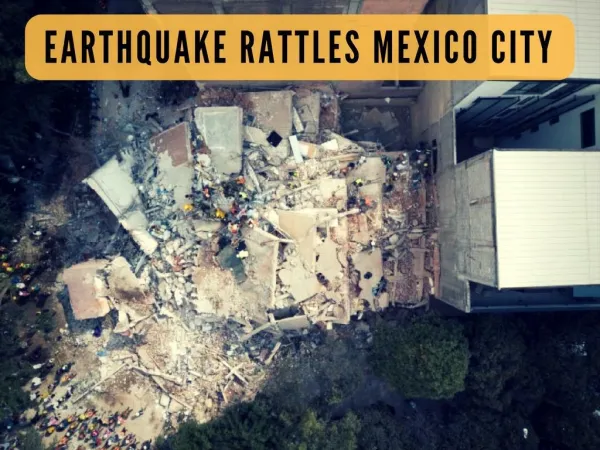
Download
1 / 9
90 likes | 206 Views
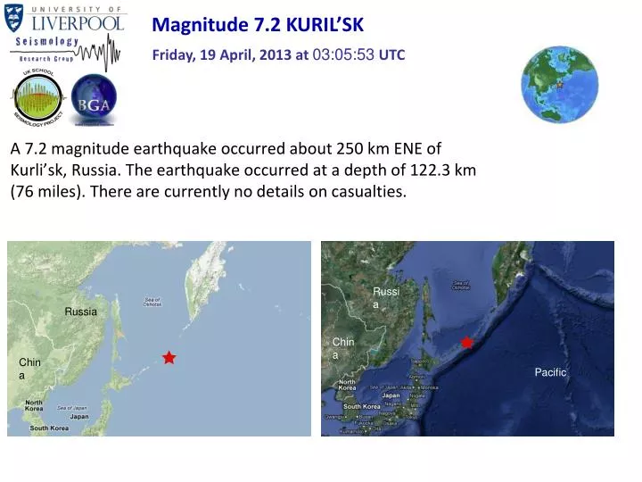
Magnitude 7.2 KURIL ’ SK. Friday, 19 April, 2013 at 03:05:53 UTC. A 7.2 magnitude earthquake occurred about 250 km ENE of Kurli ’ sk, Russia. The earthquake occurred at a depth of 122.3 km (76 miles). There are currently no details on casualties. Russia. Russia. China. China. Pacific.

E N D
Magnitude 7.2 KURIL’SK Friday, 19 April, 2013 at 03:05:53 UTC • A 7.2 magnitude earthquake occurred about 250 km ENE of Kurli’sk, Russia. The earthquake occurred at a depth of 122.3 km (76 miles). There are currently no details on casualties. Russia Russia China China Pacific
Magnitude 7.2 KURIL’SK Friday, 19 April, 2013 at 03:05:53 UTC Strong shaking (VI) was recorded in the Kuril Islands, ~20 km to the south-west of the epicentre. Shaking intensity Modified Mercalli Intensity Scale (courtesy of University of Alberta)
Magnitude 7.2 KURIL’SK Friday, 19 April, 2013 at 03:05:53 UTC USGS PAGER Population Exposed to Earthquake Shaking Overall, the population in this region resides in structures that are a mix of vulnerable and earthquake resistant construction. Recent earthquakes in this area have caused secondary hazards such as tsunamis and landsides that might have contributed to losses Image courtesy of the US Geological Survey
Magnitude 7.2 KURIL’SK Friday, 19 April, 2013 at 03:05:53 UTC Earthquake and historic seismicity The earthquake epicentre (red star) is plotted on the map with regional historic seismicity since 1970 (grey circles). Earthquakes of magnitude > 3 can be quite common in this region. The Kuril Islands earthquake of 2006 (magnitude 8.3) is one of the largest earthquakes in recent times. It killed 11 people, and caused secondary hazards of landsides and tsunami.
Magnitude 7.2 KURIL’SK Friday, 19 April, 2013 at 03:05:53 UTC Arrows show the direction of convergence between the Pacific and Okhotsk plates North America Plate Eurasia Plate Pacific Plate 82 mm/yr
Magnitude 7.2 KURIL’SK Friday, 19 April, 2013 at 03:05:53 UTC Tectonic summary At the latitude of this earthquake, the Pacific plate converges with the North America plate towards the west-northwest at a velocity of approximately 82 mm/yr, and subducts beneath the Kuril Islands at the Kuril-Kamchatka trench. This earthquake’s depth and source mechanism suggests that it might’ve occurred within the subducting Pacific plate. Normal faulting The figure on the left shows the style of faulting (focal mechanism), and the right one shows schematically how plates associated with the normal faulting move. USGS Centroid Moment Tensor Solution
Magnitude 7.2 KURIL’SK Friday, 19 April, 2013 at 03:05:53 UTC Seismogram recordings by school seismometers Bishop Wordsworths School, Salisbury
Magnitude 7.2 KURIL’SK Friday, 19 April, 2013 at 03:05:53 UTC Seismogram recordings by various seismometers across the UK
Magnitude 7.2 KURIL’SK Friday, 19 April, 2013 at 03:05:53 UTC Find out more…. • BGS (British Geological Survey) – seismology and earthquakes – frequently asked questions http://www.earthquakes.bgs.ac.uk/education/faqs/faq_index.html • IRIS (Incorporated Research Institutions for Seismology) – learning about earthquakes http://www.iris.edu/hq/programs/education_and_outreach/students • UK School Seismology Project – classroom activities, videos and support documents http://www.bgs.ac.uk/schoolseismology/home.html • USGS (United States Geological Survey) – FAQs, glossary, posters, animations http://earthquake.usgs.gov/learn/ • USGS summary of the Kuril’sk earthquakehttp://earthquake.usgs.gov/earthquakes/eventpage/usb000gbf8#summary