Download
1 / 47
470 likes | 620 Views
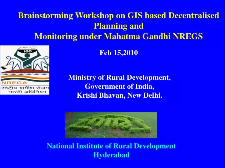
Brainstorming Workshop on GIS based Decentralised Planning and Monitoring under Mahatma Gandhi NREGS Feb 15,2010. Ministry of Rural Development, Government of India, Krishi Bhavan, New Delhi. National Institute of Rural Development Hyderabad. OUTLINE OF THE PRESENTATION

E N D
Brainstorming Workshop on GIS based Decentralised Planning and Monitoring under Mahatma Gandhi NREGS Feb 15,2010 Ministry of Rural Development, Government of India, Krishi Bhavan, New Delhi. National Institute of Rural Development Hyderabad
OUTLINE OF THE PRESENTATION PART-I MINISTRY SUGGESTED GUIDELINES PART-II NIRD SUGGESTED PROCESS PART-III NIRD RESEARCH PROPOSALS
PART-I MINISTRY SUGGESTED GUIDELINES
ASSET MANAGEMENT: Capturing existing Assets with their location, present status and meta data Validation of data on created assets. Periodic asset assessments & summarized reports using measurement scales. Asset maintenance report, assessment and management
Map Management: Preparation of Base Maps With Relevant Terrain Data. Cataloging the Maps for Easy Access and Retrieval. Integration of Attribute Information From Various Sources. Appropriate Methodology for Collection, Collation, Storage And Processing of Data in a Given Region & Synoptic
Map Management: • Standardized Formats For • Natural Resources • Socio- Economic Data • In An Integrated Manner To Establish • Linkage Among Various Hierarchical Units. • Remote Sensing Maps: Village Maps On Larger Scale • (1:4,000 or 1:10,000 scale) by • Using High Resolution Satellite Data • Identify Soil Layers and Fertility Levels.
Planning and Development: As-Is views of the area under the program - Existing assets, current coverage, impact. Scope and targets of program – Target, time lines, funds etc. Features for Asset, asset deployment, costing and its target coverage.
Planning and Development: Analytical tools for assessing a plan at asset level, region level and program level. What-if-Analysis at any stage of planning. Transition view starting from abinitio state to program completion state with provision for interim states. Plan for water harvesting structures like tributaries, drains, etc with depth and slope.
Evaluation and Monitoring of activities: • Preparation of change map that depicts the • activities taken up during the implementation • phase. • Developing methodology for nation-wide • monitoring considering time and economic • feasibilities.
Evaluation and Monitoring of activities: • Mapping two time period satellite data following • appropriate classification scheme & field visit. • Developing methodology for possible identification and • mapping of activities by respecting the limitations of • satellite data. • Ensuring visible Benefits: • Reduction in human interface • Real time and authentic data • collection • Reliability of Data • Optimising Time • Greater Convenience and ease
EXPECTED INPUTS • Work Plan and Methodology • Proposed Solution and Sizing (Diagram). • Implementation and Support Plan (If Diagram). • Process Architecture (Diagram).. • Proposed Network Architecture. (Placing of servers, • components etc). • Security features (Data, Network and Internet Security). • Integration with the NREGASoft (NREGA MIS) (Diagram). • Schedule of Activities (PERT Chart). • Technical Specification. • Activities and deliverables
AS IS STUDY • Cost and benefit analysis • Identification of project location • Identification of trainees • Identification of Equipment • Procurement of Devices or other hardware • Software Development: • Software development and software audit report • Training • Training to the GP Staff • Distribution of Job Cards and hands on training to • use Smart Card and hand held devices • Training report
Project Implementation • Methodology • Solution and Sizing. • Products / Personnel Positioning. • Implementation and Support Plan. • Process Flow Architecture. • Network Architecture. (Placing of servers, • components etc). • Security features • Integration with the NREGASoft (NREGA MIS). • Capture of data
Project Monitoring and Evaluation • Monitoring at Ministry level • Monitoring at State level • Monthly progress reports. • Report along with cost and benefit analysis • and recommendations
PART-II NIRD SUGGESTED PROCESS
GIS BASED PARTICIPATORY PLANNING UNDER MGNREGS OBJECTIVES: • Preparation of Village Level Plan for MGNREGS in a consultative process in a GIS frame work • Development of Customized Software for Geoinformatics based Planning
STEPS IN GIS BASED PARTICIPATORY PLANNING UNDER MGNREGA • Interaction with stakeholders in pilot project area • Development of framework for planning in a • participatory mode • Development/ review of data collection instruments • Integration with spatial and non-spatial data bases
STEPS IN GIS BASED PARTICIPATORY PLANNING UNDER MGNREGS • Spatial Decision Support System • Extraction Of Parameters (Development of • Parameters-Indices and Indicators • Disaggregated Unit Level) • Analysis And Generation Of Formats For • Decision Making Including Convergence • Work Estimation – Cost , Time and • Employment Norms using Geo spatial frame • work
STEPS IN GIS BASED PARTICIPATORY PLANNING UNDER MGNREGS Comprehensive Development Plan NREGS Schemes Development Seminar At Panchayat Level for Presentation of Possibilities and Alternatives Finalization of Plan by Panchayat
GEOINFORMATICS BASED MONITORING FOR MGNREGS Objectives: Device methodologies and process to apply GIS at village level for monitoring NREGS activities Capture both Spatial & Attribute Data pertaining to assets created at village level for Monitoring Generate various scenarios and convergence of various programmes for potential employment under MGNREGS
STEPS IN GIS BASED MONITORING UNDER MGNREGS • Identification & Selection of Parameters for Monitoring • Preparation of Geospatial Inventory of assets & location of works at village level • Capturing of Spatial Measurements And Conversion of Mandays for Employment Generation at project level • Developing a Framework of Monitoring at Panchayat Level Using Satellite Imageries and GPS/DGPS • Generation of Monitoring Report, Based on • Geospatial Data
FRAME WORK FOR GEOINFOMATICS BASED EVALUATION OF MGNERAGS OBJECTIVES Device Methods To Standardize Parameters for Evaluation Develop Methods For Studying Pre & Post Programme Implementation Differences Comprehensive Evaluation Report at Village Level
STEPS IN GIS BASED EVALUATION UNDER MGNREGS • Selecting Parameters & Standardization for • Evaluation • Framework For Comparing Objective • Parameters With • Achievement Parameters • Assessing Change Detection • Generation of Geospatial Data • Evaluation Report
PART-III NIRD RESEARCH PROPOSALS
Proposal on Geoinformatics Based Participatory Planning Monitoring & Evaluation of MGNREGS ( PILOT Projects in Action Research Mode) National Institute of Rural Development Hyderabad
STUDY AREA FOR PILOTS 15 villages in Various Agro climatic & Ecological Zones Selection of villages from : Hilly Region – J&K, HP, Uttakhand-3 Desert/ Drought Prone Region- Rajasthan, AP etc-4 Central India-3 North Eastern Region- 3 Southern Region-3 Coastal Region-4
CONSORTIUM OF PARTNER INSTITUTIONS 5 Regional CGARD Centers State Remote sensing Application Centers Subject mater specialist • SIRD • ETC • VRCS • CIC NGOs
DELIVERABLES (Planning) Digital Database Of Project Sites viz.- Base Map, LULC, Imagery of the Area with Attribute Database Comprehensive Plan Document Consisting of Identified Location of NREGA Works & Type of Work Digital Model (3D) of the NREGS Work Site at 1:4,000 scale Customized Software Package for Handling Spatial and Non Spatial Data Decision Support System For Prioritization of NREGS Works And Sites (Locations)
DELIVERABLES (Monitoring) • Inventory of assets with Spatial and non spatial data • describing characteristics – measurements etc. • Geoinformatics based customized analytical • methodology for monitoring progress of MGNREGS • works in a customized platform • Standardized GPS based identification for work • progress
DELIVERABLES (Evaluation) • Location specific standardized parameter for pre & • post comparison • Customized change detection process of NREGS • project sites • Methodology for area calculations (Volumetric • calculations 2D & 3D) and conversions into labor man • days
DURATION Total duration of the Project - 12 months TIME PLAN Field visit for data collection & ground truthing - 3 months Creation of spatial database - 2 months Integration of attribute database - 2 months Analysis & processing - 2 months First draft report & presentations - 1 month Final reports - 2 months
TRAINING FOR CAPACITY BUILDING • NEED • Exposure to IT and Geoinformatics Technology • Application for MGNREGS • Familiarisation with Application Modules • Skill Development on data handling, analysis • and mapping • Knowledge enhancement through Convergence
OBJECTIVES OF TOT COURSE To impart hands on training to Master Trainers, field functionaries and project managers of NREGA on the Capabilities of Geoinformatics; To demonstrate various application potential of Geoinformatics in NREGA Planning To familiarize the various GIS Software and application tools To impart working knowledge of handling GIS to develop applications for NREGA works
COURSE MODULES Module I: Concept, technology, applications and trends in Geo-informatics- 2 days Principles, concepts, tools, process and applications of Remote Sensing, Geographical Information Systems (GIS) and Global Positioning System (GPS) specific to NREGS through PPts, videos, films and Case studies and best practices. Module II : Digital Image Processing – Interpretation of Resource maps for NREGS – 2 days Introduction to Image Processing, rectification, Sub setting & Mosaicing, Enhancement techniques, classification, Preparation of Land Use/Land Cover, Generation of Slope, Aspect, DEM Generation, Change Detection Techniques. Practical sessions will be held in the lab with examples focused on MGNREGS activities.
Module III : Geographical Information Systems (GIS) & Preparation of Thematic maps for NREGS – 2 days Introduction to GIS, Data Models (Raster, Vector), Geo-referencing, Digitization, Importing and Exporting Data, Creation and converting the geo-database, Topology, Editing the existing features, working with layers, Integration and Analysis with specialized focus on MGNREGS schemes and works with appropriate hand holding exercises in the lab Module IV : Ground truthing of NREGS works – 1 day Field Verification, ground truth data collection, hand holding of GPS/DGPS/Total stations for Engineering structures and measurement of works done etc with visit to an ongoing scheme of MGNREGS wherein the participants are required to perform the measurements, formulation and computations on a geoinformatics platform like – handhelds – Palm tops (PDAs), Net books Module V : Project exercise – 3 days Participants are required to deal with data collected on field and integrate them on a GIS platform and prepare shelf of works for village level plan, to be used for identifying/planning, monitoring and evaluation. This module will actually give an experience to participants to use the l techniques learnt during the course.
PARTICIPANTS LEVEL: District level officials engaged in planning, Implementation of NREGS works Faculty from SIRDS/ATIs/Regional RD Institutes/ ETC/ VRC/ CIC etc, Officials from Sectoral Departments, engineering departments, Involved in NREGS PRI Functionaries, CEOs of Zilla Parishads/ Project Directors of NREGS
BUDGET Training cost for 30 TOT Programme (Cost Per Programme in Rs)
PARTNER INSTITUTIONS • Institutions No. Programme • SIRD 56 • VRC 20 • CICs 20 • CGARD Centres 25 • CGARD NIRD 10 • NERC /ERC/NC 15 • Total No. of TOT Programmes 146 Estimated No. of Participants to be trained 4380 • Total Financial requirements for • conducting 146 courses • @ Rs. 6,35,000 = Rs. 9,27,10,000
Process documentation of ICT Best Practices under Mahatma Gandhi National Rural Employment Guarantee Scheme
Introduction: Mahatma Gandhi National Rural Employment Guarantee Act implementation of in all States and Union Territories of India Though the Act is analogous to all states, some States perform better than other. All states have adopted their own strategies to implement this Act effectively. Some states adopted some innovative practices for better implementation Objectives: Documentation of Best Practices adopted by various states in implementation and payment of wages under MGNREGS To video document Best Practices to share during the Training Programmes in various states (both in Hindi and English).
Details of Documentation: • SMS monitoring of workers’ attendance – Tamil Nadu • Biometric payment and of wages through post offices – Andhra Pradesh • Payment of Wages through Smart Card–Andhra Pradesh (Banks), Orissa (Post Offices) • Payment through mobile ATMs – Dadra, Nagar & Haveli • Social Audit Process and follow up action–Andhra Pradesh • Online entry of muster rolls and measurements, generation of wage slips–Andhra Pradesh and Chhattisgarh. • Computerization of Gram Panchayats–Rajasthan • Payment through ATMs-Tamil Nadu & Kerala
Time Frame: 6 months • Budget Requirement: • Process Study by NIRD Research Team including their travel and faculty charges – Rs.5.00lakhs • Video Documentation Charges – Rs.30.00 lakh @ Rs.3.00 lakh per film • NIRD Institutional Charges (10%) – Rs.3.5 lakh • Total Cost of Documentation – Rs. 38.50 lakh
BUDGET Training cost for 30 TOT Programme (Cost Per Programme in Rs)
THANK YOU THANK YOU