Download
1 / 54
540 likes | 686 Views
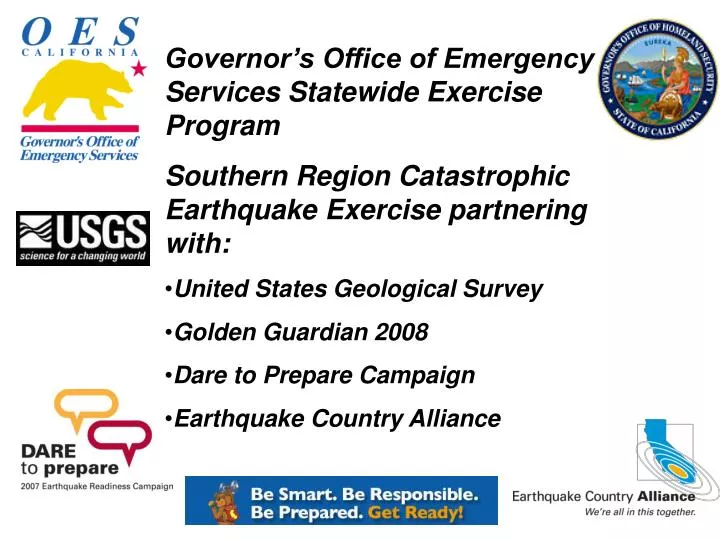
Governor’s Office of Emergency Services Statewide Exercise Program Southern Region Catastrophic Earthquake Exercise partnering with: United States Geological Survey Golden Guardian 2008 Dare to Prepare Campaign Earthquake Country Alliance. Ms. Curry Mayer, State Exercise Officer

E N D
Governor’s Office of Emergency Services Statewide Exercise Program • Southern Region Catastrophic Earthquake Exercise partnering with: • United States Geological Survey • Golden Guardian 2008 • Dare to Prepare Campaign • Earthquake Country Alliance
Ms. Curry Mayer, State Exercise Officer State Exercise Program Update New Exercise Page Statewide Exercise Strategy Training and Exercise Needs Assessment SEMS/NIMS Integration 07/08 Governor’s Office of Emergency Services Statewide Exercise Program
State Emergency Responder Credentialing Program New Specialist Certificates State Emergency Plan/Administrative Orders COOP/COG and ORP GG 07 The NEW FEMA Federal DHS National Exercise Program Governor’s Office of Emergency Services Statewide Exercise Program
Mr. Stephen Sellers 12 Years at OES Over 45 State and Federal Disasters Southern Region contains 2/3 of the State’s diverse population Nuclear Power Plants, 2 major port complexes, fires, floods, earthquakes, tsunamis, etc Regional Emergency Operations Center Governor’s Office of Emergency Services Southern Regional Administrator
Why we must act now. • 2007 is the 150th anniversary of the last great San Andreas earthquake in Southern California. • Scientists are nervous about the potential for another great earthquake on the San Andreas fault, especially the southernmost section. • There will be major loss of life and property unless we each take action now to be ready, by securing our buildings and their contents.
“California will fall in the ocean someday” “Northridge was a big-one” “It won’t happen here” “Earthquakes happen in the morning, when it’s hot and dry, etc.” “The most damage in an earthquake is always at the epicenter” “Scientists really do know how to predict earthquakes but don’t want to cause a panic” Common beliefs about earthquakes Myths...
Let’s talk about our faults SCEC Community Fault Model: 3-dimensional structures of major faults
Major Southern California faults in 3D SoCalFaults3D.mov • The Puente Hills fault: • Four large earthquakes in the last 10,000 years. • A potential 7.5 magnitude earthquake on this fault will cause great devastation. • These earthquakes occur much less frequently than San Andreas earthquakes.
23 large earthquakes since 1933 Date Time (local) Location Magnitude 1. 03.10.1933 5:54 pm Long Beach 6.4 2. 03.25.1937 8:49 am San Jacinto 6.0 3. 05.18.1940 8:37 pm Imperial Valley 6.9 4. 10.21.1942 9:30 am Fish Creek Mountains 6.6 5. 03.15.1946 5:49 am Walker Pass 6.0 6. 04.10.1947 7:58 am Manix 6.5 7. 12.04.1948 3:43 pm Desert Hot Springs 6.0 8. 07.21.1952 3:52 am Kern County 7.5 9. 11.21.1952 11:46 pm Bryson 6.2 10. 03.19.1954 1:54 am Arroyo Salada 6.4 11. 04.09.1968 6:29 pm Borrego Mountain 6.5 12. 02.09.1971 6:01 am San Fernando 6.6 13. 10.15.1979 4:54 pm Imperial Valley 6.4 14. 07.08.1986 2:21 am North Palm Springs 5.9 15. 10.01.1987 7:42 am Whittier Narrows 5.9 16. 11.23.1987 5:54 pm Elmore Ranch 6.2 17. 11.24.1987 5:15 am Superstition Hills 6.6 18. 04.22.1992 9:50 pm Joshua Tree 6.1 19. 06.28.1992 4:57 am Landers 7.3 20. 06.28.1992 8:05 am Big Bear 6.3 21. 01.17.1994 4:30 am Northridge 6.7 22. 10.16.1999 2:46 am Hector Mine 7.1 23. 12.22.2003 11:15 am San Simeon 6.5
Potential earthquake shaking Regions near major, active faults, will on average experience stronger shaking more frequently. This intense shaking can damage even strong, modern buildings. Regions distant from known, active faults. Will experience lower levels of shaking. In most earthquakes, only weaker masonry buildings would be damaged. However, very infrequent earthquakes could still cause strong shaking here.
Northridge earthquake • Jan. 17, 1994 • Magnitude 6.7 • 10x10 mile section of fault moved, all underground, from Southeast to Northwest • $40 billion • 33+ deaths
“Ft. Tejon” Earthquake: our last “Big One” • Jan. 9, 1857 • Magnitude 7.9 • 225 mile long rupture, from Northwest to Southeast Northridge • As long as 23 Northridge-sized faults • Today: at least $150 billion
Over 23 million people Fastest growing areas are close to the San Andreas Southern California in 2007
Our most likely next “Big One” • Southernmost San Andreas • Magnitude 7.8+ • Shaking for 2-4 minutes! • This will likely happen in our lifetimes, and could actually happen today.
Strong shaking throughout the most populated areas of So. Cal. • A regional disaster • You and your neighbors will need to rely on each other for several days: join or form a Community Emergency Response Team (CERT)
Most railroads, highways, aqueducts, power lines into LA cross the San Andreas fault
EQ +00:00:00 EQ 00:00:00 • 00:00:00 Earthquake Nucleates • 00:00:10 Electric Circuits Near Epicenter Begin to Trip Off • 00:00:10 DWP et al. and ISO Op- Centers Initiate Power Shedding to Balance Grid • 00:00:15 Progressive Blackout of Region Initiated to Prevent Cascading Failure • 00:00:30 Strong Ground Motions Felt Throughout Southern California
EQ +00:00:35 00:00:35 State Warning Center Receives Calls from Southern Counties on CALWAS – “Expletive! We’re having an Earthquake” 00:00:45 Electrical Power Off in Most of the Southern California 00:01:00 Earthquake Reported on Fox and CNN
EQ +00:01:00 Strong Ground Motions Taper Off Southern County 911 Centers are Saturated Phone Systems Saturated State Warning Center Begins Notification of Key State Agencies, Executive Staff, Governor’s Office
EQ +00:03:00 CISN Posts Location of Earthquake Epicenter Local Governments Responding to What They Can See State Warning Center Initiates Activation of State Operations Center CalTrans Initiates Remote Video Inspections of Bridges (If Operational)
EQ +00:03:00 CalTrans Maintenance and Traffic Operations Personnel Mobilized to EOCs and Maintenance Facilities Media Provides Initial Public Information on Emergency Alert System
EQ +00:05:00 CISN Posts Epicenter Location, Magnitude UC Berkeley Confirms Magnitude, Location to State Warning Center Caltech Off-line WCATWC Issues Tsunami Information Bulletin
EQ +00:08:00 CISN Posts First ShakeMap From UC Berkeley ShakeMap Downloaded to Federal, State and County Agencies ShakeMap is the First “Image” of the Event How Big? How Bad? Where?
EQ +00:10:00 State OES Completes Notification of Executive Staff, State Agencies and FEMA Governor and Staff Briefed State OES Mobilizes Response Team To Sacramento and Southern Region Statewide Mobilization of Fire and Law Mutual Aid System California National Guard Mobilized
EQ +00:20:00 USGS Issues Automated Aftershock Forecast (90% Probability of M5 and Larger Aftershocks in Next 7 days) 5% to 10% Probability of Larger Event
USGS Aftershock Assessment 7 Day Interval Calculated 20 Minutes After the Quake Magnitude Probability Number --------------- -------------- --------------- 5+ 100 46 (33-59) 6+ 100 6 (1-10) 7+ 50 1 (0-2)
EQ +00:30:00 OES GIS Staff are Recalled to Run HAZUS Loss Estimate Fire Mutual Aid Dispatched to Damaged Areas and Staging Areas CalTrans Imports ShakeMap into Damage Assessment Tools
EQ +00:35:00 OES Executive Requests Federal Assistance from FEMA, Based on ShakeMap (National Response Plan) Urban Search & Rescue Task Forces (USAR) Disaster Medical Assistance Teams (DMAT) Disaster Mortuary Teams (DMORT) Emergency Response Teams (ERT) Liaisons to Emergency Support Functions (ESF) for National Response Plan
EQ +02:00:00 Initial HAZUS Damage Estimates Available State Provides Initial Damage Estimates to FEMA and Request Presidential Disaster Declaration CalTrans and Highway Patrol Coordinating Inspections and Traffic Controls CalTrans Assessing Residual Capacity
HAZUS Estimates: Estimated Building Damage by Occupancy
Lifeline Damage Estimated Utility Pipeline Damage
Highway & Bridge Damage Estimated Damage to Transportation
Secondary Impacts Estimated Fire Ignitions and Debris Generated
Electric Power & Potable Water Estimated Households Without Service