Download
1 / 76
780 likes | 1.01k Views
Prepared for UNEP by Ahmed O. El-Kholei Professor of Urban Planning, Menofia University, and President, Consultants for Development and Environment (CDE), Egypt Email : aelkholi@cde.com.eg URL : www.cdefirm.com.

E N D
Prepared for UNEP by Ahmed O. El-Kholei Professor of Urban Planning, Menofia University, and President, Consultants for Development and Environment (CDE), Egypt Email: aelkholi@cde.com.egURL: www.cdefirm.com Rapid Environmental AssessmentPresented toThe Urban Community of Al-Fayha’, Lebanon
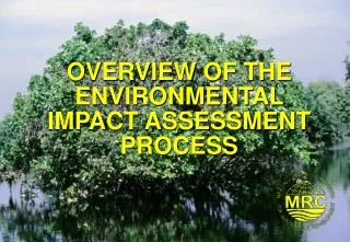
Introduction GEO conceptual framework
Introduction Location of Al Fayha’ within Lebanon
Introduction Tripoli, El-Mina and El-Beddawi
Introduction • A major feature of North Lebanese topography is the alternation of lowland and highland that runs generally parallel with a north-to-south orientation. • Al Fayha’ is blessed with two major waterways: • Abu Ali river, which is polluted and does not provide the city with fresh water, and • Naba Hab, which is a source of fresh water, • in addition to a number of springs and wells that provide the inhabitants with fresh water. Geography and topography
Introduction Geography and topography • There are number of good folds that occur in the Tripoli area. A major fold that is widely seen is the NNE-SSW trending Western Lebanon Flexure. This feature is technically a monocline and in places gives steep and even vertical dipping rocks. • Earthquakes constitute a major hazard for Lebanese population. A subtler hazard in Lebanon is that of soil erosion. • A final geological concern is of the pollution and contamination of the underground water supplies due, in part, to poor waste disposal practices.
Introduction Geography and topography: Simplified geological map of Lebanon
Introduction Geography and topography: Simplified structural map of Lebanon
Introduction Climate • Prevailing wind is from the southeastern direction • Tripoli witnessed 71 days of rain, and the sea was calm for 101 days during that year.
Social, Economic and Political Contexts Territorial occupation and land use over time
Social, Economic and Political Contexts Territorial Ooccupation and land use over time
Social, Economic and Political Contexts Territorial occupation and land use over time Green areas as percentage of total area of city, 2008 Per capita share of green areas (m2), 2008
Social, Economic and Political Contexts Distribution of economic activities Sectoral value added as percent of GDP), 2002-2007 Lebanon, GDP and GDP growth rate, 2000-2007
Social, Economic and Political Contexts Distribution of economic activities Rate of real growth of GDP (%) and per capita share ($), 1996-2006 Lebanon, Imports and export as percent of GDP, 2000-2006
Social, Economic and Political Contexts Distribution of economic activities Labor force stratified by economic sector, 1997-2004, percent
Social, Economic and Political Contexts Distribution of economic activities Registered and unregistered economic establishments in Al Fayha’, 2008 Share of shipments through Port of Tripoli versus other ports of Lebanon
Social, Economic and Political Contexts Growth and distribution of the population North Lebanon, population growth, 2000-2007 Al Fayha’, Population and Land distributed among the three cities, 2008
Social, Economic and Political Contexts Growth and distribution of the population Al Fayha’ - Population densities (persons/ha.), 2007 North Lebanon population histogram 1997 (right) and 2002 (left)
Social, Economic and Political Contexts Growth and distribution of the population Lebanon and North Lebanon Dependent population, 2004 Population of capital cities and selected urban agglomerations with 750 000 inhabitants in 2000 (thousands) Average annual rate of change of capital cities and selected urban agglomerations with 750 000 inhabitants or more in 2000 (%)
Social, Economic and Political Contexts Growth and distribution of the population Population with health insurance Health Insurance stratified by sponsor
Social, Economic and Political Contexts Growth and distribution of the population Cases stratified by diseases, 2007
Social, Economic and Political Contexts Growth and distribution of the population North Lebanon, Public and Private (free and for fees) Schools, 2003-2007 Lebanon, Public and Private (free and for fees) Schools
Social, Economic and Political Contexts Description of the local political-administrative structure • Lebanon consists of six governorates. • The Council for Development and Reconstruction (CDR) is the central body responsible for managing donors’ funds for various initiatives • The central government understands the urgency for interventions at the local level. • The Directorate General of Urban Planning, CDR has put a National Physical Master Plan of Lebanon that “defines the guiding principles for the development of the various regions and for the use of the diverse areas that constitute the national territory, proposing the infrastructure, the sites for activities and the actions best suited for implementation, specifying their purpose, magnitude and locations.”
Social, Economic and Political Contexts Description of the local political-administrative structure • The Ministry of Interior and Municipalities consists of seven agencies (muduriyat). One of these agencies is responsible for municipalities and local councils. • The Governor is appointed as a public official. At the municipal level, members of the local councils are elected, and they elect among themselves the City Chief (Mayor). For each municipality there is an observer, an employee of the fourth rank, who reviews and approves the decisions of the local council. • The civil society is completely politicized
Social, Economic and Political Contexts Description of the local political-administrative structure Revenues to the municipalities 2000-2007 (thousand LBP) The municipalities of Al Fayha’ provides a wide range of services and physical interventions.
Social, Economic and Political Contexts Analysis of local socio-economic factors • The major determinant for urban growth is migration from rural areas to urban centers • Workers’ remittances represent a significant source of income • The population of Al Fayha’ seems to be young, and will require special attention to initiate both economic growth and social development. • Al Fayha’ has number of economic development opportunities.
Social, Economic and Political Contexts Analysis of local socio-economic factors • However, there are number of barriers, such as: • The image of the metropolis; • Institutional hurdles (heavily centralized); and • The sectarian division.. • Urban sprawl will continue at the expense of vegetation cover and both the marine environment and coastal zones • Poverty is a major issue
Social, Economic and Political Contexts Analysis of local socio-economic factors
Social, Economic and Political Contexts Analysis of local socio-economic factors Share of total primary energy supply in 2006
Social, Economic and Political Contexts Analysis of local socio-economic factors
Social, Economic and Political Contexts Analysis of local socio-economic factors • Tripoli county suffers from quantitative water problem. • There is some pollution to the groundwater because of olive oil production processes that contaminate groundwater • The average daily consumption of water in Tripoli, according to Eng. Nasr, is around 120 to 150 liters/capita/day depending on the season. • Currently, Al Fayha’ does not have an integrated system for wastewater management. Many residential and non-residential buildings depend on septic tanks that are seldom evacuated. Al Fahya’ is developing a network for wastewater collection.
Social, Economic and Political Contexts Analysis of local socio-economic factors • The landfill of Al Fayha’s at the estuary of Abu Ali River at the Mediterranean next to the wastewater treatment plant. The landfill receives about 280 ton each day from the three cities and Al Qalamoun, the slaughterhouse, the refugee camp and resorts, such as Palma and Nagi. • Traffic, ships (port), landfill, car painting, furniture painting, Power plant of Deir Amar, landfill, ready mixed concrete plant, building construction, dust (geological) suspension from paved roads, fishing boats, unpaved unfenced parcels, road surface erosion, furniture manufacturing, and petrol transfer from tanks to road trucks, electrical power generators, and domestic heating are responsible for degraded air quality measured in PM10, PM 2.5
Social, Economic and Political Contexts Analysis of local socio-economic factors
Social, Economic and Political Contexts Analysis of local socio-economic factors Amount of wastes dumped in the landfill (kg), 2000-2007
Social, Economic and Political Contexts Analysis of local socio-economic factors Height of solid wastes in the land fill (m), 2000-2007
Social, Economic and Political Contexts Analysis of local socio-economic factors Daily generation of solid wastes by type of waste (ton), 2000-2007
State of the Environment Local ecosystems • Marine environment and coastal area: Fragile ecosystems with limited ability to regenerate themselves • Land is limited • Fresh water resources within and around Al Fayha’ are subject to all sources of pollution • Rich biodiversity
State of the Environment Analysis of ecosystems: AIR • The inventory list of air pollutants that TEDO has put together is a step into the right direction. For the air monitoring to be complete there is a need for: • Measure of background air quality plus the two monitoring stations at the port and downtown • Mobile station(s) to record measures in areas that experience episodes of severe air pollution. • Collect information on indoor air quality.
State of the Environment Analysis of ecosystems: Water • Integrated management of water resources is a major critical issue to be addressed in combating water stress • “There is no well-developed sewage network, nor wastewater control, nor proper solid waste collection and/or disposal in upstream areas. The major problem is the seepage of pollutants, leachates and chemicals into the groundwater affecting its quality. It is difficult to accurately estimate the pollution loads into water bodies since data on effluent generation from industries are poorly monitored, and there is insufficient data on effluent routes, i.e., direct discharge on land or into nearby water courses and the Mediterranean” (El-Hoz, undated, p. 7-8).
State of the Environment Analysis of ecosystems: Water • The available data that TEDO and the Water Authority in Tripoli provided is not sufficient for deciding on the quality of fresh water resources. The tests are not complete. They do include measurements of Total Organic Carbon (TOC), which is a major indicator for water pollution. • The measures applied to produce drinking water falls short of treating organic contamination.
State of the Environment Analysis of ecosystems: LAND • Population and economic growth exert excessive pressures on land within and around Al Fayha’. • The limited opportunities for agricultural development and lack of minerals limit opportunities for economic development to productive services, such as tourism and transportation, including the port • This will require the development of transportation facilities and roads that can negatively affect the environment. • The extensions of the harbor and the development of the new economic zone, if precautions mentioned in the EIA are not taken seriously, can lead to serious impacts.
State of the Environment Analysis of ecosystems: Biodiversity • The Palm Islands Nature Reserve, declared protectorate in 1992, comprises a group of three flat, rocky islands of eroded limestone pavement, 5.5 km offshore and northwest of Tripoli • Reserve has been designated a Specially Protected Area of the Mediterranean under the Barcelona Convention, an Important Bird Area by BirdLife International, as well as Wetland of Special International Importance
State of the Environment Analysis of ecosystems: Built Environment and Cultural Heritage • The cultural heritage and built environment of Al Fayha’, particularly old Tripoli, has dilapidated over time. The metropolis lost most of its green areas, particularly the lime and lemon plantations that gave it the reputation of Al Fayha’ • Urban planning and management in a capitalist society is often faced with property contradiction • Urban planning and management in a capitalist society also faces capitalist-democracy contradiction
State of the Environment Analysis of ecosystems: Solid wastes • Despite there is a system for collection and disposal of solid wastes, still there are quantities of solid waste that are not collected for one reason or another. • According to a LAVAJET official, there are three shifts to collect the waste and cleanse the streets because the residents are not totally cooperative with the company – an issue that requires attention by applying law enforcement and raising awareness.
State of the Environment Analysis of ecosystems: Marine Environment and Coastal Zones • The marine environment and adjacent coastal areas form an integrated ecosystem that provides local economies with amble development opportunities. . • The marine environment and coastal zones of Al Fayha’ are under severe development pressures. There are number of endangered marine animals that can be spotted at the Palm Island vicinity.
State of the Environment Analysis of ecosystems: Mountains • Mountains are an important source of water, energy and biological diversity. Furthermore, they are a source of such key resources as minerals, forest products and agricultural products and of recreation. • Under Law No.121 on March 9, 1992, the HorshEhden Nature Reserve was established, 26 km away from the city of Zgharta • It represents an opportunity for ecotourism activities that can have positive impact on the local economies of both the Governorate and that of Al Fayha’.
State of the Environment Analysis of ecosystems: Summary • The state of the local environment is not serious yet. However, if current conditions continue then the state of the local environment will get worse with serious implications that can possibly threaten the sustainability of Al Fayha'. • Water resources are receiving loads of pollution. This situation will be resolved once the construction of the tunnel and the network is completed, and the wastewater treatment plant is operational. • Today the landfill is approaching its full capacity. Al Fayha' needs a sanitary landfill in the near future. • There is a need for a transit station for sorting solid wastes and then reusing whatever solid wastes, recovering energy of the collected wastes and recycling recycables. • Monitoring air pollution needs more attention. There is a need for preventive and corrective measures • Marine environment, coastal areas and biodiversity all require special attention given that Lebanon is a signatory to several international conventions. Future economic plans for boosting the local economy are pressures on these delicate ecosystems. • Land and the built environment are in need for proper management. The current environmental status indicates need for proper land use and management.
Impact of the State of the Environment • The environmental degradation stands at US$ 107 million, equivalent to 4.2 percent of the GDP of the northern coast in 2005 • The order of magnitude cost estimates are slightly greater than the ones derived from Lebanon’s Cost of Environmental Degradation (COED) in 2000 (3.9 percent). • However, when global externalities are not included, the difference between both figures reaches 0.7 percent of GDP
Impact of the State of the Environment Lebanon and Northern Coastal Zone Cost of Environmental Degradation Comparison
Impact of the State of the Environment • Ranked by Casa • The Tripoli federation of municipalities (57 percent) bears the brunt of the coastal environmental degradation • Batroun (16 percent), • Akkar (14 percent), • Minieh-Dennieh (11 percent) and • Koura (1 percent).