Download

1 / 52
520 likes | 525 Views
Join NASA's Curiosity rover on a fascinating journey in Gale Crater to explore Mars' habitability and geological history. Discover the rover's findings on Martian rocks and minerals and learn about the impact of water on the planet's surface. Witness the rover's survival through a daring landing and its use of advanced tools to answer crucial scientific questions. Follow Curiosity's tracks as it uncovers the mysteries of the Red Planet.

E N D
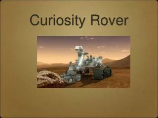
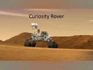
Following Our Curiosity NASA/JPL-Caltech/MSSS A Stunning Year of of Science in Gale Crater!
In August 2012, Curiosity landed safely in Gale Crater. NASA/JPL-Caltech Artist’s Concept. NASA/JPL-Caltech
Since then, Curiosity has been scooping, sampling, driving and drilling. NASA/JPL-Caltech/MSSS
Our goal is to learn if Mars could have supported microbial life. NASA/JPL-Caltech/MSSS
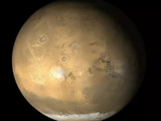
Scientists chose Gale Crater because of the interesting minerals found there… NASA/JPL-Caltech NASA/JPL-Caltech/ESA/DLR/FU Berlin/MSSS Clays and sulfates require water for their formation.
…and the 3-mile (5-km) high mountain in the center—Mount Sharp! Interesting layers NASA/JPL-Caltech/ESA/DLR/FU Berlin/MSSS Differences in the texture of the rock layers at the bottom of the mound suggest environmental changes over time. NASA/JPL-Caltech
Some of the questions are: Could microbial life have survived here? What can we learn from studying Martian rocks and minerals? How has water shaped the surface of Mars? Will the surface radiation be harmful to human explorers? Artist’s Concept. NASA/JPL-Caltech
Curiosity is loaded with tools to answer these questions. ChemCam (Chemistry) Mastcam (Imaging) APXS (Chemistry) Drill Scoop Brush Sieves MAHLI (Imaging) RAD (Radiation) REMS (Weather) DAN (Subsurface Hydrogen) MARDI (Imaging) CheMin (Mineralogy) SAM (Chemistry and Isotopes)
But first, Curiosity had to survive a hair-raising landing. NASA/JPL-Caltech/MSSS The descent camera took a picture of the heat shield just after it was released.
Curiosity’s descent engines blew dust and gravel off the ground just before touching down. NASA/JPL-Caltech/MSSS
“Touchdown confirmed” = Music to Our Ears! NASA/JPL-Caltech First picture from Mars!
This panorama shows tracks leading away from “Bradbury Landing.” NASA/JPL-Caltech The landing site was named after science fiction writer, Ray Bradbury, an inspiration to many on the team.
From Bradbury Landing, Curiosity had a great view of its primary destination--Mount Sharp. These marks are called ‘scours’ Mount Sharp rises in the distance, about 12 miles (20 km) away. NASA/JPL-Caltech/MSSS
After health checks and software updates, the team tested the first laser used on Mars, on ‘Coronation’ rock. NASA/JPL-Caltech/LANL/CNES/IRAP NASA/JPL-Caltech/MSSS NASA/JPL-Caltech/LANL/CNES/IRAP/MSSS
By analyzing the sparks produced by the laser, scientists learned it is basalt, a volcanic rock common on Mars. NASA/JPL-Caltech/LANL/CNES/IRAP/IAS/MSSS NASA/JPL-Caltech/LANL/CNES/IRAP The vertical lines, or peaks, show the chemical elements that are found in the rock.
Scientists used three tools to study this rock, yielding richer data than ever possible. APXS Spectra NASA/JPL-Caltech/MSSS LANL/IRAP/CNES/IAS/LPGN NASA/JPL-Caltech/U. Guelph One instrument showed that this pyramid-shaped rock is similar to basalts on Earth produced by partial melting of the rock below the Earth’s surface.
Scientists can learn about how a rock was formed, just by looking closely at the texture. Close Closer Closest These images were taken by the camera on Curiosity’s arm, which can see in microscopic detail. NASA/JPL-Caltech/MSSS
Curiosity’s cameras are not only used for science, they can also help checkout the rover. NASA/JPL-Caltech/MSSS Even though she was dusty, Curiosity still got a ‘clean bill of health!’
After the Bradbury Landing studies, it was time to start driving. NASA/JPL-Caltech/Univ. of Arizona Curiosity and its tracks as captured by the Mars Reconnaissance Orbiter, 200 miles overhead.
Curiosity headed toward Glenelg, where three distinct terrain types meet. NASA/JPL-Caltech/Univ. of Arizona Pictures from orbit suggest that the rocks in the three areas are very different. The science team would like to know why.
On the way to Glenelg, Curiosity discovered rocks formed in ancient streambeds, called conglomerates. NASA/JPL-Caltech/MSSS Conglomerates are water-smoothed pebbles cemented together over time.
The rock “Link,” made of round pebbles cemented together, confirmed that water once flowed in Gale Crater. NASA/JPL-Caltech/MSSS
Curiosity is driving on an area scattered with small rocks and soil washed down from the northern crater rim, called an alluvial fan. NASA/JPL-Caltech/UofA
Next, it was time to try Curiosity’s scoop, one of the tools for collecting samples. NASA/JPL-Caltech/MSSS Scooping sand or soil and drilling into rocks are two ways Curiosity can get samples into the on-board instruments.
Scientists chose this windblown “sand shadow” at the Rocknest site for the first sand scoops. NASA/JPL-Caltech/MSSS
This wheel scuff confirmed it was safe to scoop the sand. Some kick the tires, Curiosity uses her ‘tires’ to do the kicking. NASA/JPL-Caltech
NASA/JPL-Caltech/MSSS NASA/JPL-Caltech NASA/JPL-Caltech/MSSS A close look at the sand reveals different textures and sizes. Only the smallest grains can fit into the instruments.
The team put the sand into the Sample Analysis on Mars (SAM) instrument to learn its makeup. NASA/JPL-Caltech/Goddard Water Oxygen Carbon Dioxide Sulfate Hotter Hot SAM’s tiny ovens heat the sample and measure the gases that emerge at different temperatures during a heating cycle.
The CheMin instrument also ‘snacked’ on sand, using X-rays to identify the mineral ingredients. NASA/JPL-Caltech/Ames Rocknest sand is made of basaltic minerals, evidence of past volcanic eruptions on Mars.
Curiosity took a ‘selfie’ at Rocknest, made from 55 images taken with the MAHLI camera on the arm. Four scoops and a wheel scuff, a busy few weeks! NASA/JPL-Caltech/MSSS
Curiosity’s Rover Environmental Monitoring Station (REMS) is always looking at the weather. NASA/JPL-Caltech/CAB(CSIC-INTA) The ground temperature changes by 90°C (170 F) between day and night— you would need to dress in layers!
REMS measurements show that the daily air pressure changes as much as if you were driving from Los Angeles to Denver. NASA/JPL-Caltech/CAB(CSIC-INTA)/FMI/Ashima Research Air pressure increases daily because the sun heats the ground. This creates a high pressure ‘wave’ across Mars, following the sun.
Curiosity’s Radiation Assessment Detector (RAD) measures high-energy radiation, helpful for planning future human missions. The red line shows RAD’s radiation data Blue ‘peak’ indicates higher air pressure NASA/JPL-Caltech/SwRI When the atmosphere is thicker (higher pressure), RAD measures less radiation on Mars’ surface. NASA/JPL-Caltech/SwRI
A spacecraft carrying humans to Mars would need layers of protection. The light blue bar shows that on a 6 month voyage to Mars, human explorers would be exposed to a lot of radiation. NASA/JPL-Caltech/SwRI
Curiosity’s Dynamic Albedo of Neutrons (DAN) instrument shoots a stream of neutrons into the soil, seeking water abundance beneath the rover. Scientists compare Mars data (red line) with Earth data (blue line) measured before launch. NASA/JPL-Caltech/Russian Space Research Institute If hydrogen is present in the ground, it could be a sign of water molecules trapped within minerals.
The SAM instrument, inside the rover, can measure the chemical mix in Mars’ atmosphere. Atmospheric Gas Abundances Measured by SAM SAM found that Mars’ atmosphere has more ‘heavier’ versions or isotopes, of the gases. Lighter isotopes may have been lost as the top of Mars’ atmosphere escapes into space. NASA/JPL-Caltech/Goddard Methane, which can be produced by living things, has not been definitively detected.
Curiosity has completed its study of Yellowknife Bay, a basin within the Glenelg region. NASA/JPL-Caltech/Univ. of Arizona
Yellowknife Bay resembles many desert areas on Earth. NASA/JPL-Caltech/MSSS
But Yellowknife was not always dry. These rock layers form when fine soil washes down a streambed and settles downstream. NASA/JPL-Caltech/MSSS
NASA/JPL-Caltech/MSSS A closer look shows different rock types, fractures, and veins of harder rock. NASA/JPL-Caltech
These rocks contain tiny cracks filled with calcium sulfate minerals left when the water that flowed here dried up. NASA/JPL-Caltech/LANL/CNES/IRAP/IAS/ LPGN/CNRS/LGLyon/Planet-Terre ChemCam Remote Micro-Imager NASA/JPL-Caltech/LANL/CNES/IRAP/LPGNantes/CNRS; Earth image: LGLyon)
These rocks also contain ‘spherules,’ like little marbles, left when water is forced through tiny holes in the rock. NASA/JPL-Caltech/MSSS
Because of signs that water was once present in Yellowknife Bay, scientists chose this site for the first-ever drilling on Mars! NASA/JPL-Caltech/MSSS This drill site, named John Klein, shows the interesting cracks and veins.
As with other rocks, the team uses several tools to learn about each target. The ChemCam laser left these tiny pits. “Wernecke” Sol 169 NASA/JPL-Caltech/MSSS/Honeybee Robotics/LANL/CNES NASA/JPL-Caltech/LANL/IRAP/CNES/LPGNantes/IAS/CNRS/MSSS
This image shows Curiosity’s arm in drilling position, as Mount Sharp looms in the distance. NASA/JPL-Caltech/D. Bouic
NASA/JPL-Caltech/LANL/CNES/IRAP/IAS/LPGN NASA/JPL-Caltech/MSSS NASA/JPL-Caltech/MSSS Two drill holes surrounded by grey powder. The inside of the rock is very different than the surface.
The CheMin instrument found clay minerals in the grey rock powder – clays form when rock interacts with fresh water! NASA/JPL-Caltech/Ames
NASA/JPL-Caltech/GSFC SAM found elements, such as sulfur, that could have provided energy for microbes if they lived at Gale. Gale was a place that could have supported life. NASA/JPL-Caltech/GSFC
Curiosity drilled a second rock, called “Cumberland” to confirm science results found at the first drill site. NASA/JPL-Caltech/MSSS
An Ancient Habitable Environment • at Yellowknife Bay • The John Klein site was at the end of an ancient river or in a lake bed that was sometimes full of water. • Minerals found there form in water that was not too salty and not too acidic. Was it ‘just right?’ • Key chemical ingredients for life are present, such as carbon, hydrogen, nitrogen, oxygen, phosphorus, and sulfur • Minerals in various states of oxidation (or changing in the presence of oxygen) could have been ‘eaten’ by primitive microbes, if they were there. NASA/JPL-Caltech/MSSS