Download
1 / 33
330 likes | 494 Views
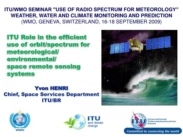
ITU/WMO SEMINAR "USE OF RADIO SPECTRUM FOR METEOROLOGY” WEATHER, WATER AND CLIMATE MONITORING AND PREDICTION (WMO, GENEVA, SWITZERLAND, 16-18 SEPTEMBER 2009). ITU Role in the efficient use of orbit/spectrum for meteorological/ environmental/ space remote sensing systems. Yvon HENRI

E N D
ITU/WMO SEMINAR "USE OF RADIO SPECTRUM FOR METEOROLOGY” WEATHER, WATER AND CLIMATE MONITORING AND PREDICTION (WMO, GENEVA, SWITZERLAND, 16-18 SEPTEMBER 2009) ITU Role in the efficient use of orbit/spectrum for meteorological/ environmental/ space remote sensing systems Yvon HENRI Chief, Space Services Department ITU/BR
ITU in brief • Founded on 17 May 1865 • 191 Member States, > 700 Sector Members & Associates • 750 staff / 70 nationalities • Annual budget = $140,000,000 • http://www.itu.int • ITU is the leading UN agency for information and communication technologies
ITU Key priorities • radio spectrum • international standards • emergency communications • climate change monitoring • digital divide • cybersecurity
ITU Mission “To ensure rational, equitable, efficient andeconomicaluse of the radio frequency spectrum by all radiocommunication services - including those using the geostationary satellite orbit or other satellite orbits- and to carry out studies on radiocommunication matters”
United Nations Outer Space Treaty (1967) Outer space free for exploitation and use by all states in conformity with international regulations States retain jurisdiction and control over objects they have launched into outer space
United Nations Outer Space Treaty (1967) • International Telecommunication Union Principles of use of orbit/spectrum Allocation of frequency bands Procedures, Plans, operational measures Instruments (CS, CV, RR, RoPs, Recs)
INTERFERENCE GSO SATELLITES Non-GSO SATELLITES TERRESTRIAL STATION RECEIVING EARTH STATION TRANSMITTING EARTH STATION
Propagation of Radio waves • Laws of physics • Radio waves do not stop at national borders Interference • possible between radio stations of different countries • This risk is high in Space Radiocommunications Radio Regulations (RR) • One of its main purposes - Interference-free operation of Radiocommunications
Radio Regulations Mechanisms Control of Interference ALLOCATION Frequency separation of stations of different services POWER LIMITS PFD to protect TERR services / EIRP to protect SPACE services / EPFD to protect GSO from Non-GSO REGULATORY PROTECTION e.g. No. 22.2: Non-GSO to protect GSO (FSS and BSS) COORDINATION between Administrations to ensure interference-free operations conditions
Radio Regulations • Lengthy & complex procedure Decided by Administrations during WRC Governed by: • More sophisticated use of spectrum • Individual requirements of administrations Trend towards simplification / improvement to certain procedures
Radio Regulations • Lengthy & complex procedure • Efficient use of spectrum • Equitable access • Opportunity to resolve interference before operation • Prevents loss of investment, customers & revenue by minimizing unusable capacity due to interference 11
Radio Regulations • Rights & obligations + applicable procedures • Two mechanisms of sharing orbit / spectrum: Coordination Approach Efficiency ÛFirst come, first served for actual requirements Planning Approach Equitable access Û Plan for future use 12
Article 9 (Sect.I, II)(Coordination procedure) Article 11(Notification procedure) Article 21, 22(Limits) Procedural ApproachObjectives App. 4App. 5 Exchange of information Res 49 … Coordination Efficient & Rational Utilization 13
Radio Regulations (RR) • The internationalrights and obligations of the Administrations in respect of their own satellite • systems and of other administrations’ frequency assignments are derived • from the recording of their assignments in the MIFR. • Such rights, and in particular the international recognition, are conditioned by the provisions of the Radio Regulations
Status RIGHT for international recognition OBLIGATION to eliminate harmful interference Art7-8 Radio Regulations - 3 Definitions – Art1-3, AP14, 42 Administrative Secrecy/Licences/Interception/Identification of stations/call signs/Service PublicationsArt 17-20 Bureau & RRB – Art13-14 Frequency TABLE (9kHz-275GHz) Art4-6 Interference & Monitoring Art15-16 AP9-10 ProceduresCoordination, Notification & Recording Art9, 11AP4-8 Limits technical/operational Arts 21, 22 Apps 1-3 Services Aeronautical – Art35-45 Maritime – Art46-58Amateur, broadcasting, fixed, radiodetermination, standard freq. & time - Art12, 23-29 AP11-13, 16, 19 Plans Maritime HF, VHF (AP17-18) Maritime coast stations (AP25) Aeronautical (OR) (AP26) Aeronautical (R) (AP27) Broadcasting-satellite (AP30-30A) Fixed-satellite (AP30B) GMDSSArt30-34AP15 MIFR(Master Register)
ART 5 frequency allocations No. 5.2 - For the allocation of frequencies the world has been divided into three “radiocommunication” Regions
ART 5 frequency allocations • A frequency band can be allocated to more than one service (PRIMARY or secondary), either on a worldwide or Regional basis • No. 5.28 - Stations of a secondary service: • 5.29 -shall not cause harmful interference to stations of primary services …; • 5.30 –can not claim protection from harmful interference from stations of a primary service …; • 5.31 -can claim protection, however, from harmful interference from stations of the same or other secondary service(s) …. • A footnoteto a frequency band or service may include a restrictionon the service or services concerned • to operate in a particular country (ies) • not causing harmful interference to another service • not claiming protection from another service
Radio Regulations and Sensors • No. 1.182 active sensor: A measuring instrument in the earth exploration-satellite service (EESS) or in the space research service by means of which information is obtained by transmission and reception of radio waves. • No. 1.183 passive sensor: A measuring instrument in the earth exploration-satellite service or in the space research service by means of which information is obtained by reception of radio waves of natural origin.
Remote Sensing (1) • Remote sensors are the only tools that provide environmental data on a long term, repetitive and GLOBAL scale. • Radiocommunication systems based on remote sensing play the major role in weather and climate prediction. • Remote sensing is the essential tool for disaster prediction, detection, disaster mitigation and planning of relief operations. • Sensors are used for detection and tracking of earthquakes, tsunamis hurricanes, typhoons, floods, fires, oil leaks, dangerous pollution, etc.
Remote Sensing (2) • Remote sensors are the basis of meteorological and Earth exploration-satellite services. • Operated in the main by governments and international agencies (NASA, ESA, CNES, ISRO, NOAA, METEOSAT, etc) • Data collected by active and passive sensors are distributed worldwide in the Global Observing System (GOS) and used to benefit humanity as a whole. • Remote sensing data are frequently disseminated through other radiocommunication systems belonging to the fixed-satellite service as well as other services.
WRC and Remote Sensing (1) • WRCs regularly consider remote sensing requirements for allocation of additional frequency bands, sharing with other services, protection from interference, etc. • WRC-07 considered (with positive results) 4 main issues directly related to remote sensing: • extension of band for active sensors; • extension of band for meteorological-satellite service; • sharing between Earth exploration-satellite service (EESS) (passive) and active services; • protection of EESS (passive) from unwanted emission from actives services.
WRC Remote Sensing (2) • WRC-07 also approved 5 Resolution and specific Agenda items for the next WRC-11 on the use and further development of remote sensing systems: • These Resolutions are related to: • use of optical links for remote sensing; • development of systems for lightning detection; • use of high-frequency oceanographic radars for measurement of coastal sea surface conditions; • further development of the meteorological-satellite systems operating near 8 GHz; • use of radiocommunications for Earth observation
WRC and Remote Sensing (3) • The relevant Agenda items in connection with Remote Sensing are as follows for WRC-12 • 1.6: frequencies between 275 and 3 000 GHz: passive or active? • 1.8: regulatory issues relative to the fixed service between 71 and 238 GHz (protection of the passive band 86-92 GHz) • 1.22: effect from Short Range Devices (SRD), impact on ALL radiocommunication services
Use of the EESS Passive Sensors • Microwave observations at frequencies below 100 GHz enable studies of the Earth’s surface and its atmosphere from spaceborne instruments even in the presence of clouds, because clouds are almost transparent at these frequencies. This "all-weather" observing capability has been very important for EESS in achieving the repetitive global coverage mandatory for meteorological, climatological, and environmental monitoring and surveying. • The impressive progress made in recent years in weather analysis, warning and forecasts, especially for dangerous weather phenomena that affect all populations and economies is largely attributable to the spaceborne observations and their assimilation in numerical models. • Play a major role in the prediction and detection of disasters.
EESS Passive sensors - Frequency bands Typical bands and their main application: • 1 400-1 427 MHz: salinity (ocean), soil moisture (ground) • 10.6-10.7 MHz: rain, snow, ice, sea state, ocean wind • 23.6-24 GHz: total content of water vapour • 31.3-31.5 GHz: the lowest cumulated effects due to oxygen and water vapour in the vicinity of the 50 GHz band. Optimum window channel to see the Earth’s surface: reference for the other channels. • 36-37 GHz: cloud liquid water, vegetation structure, surface roughness • 50.2-50.4 GHz: temperature profile
Microwave Spectrum Spectral Sensitivity to Environmental Parameters: Land Surface
Microwave Spectrum Spectral Sensitivity to Environmental Parameters: Ocean Scene
Aura/Aqua/Terra SORCE QuikScat Sage TRMM SeaWiFS SeaWinds Envisat UARS ERBS Landsat 7 Grace Jason EESS Observation Systems IKONOS CBERS SPOT 4, 5 SPIN-2 Orbview 2, 3 DMC ACRIMSAT EROS A1 Radarsat ALOS Toms-EP QuickBird
EESS (passive) Application Remote Sensing Key Applications -1 • Weather Prediction: a key input to numerical weather prediction models used globally for weather forecasting. • Global Warming: concentrations and distributions of atmospheric gases, sea and land ice thickness and change, and ozone measurements are key components to studying and prediction of global warming. • Significant Weather Events: the prediction of dangerous weather events requires accurate measurements of rain rates in storms over the oceans which is only possible with remote sensing EESS. • Forest Fires: detection of fires through smoke by their microwave radiation.
EESS (passive) Application Remote Sensing Key Applications -2 • Management of Natural Resources: measurements of biomass, deforestation, and water resources through systematic environmental monitoring. • Volcanoes: used to detect volcanic activity even before eruptions and to track and predict the volcanic fallout effects. • Shipping: used to track sea ice, ice floes, and ocean storms to steer ships out of harm’s way. • Long Range Climate Forecasts: study of global atmospheric and oceanic events such as El Niño requires sea surface temperature, ocean winds, ocean wave height, and many other components used in the prediction of long range weather forecasting and climatic trends.
ITU Role in the efficient use of orbit/spectrum for meteorological/ environmental/ space remote sensing systems Yvon HENRI Chief, Space Services Department ITU/BR Questions ?