Download
1 / 25
250 likes | 420 Views

E N D
1. Identification of Invasive guava (Psidium guajava) on Isabela Island, Gal�pagos Archipelago using Object Based Image Analysis Techniques Amy L. McCleary
Department of Geography & Carolina Population Center
University of North Carolina at Chapel Hill
2. Introduction Galapagos Islands are a site of world renowned biodiversity
Increasing human impact on the islands� fragile ecosystems
Tourism
Population growth
Mounting pressure on native plant and animal species
3. Introduction (cont) Introduced & Invasive species indicative of human impacts
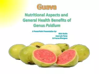
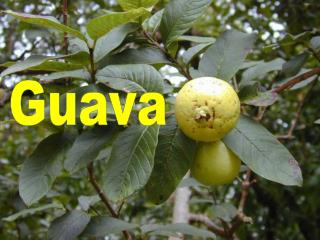
Guava (Psidium guajava) is one such invasive species
Spatial distribution and pattern of invasive plants in Galapagos is often not well understood
4. Research Goals Characterize the occurrence and spatial pattern of guava (Psidium guajava) for a test site on Isabela Island, Galapagos using Object Based Image Analysis methods.
Evaluate whether OBIA methods are well suited to characterization of an invasive plant at the species level.
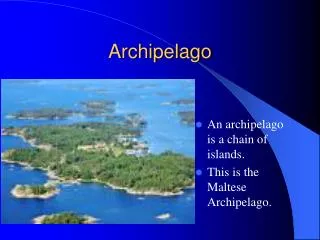
5. Galapagos Archipelago 1,000 km off the coast of Ecuador
19 large islands, 200 small islands and rocks
97% of the archipelago is protected; 3% is comprised of agricultural zones and small communities
Rapid growth of human population in last 20 years
6. Isabela Island, Galapagos Study area is positioned on the southeastern slope of Sierra Negra volcano
Straddles agricultural zone and Galapagos National Park
Guava has become a highly conspicuous invasive plant on Isabela Island
7. Guava (Psidium guajava) Cultivated shrub/small tree grown for its edible fruit
3-10 m tall
Intentionally introduced into humid highlands
Has become invasive and is replacing native species
Costly and time-consuming to eradicate
8. QuickBird Multispectral Data Acquired October 22, 2004
2.4 m spatial resolution
4 bands, 0.45-0.90 micrometers
20-40 km swath width
9. QuickBird Multispectral Data Acquired October 22, 2004
2.4 m spatial resolution
4 bands, 0.45-0.90 micrometers
20-40 km swath width
10. QuickBird Multispectral Data Acquired October 22, 2004
2.4 m spatial resolution
4 bands, 0.45-0.90 micrometers
20-40 km swath width
11. Object Oriented Image Analysis Well suited to the classification of high spatial resolution imagery
E.g., QuickBird, Ikonos, Aster
Relies on knowledge-based membership functions that explicitly define rules to classify regions (i.e., contiguous groups of pixels), rather than traditional methods that apply a single decision-rule on a per-pixel basis
Segmentation and classification algorithms are available in Definiens Professional 5
12. OBIA Workflow Load image data.
13. OBIA Workflow Load image data.
Create image objects.
14. OBIA Workflow Load image data.
Create image objects.
Define classification scheme.
15. OBIA Workflow Load image data.
Create image objects.
Define classification scheme.
Apply classification to image objects.
16. Methods: Image Segmentation Multiresolution segmentation.
Top-down approach.
5 levels of analysis.
17. Methods: Define Classification Scheme Created class scheme:
Guava
Green vegetation
Soil & dry vegetation
Defined membership functions for each of the classes
Based on spectral response of landscape features within objects
18. Methods: Apply Classification Applied to all 5 levels of analysis.
19. Methods: Re-Define Classification Scheme Altered class scheme:
Guava
Green vegetation
Soil & dry vegetation
Trees
Non-photosynthesizing
Photosynthesizing
20. Methods: Apply New Classification Applied to all 5 levels of analysis.
21. Landscape Pattern Metrics Total Area
Total area of guava for the defined study area
Patch Density
Number of patches of guava per 100 hectares
Contagion
Landscape fragmentation
These metrics were used to quantify the degree of land fragmentation of guava
22. Summary of Findings Guava exists across a large proportion of the test area.
Nearly 1,600 Ha (of 8700 Ha)
Guava occurs mainly in large patches that are moderately connected.
Abandoned agricultural plots
Young patches are difficult to identify as the are spectrally similar to grasslands
Present both in the agricultural zone and within the Galapagos National Park boundary.
Largest patches mostly restricted to the agricultural zone
Individual trees/shrubs in transition zone along GNP
23. Summary of Findings (cont) In general, OBIA methods are well suited to the identification of invasive guava at the species level.
However, there are some drawbacks
Time consuming
Requires good understanding of landscape
Software is expensive, as is high-spatial resolution imagery
And benefits also
Processes can be automated
Integrates RS and GIS functionality
Flexibility in defining classes
24. Future Research Work with fuzzy membership classes to improve overall LULC classification.
Expand the membership functions to include textural measures of target classes, as well as spatial-spectral relationships between neighboring classes.
Include non-spectral attributes in the segmentation and classification processes
Terrain characteristics
Land ownership information
25. Acknowledgements People
Dr. Stephen J. Walsh
Carlos F. Mena
Julie P. Tuttle
Yang Shao
Institutions
Carolina Population Center
Department of Geography, UNC-CH
Galapagos National Park Service
Charles Darwin Foundation
CLIRSEN
THANKS!