Download
1 / 37
370 likes | 474 Views
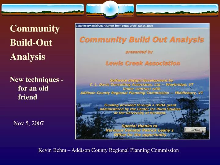
Community Build-Out Analysis. New techniques - for an old friend. Nov 5, 2007. Kevin Behm – Addison County Regional Planning Commission. Community Build-Out Analysis.

E N D
Community Build-Out Analysis New techniques - for an old friend Nov 5, 2007 Kevin Behm – Addison County Regional Planning Commission
Community Build-Out Analysis • Development started in 1999 as a part of the Community Planning Tools Demonstration Project funded by Sen. Leahy’s Office and administered by the Center for Rural Studies at UVM. • Center for Rural Studies has provided additional funding to improve the program over the past 6 years. The Vermont Agency of Transportation assisted in this version. • Operates as an extension to the ESRI GIS program ArcView 3.2 • Public funding – the program is free, but support is limited
Community Build-Out Analysis • The current version (v2.0) and a detailed manual are available as a download from The Center for Rural Studies at UVM. http://crs.uvm.edu/cpdp/buildout • A new version (v.3.0) with innovative techniques is in beta testing and will be available soon. • The new features include: • Mixed use zoning districts and mixed res/com buildings • Open-space zoning concepts • User defined timelines for build out scenarios • Population projections using trend analysis • User defined compact areas for development ‘seeds’
What is a Build-Out? • A build-out analysis predicts the maximum potential for development based on town policies and zoning bylaws as well as environmental or geographic constraints to development. • WHY? A planning tool to assess the consequences of existing and proposed planning and zoning practices.
1869 1942
1962 1977
1992 1995
Build-out under existing zoning • Existing residential – 611 • Potential development with no development in wetlands, floodplain, or forest districts - 3263
DRAFT zoning • Low density district changed from 5 acre to 10 acre • Forest District changed to Conservation to include hilltops and steep slopes
Build-out under draft zoning • Potential residential development – 1546 • vs. current zoning of 3263 units
Build-Out Status All parcel/zoning combinations are symbolized with a build-out result No existing house and under the minimum lot size ( 1 unit added) Under the minimum lot size Density removed using a layer Density allowed but houses must be relocated off of layer Density reduced using a layer and fewer houses shown
Compare build-out results - spatial • Existing zoning • Draft zoning • Development density changes • Polygon symbology changes
Methodology – Com/Industrial Village/ Commercial Area Min Lot Size .33 ac (14,520 sq ft) Lot Coverage 75% Max Building Hgt 35 ft Sq Ft / Parking Sp 200 Existing Development
Compare build-out results – export to spreadsheet • Existing zoning • Draft zoning • Existing zoning residential units – 3263 • Draft zoning Residential units –1546
Methodology – Data Needs • Uses existing town GIS data Zoning Tax Parcels Existing Development Points • Residential • Commercial • Industrial • Public Service Excluded parcel points • Natural Resource Information • Data must be current or updated for accuracy
Methodology – Basic Steps • Construct a table of each parcel’s acreage by zoning district • Determine existing parcels that are fully developed • Calculate potential new development allowed in each zone
Methodology – Next Level Change minimum lot size of ASRR district to 5 acres from 10 acres
Methodology – Compare Tables Potential units in the ASRR district increase from 181 to 617
Methodology – Operations • Build out operations on multiple layers • Removal of development potential • Reduction of potential • Increase development potential • A road frontage-based build out is also possible with a properly prepared road file
Open-space zoning concepts Density-based or Set-Aside with bonus • Density – based example60 acre parcel in a 1 house/5 acre maximum density districtTypically provides for 12 houses on 5-acre lotsWith a minimum lot size of 2 acres –12 homes can be placed on as little as 24 acres Leaving up to 36 acres open on this parcel
Open-space zoning concepts Tracking open-space acres
Time – based scenario requirements Supply – Demand model • Maximum build out is available supply • Population projection is the demand over a certain time frame. • Population is divided into households and per household estimates of commercial and industrial land use are used. (these estimates are set by the user) Spatial allocation of growth • Where is growth likely in the community – mixed use areas vs. scattered development • Placement of residential and commercial uses in a mixed use zone is determined by locations of existing development
Identify mixed-use areas as possible ‘seeds’ for future growth • Using Herfindal-Hirschman Index (HHI) – Daniel Rodriguez, Univ of North Carolina • Sum of each land use proportion squared • 100% Res HHI = 1002 = 10,000 • 50% Res, 50% Com HHI = 502 +502 = 5,000 • 50% Res, 25% Com, 25% Ind HHI = 502 +252 +252 = 3750 • Establish a neighborhood around existing development and calculate
Identify mixed-use areas as possible ‘seeds’ for future growth • Review each land use proportion in the neighborhood
Identify mixed-use areas as possible ‘seeds’ for future growth • Transfer HHI and percentages to parcels • Query build out parameters to identify ‘compact areas’
Population Projections Establish base year, interval and final year Enter historic data for base period Calculate population projections using trend extrapolation techniques
Review and Select Projection Statistics are provided for evaluation MAPE – Maximum Absolute Percent Error CRV – Coefficient of Relative Variation Mean Error
Time slice growth allocation • Primary growth allocation via compact area vs. scattered Compact • If there are multiple compact areas allocation is in order of density • Parcels adjacent and within each compact area are queryed for the highest density differential (ie. vacant parcels adjacent to fully developed parcels developed first) • Parcels selected for development based on best-fit of the number of units Scattered (Town-wide) • Random choice of parcels including those in compact areas
Time scenario results by time slice Parcels are built out completely so extra units must be carried over to the next time period • Household units with HH units carried over to next time slice. • Commercial units with commercial sq ft carried over. • Industrial units with commercial sq ft carried over.
Time slice growth allocation • 75% Compact • 50% Compact • 50% Town-wide • 100% Town-wide
Next Steps for CBOA • Continue to use the program with communities. • Work to improve the currency/accuracy of town data. • Improve the program with new ideas from users. • Issues – move to ArcGIS or Open-Source • Web-based? • Funding partner? – please call.
Acknowledgements Thanks to the Vermont USDA and Senator Leahy’s staff for originally supporting the Community Planning Tools Demonstration Project and to the Center for Rural Studies at UVM and the Vermont Agency of Transportation for providing development support. In addition, we want to recognize the important land use decisions that are made by the volunteer boards and commissions in each of our communities. We sincerely hope that these tools will be an asset to their efforts.