Download
1 / 73
730 likes | 761 Views
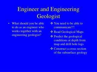
An engineer partnering with an engineering geologist must understand geological processes, hazards, and weathering. They need to predict subsurface conditions, read maps, and communicate effectively to determine safe construction locations. Knowledge of bedrock, soil types, and water flow is crucial for proposing and implementing engineering solutions. Cross-section construction, map interpretation, and hazard assessment are key tasks in collaboratively selecting safe construction sites.

E N D
What should you be able to do as an engineer who works together with an engineering geologist? You need to be able to communicate!!! Read Geological Maps Predict the geological conditions at depth from map and drill hole logs Construct a cross section of the subsurface geology Engineer and Engineering Geologist
understand geological processes natural hazards weathering and products evaluate positive and negative conditions relate to planners and politicians economic implications What should you be able to do as an engineer who works together with an engineering geologist? Engineer and Engineering Geologist
earthquakes are common? volcanic eruptions are common? landslides are common? etc. Don’ let anyone live in Japan or San Francisco It is too hazardous from a geological point of view!! Can we choose where it is best to build?Hazardous areas?
Your job as Engineer • Recognize problems • Propose an engineering solution • If you want to build (X) then you must build in the following way (Y)
There is an engineering solution to any geological/constructional problem. You- the engineer - must be able to recognize the risk or problem If you know the problem then you can suggest an engineering solution If you do not recognize the geological problems the engineering construction can be at great risk
Freedom of “choosing” the solution • Political decisions govern • Existing construct • Economic restrictions • Dialogue would be advantageous
design based upon geological conditions rock and soil availability for foundations and construction materials physical properties of the available material; strength, permeability etc etc Specific design developed
Investigations for a project • pre investigations • maps of all types • previous reports • complimentary field studies • drillings and drill hole logging • geophysics • detailed mapping • active design – as the work goes on changes are made due to the geological conditions
Source of maps • Geological Survey of the country – all countries have one • Geological maps of • bed rock distribution • soil types and distribution (glacial & post glacial) • hydrological conditions • geophysical (magnetic, electric, radiactivity) • many other types (engineering, rock quality)
Methods and scale • Aerial photo interpretation – several are in the book for your review • Field mapping at a scale • 1/10,000 for highly populated areas • 1/250,000 for sparsely populated areas • others -
Example of the unconsolidated sediments maps 1:10 000 • Genetic • Grain Size & Sorting • Mapping depth 50 cm (under soil zone)
Example of the hydrological maps 1:10 000 • unconsolidated sediment map (base) • wells • location and depth • production • chemistry of water • groundwater table and isochrones • flow direction
Example of the bedrock maps 1:10 000 • rock outcrops identified during “soils” mapping • stratigraphic age • Rock type
Cross sections of maps • cross sections • stratigraphic relationship • oldest at bottom • youngest at top • predicted subsurface continuation of the rocks and soils
Geological maps of other areas Deserts / Non-Glacial areas / Tropics How would these differ from those in Sweden?
Precambrian shield (predominately gneiss and granite) few sedimentary rocks extensive hiatus between rocks and unconsolidated sediments bedrock is covered by glacial soils (till, glaciofluvium, glacial clay) post glacial soils (post glacial clay, wave reworked sand, wind sand, gyttja, peat, alluvium) Thickness varies Sweden’s geology
Contrast with other countries • 70% of the earth’s land area is composed of sedimentary rocks • very few in Sweden
Contrast with other countries • Tropics (warm and moist climate) enhances chemical weathering • decomposes the rocks forming soil “regolith” or “saprolite” overlying the fresh rock, up to 500 m deep • present day Sweden – very little chemical weathering • Sweden has been located at the equator thus we have remnants of this weathering
Contrast with other countries • Non-glaciated areas lack extensive colluvium (unconsolidated sediments), • bedrock outcrops predominate • alluvium in valleys, thin
Contrast with other countries • Desert areas • sand seas can be extensive • bedrock usually crops out at surface
Aerial photos – remote sensing - • satellite images
Aerial photos – remote sensing - • aerial photos cover all of Sweden • photos from several different years • photos of different types • black white • infra red stereo view
Aerial photos – remote sensing - interpretation • aerial photos • satellite photos • require interpretation and field checking
Aerial photos – remote sensing - interpretation • slope stability study • large area viewed in little time • location of slides mapped • location compared to geology and geological structures • conclusions can be drawn as to which positions along the slope are more susceptible to sliding
aerial photography • who does it? Governmental agency! • you can not order a private study for a given project • photos are available • you can visit the survey office to view them • purchase of photos
aerial photography • (note that quality varies from year to year so it can be good to have visited the office to see first that the year you order is not taken when there were lots of clouds)
landforms landslides avalanches river meanders (old abandoned channels) high water table conditions sinkholes faults volcanic flows extent layering of rocks strike and dip of rocks joints magmatic intrusion extent alluvial deposits extent What can we determine from aerial photos?
landforms landslides avalanches river meanders (old abandoned channels) high water table conditions sinkholes faults volcanic flows extent layering of rocks strike and dip of rocks joints magmatic intrusion extent alluvial deposits extent What can we determine from aerial photos?
Map suitability for engineering projects Engineering projects are often at a very small scale compared to geological maps. Geological maps are not to be “trusted” to show the detail that is needed for the project. These are constructed to show the geological trends.
Map suitability for engineering projects Example: A glacial soils map may show that there is a bedrock outcrop in a field of glacial clay.
WHY??? The map suggests that the outcrop is 2500 m2 (1mm2 on the map is the smallest area that can be shown on the map at the scale 1:50,000). In reality the outcrop may only be 5m2. But the map maker has chosen to include the outcrop instead of exclude it from the map.
information about the depth to bedrock What would be the difference with – or without this outcrop on the map??
With - without With the outcrop we make the interpretation that there is not much clay covering the bedrock. Without the outcrop we would have interpreted the map to indicate that the clay thickness to be quite extensive. When could this be important??
Map suitability for engineering projects Scale of the geological maps are seldom sufficient for engineering projects good for a overview and reconnaissance but complimenting with detailed mapping is often necessary
Maps are of the surface • how do we determine the subsurface geology? • information on maps • understanding of the stratigraphy • correct model of the geological history Principles of structural geology can be employed to predict the extension of the surface geology
trenches and holes Further investigations!
seismic electric magnetic gravity radar seismic geophysical methods
geophysical methods seismic electric magnetic gravity radar seismic geophysical methods
geophysical methods seismic electric magnetic gravity radar electric – resistivity of electric currents geophysical methods
rocks with different Fe contents magnetic