Download

1 / 71
710 likes | 845 Views
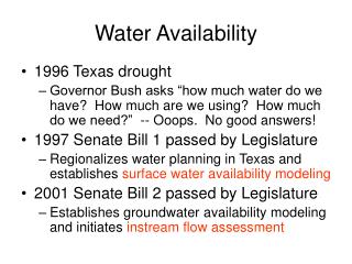
Metropolitan Groundwater Model for Water-Supply Availability Analysis. Technical Advisory Group Meeting June 19, 2008. Quick Review. Model Domain. Anoka. Entire 7 county metro Extend to edge of Mt. Simon – Hinckley Aquifer to NW 4913 sq miles Model cell size: 500m 417,793 active cells.

E N D
Metropolitan Groundwater Model for Water-Supply Availability Analysis Technical Advisory Group Meeting June 19, 2008
Model Domain Anoka • Entire 7 county metro • Extend to edge of Mt. Simon – Hinckley Aquifer to NW • 4913 sq miles • Model cell size: 500m • 417,793 active cells Ramsey Washington Hennepin Carver Dakota Scott
West East Dakota Carver Washington Hennepin St. Peter Glacial Drift Prairie du Chien Jordan St. Lawrence Franconia Mt Simon-Hinckley Ironton-Galesville Eau Clair Model Layers • All major aquifers and aquitards included • Total of 9 Layers
Rivers and Streams • All rivers and streams represented with lake package
River Segments • Each river broken into segments (reaches) • Stage based on topography or gage data
Lakes • Stage from DNR or DEM • Deeper lakes allowed to be in deeper layer • Represented with River Package
Targets • 14,542 Head targets • SWL from CWI • 33 Baseflow targets • 55 Transmissivity targets • Pumping Tests • 378 Anisotropy targets • Penalty for Kz > Kx within a zone
Head Targets • 14,542 head targets • Static water levels from county well index • Cross-validated
Baseflow • 33 baseflow reaches
Temp, Julian Day Wind Daily Precipitation EVAPOTRANSPIRATION Topography(30-m Digital Elevation) Land Use (including imperviousness) SURFACE RUNOFF Soil Type (Hydrologic Classification) RECHARGE Surface Water Balance (SWB) Model for Recharge (Adapted from Dripps and Bradbury, 2007)
SWB Recharge Output • Mean recharge 1975-2003 • 30m grid
Recharge Model Grid • 500 m grid
Calibration Parameters • 756 hydraulic conductivity zones • 378 Kx=Ky • 378 Kz • 8 lake conductance zones • 33 river conductance reaches • Recharge remained fixed
Quaternary Zones • Zones roughly defined based on sand content • 65 zones
Quaternary Zones • Zones roughly defined based on sand content • 65 zones
Jordan Zones • 48 zones • Zones defined based on first bedrock unit and subdivided into additional zones
Calibration Stats • Mean Head Residual = -1.65 m • Residual Standard Deviation = 5.18 m • Minimum Head Residual = -31.21 m • Maximum Head Residual = 33.08 m • Total range of observed values = 125.27 m • Percent of head residuals within 5% of range = 93.2%
Using the model to address future water supply Example for the City of Ramsey
City of Ramsey (Runkel, 2006)
Regional Model • Run regional model with 2050 average day pumping • Extract TMR for more detailed analysis • Used constant head boundaries at edge of TMR
Municipal Supply Wells • Well spacing about 1 mile
Grid Refinement • Refine grid in the Ramsey area
Ramsey Well 7 Pumping Test Observation Well
Drawdown (m) Time (days) Ramsey Well 7 Pumping Test Pumping Rate: 1000 gpm (constant)
2030 Drawdown in Ironton - Galesville (Average Day) Contour Interval: 1 ft
2030 Drawdown in Ironton - Galesville (2 Week Peak) Contour Interval: 2 ft
2030 Drawdown in Layer 1 (Average Day) Contour Interval: 1 ft
2030 Drawdown in Layer 1 (2 Week Peak) Contour Interval: 1 ft
2050 Drawdown in Ironton - Galesville (Average Day) Contour Interval: 1 ft
2050 Drawdown in Ironton – Galesville (2 Week Peak) Contour Interval: 2 ft
2050 Drawdown in Layer 1 (Average Day) Contour Interval: 1 ft
2050 Drawdown in Layer 1 (2 Week Peak) Contour Interval: 1 ft