Download
1 / 77
830 likes | 1.16k Views
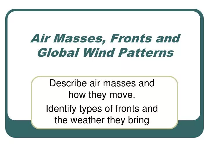
Air Masses, Fronts and Global Wind Patterns. Describe air masses and how they move. Identify types of fronts and the weather they bring. Air Masses. Weather changes. Did you ever hear this riddle? Question : Why did the woman go outdoors with her purse open?

E N D
Air Masses, Fronts and Global Wind Patterns Describe air masses and how they move. Identify types of fronts and the weather they bring
Weather changes • Did you ever hear this riddle? • Question: Why did the woman go outdoors with her purse open? • Answer: Because she expected some change in the weather! • Weather is always changing. One day might be cold and cloudy. The next day might be warm and sunny. Even on the same day, the weather can change a lot. A beautiful morning might be followed by a stormy afternoon. Why does weather change? The main reason is moving air masses.
Air Masses • An air massis a large body of air that has about the same conditions throughout. • For example, an air mass might have cold dry air. • Another air mass might have warm moist air. • The conditions in an air mass depend on where the air mass formed. • A region under the influence of an air mass will probably experience generally constant weather conditions, a situation referred to as air mass weather.
Air mass formation • Formation of Air Masses • Most air masses form over polar or tropical regions. They may form over continents or oceans. • Air masses are moist if they form over oceans. • They are dry if they form over continents. • Air masses that form over oceans are called maritime air masses. • Those that form over continents are called continental air masses.
Air Mass Formation • The Sun's heat causes air masses to form and circulate in the atmosphere. • This movement creates differences in air pressure, which in turn, creates winds. • Air moves horizontally because of differences in pressure. • When air is heated, the air expands, the density decreases, and the air rises. • When air is cooled, the air, the air becomes more dense and sinks.
Air Masses • Six major air masses affect weather in the United States. • Each air mass has the same characteristics of temperature and moisture content as the area over which it formed.
Air Masses • An air mass takes on the conditions of the area where it forms. • For example, a continental polar air mass has cold dry air. • A maritime polar air mass has cold moist air • An air mass can cover thousands of square kilometers. • When you observe a change in the weather form one day to the next, it is due to the movement of air masses.
Figurebelow shows air masses that form over or near North America.
Movement of Air Masses • Which air masses have warm moist air? Where do they form? • Movement of Air Masses • When a new air mass goes over a region it brings its characteristics to the region. • This may change the area's temperature and humidity. • Humidity The ratio of the amount of water vapor in the air at a specific temperature to the maximum amount that the air could hold at that temperatureMoving air masses cause the weather to change when they contact different conditions. • For example, a warm air mass moving over cold ground may cause a temperature inversion.
Movement of Air Masses • Why do air masses move? • Winds and jet streams push them along. • Cold air masses tend to move toward the equator. • Warm air masses tend to move toward the poles. • Coriolis effect causes them to move on a diagonal. • Many air masses move toward the northeast over the U.S. This is the same direction that global winds blow.
Continental Arctic (cA): • Frigid – record low temperatures • Dry - very low dew points • Dense - very high barometric pressure • Usually originate north of the Arctic Circle • Siberian Express • Usually once or twice a winter • very rarely form during the summer • because the sun warms the Arctic.
Continental polar (cP): • Cold and dry - stable • Usually originates in NW Territory of Canada • Influences mainly the northern USA • Responsible for clear and pleasant weather during the summer • Usually in winter • Creates troughs in the polar jet stream • Lake effect snow in Great Lakes areas
Maritime polar (mP): • Cool and moist - unstable • Originate over N. Atlantic and N. Pacific • Main Influence - the Pacific Northwest and the Northeast. • can form any time of the year • Generally not as cold as cP air masses
Maritime tropical (mT): • Warm and very moist – unstable • Originate in the Gulf of Mexico and the Southern Atlantic Ocean • Influences the eastern USA • Most prevalent during summer • Responsible for hot, humid summer days across the South and the East.
Continental Tropical (cT): • Very Hot and very dry – stable aloft • Originates in Desert Southwest and northern Mexico • Occurs in the summer, rarely in winter • Usually keeps the Desert Southwest scorching above 100oF during summer • Generally clear skies, hot, low humidity
Jet Stream • Jet streams are relatively narrow bands of strong wind in the upper levels of the atmosphere. • The winds blows from west to east in jet streams but the flow often shifts to the north and south. • Jet streams follow the boundaries between hot and cold air. • Since these hot and cold air boundaries are most pronounced in winter, jet streams are the strongest for both the northern and southern hemisphere winters
Jet Stream • Why does the jet stream winds blow from west to east? • If the earth was not rotating, the warm air rising at the equator would move toward both poles • The earth's rotation divides this circulation into three cells. • The earth's rotation is responsible for the jet stream as well.
Jet Stream • The motion of the air is not directly north and south but is affected by the momentum the air has as it moves away from the equator. • The reason has to do with momentum and how fast a location on or above the Earth moves relative to the Earth's axis. • Your speed relative to the Earth's axis depends on your location.
The momentum the air has as it travels around the earth is conserved, which means as the air that's over the equator starts moving toward one of the poles, it keeps its eastward motionconstant. • The Earth below the air, however, moves slower as that air travels toward the poles. • The result is that the air moves faster and faster in an easterly direction (relative to the Earth's surface below) the farther it moves from
Jet Stream • the three-cell circulations below, the regions are areas where temperature changes are the greatest. • As the difference in temperature between the two locations increase, the strength of the wind increases so they are also where the wind, in the upper atmosphere, is the strongest.
Jet Stream • Someone standing on the equator is moving much faster than someone standing on a 45° latitude line. • In the graphic (right) the person at the position on the equator arrives at the yellow line sooner than the other two. • Someone standing on a pole is not moving at all (except that he or she would be slowly spinning). • The speed of the rotation is great enough to cause you to weigh one pound less at the equator than you would at the north or south pole.
Fronts: • Boundary between two air masses • Characterized by shift in weather • Cold • Warm • Stationary • Occluded
5 Characteristics of a Front • Sharp temperaturechanges over a relatively short distance. • Changes in air moisture content • Shifts in wind direction • Pressure changes • Clouds and precipitation
Cold Front • A cold frontoccurs when a cold air mass runs into a warm air mass. • The cold air mass moves faster than the warm air mass and lifts the warm air mass out of its way. • As the warm air rises, its water vapor condenses.
Cold Front • Clouds form, and precipitation falls. • If the warm air is very humid, precipitation can be heavy. • Temperature and pressure differences between the two air masses cause winds. • Winds may be very strong along a cold front.
Cold Front • As the fast-moving cold air mass keeps advancing, so does the cold front. • Cold fronts often bring sudden changes in the weather. • There may be a thin line of storms right at the front that moves as it moves. • In the spring and summer, these storms may be thunderstorms and tornadoes. • In the late fall and winter, snow storms may occur. After a cold front passes, the cold air mass behind it brings cooler temperatures.
Reasoning for Tornadoes • Orographic Perfection • Meeting of • Moist - mT • Hot - cT • Cool – cP Rocky Mtn. http://www.youtube.com/watch?v=Tv8PciVvYEo&feature=fvo
Tornado Alley • http://www.youtube.com/watch?v=Tv8PciVvYEo&feature=fvo
Fujita Scale (NationalAtlas.com)
Cold Fronts • Temperature – drops rapidly • Pressure – rises steadily • Clouds – Vertical building • Precipitation – Heavy along front • Winds – Strong and shifting • Typically move faster than warm front
Cold Front A cold front is drawn on a weather map as a blue line with triangles
Cold Front (Fozzy)
In the summer, cold fronts can trigger: • thunderstorms • large hail • dangerous winds • tornadoes
Warm Fronts • Temperature – rises slowly • Pressure – slight rise, then fall • Clouds – strato- and cirro- • Precipitation – long, steady • Winds – variable and light • Typically will have affect for days
Warm front • When a warm air mass runs into a cold air mass it creates a warm front. The warm air mass is moving faster than the cold air mass, so it flows up over the cold air mass. As the warm air rises, it cools, resulting in clouds and sometimes lightprecipitation.
Warm Front Warm fronts move slowly and cover a wide area. After a warm front passes, the warm air mass behind it brings warmer temperatures. The warm air is also likely to be more humid.
Effects of warm fronts • Slow-moving warm front can mean days of wet weather before warm air • Sometimes water vapor in warm fronts condense to produce • rain • snow • sleet • freezing rain • A warm front is drawn on a map as a red line with red semicircles
Stationary Front • A stationary front occurs when a boundary between air masses stops advancing. • Such a front may bring clouds and precipitation to the same area for many days. A stationary front is drawn as alternating red and blue line. Red semicircles point toward the cold air and blue triangles point toward the warm air
Stationary Fronts • Temperature – stagnent • Pressure – slightly fluctuates • Clouds – altocumulus • Precipitation – none • Winds – variable and light • Can last for days weeks
Occluded Front • With an occluded front, a warm air mass becomes trapped between two cold air masses. • The warm air is lifted up above the cold air. • Cloudy weather and precipitation along the front are typical.
Occluded Fronts • Temperature – • Warm – gets milder • Cold – gets colder • Pressure – • Warm - slight drop • Cold – slight rise • Clouds – cumulus • Precipitation – steady and light • Winds – variable and light