Download
1 / 19
190 likes | 259 Views
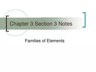
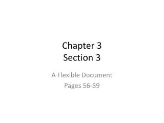
Chapter 3, Section 3. Key Terms. Create a flash card for the following key terms (p. 63 in textbook): Topography Elevation Contour line Relief If you finish early, study your flash cards!. Topographic Maps. Topographic maps show the surface features of a location.

E N D
Key Terms Create a flash card for the following key terms (p. 63 in textbook): • Topography • Elevation • Contour line • Relief If you finish early, study your flash cards!
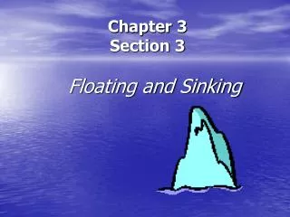
Topographic Maps • Topographic maps show the surface features of a location. • They include rivers, hills, roads, and more. • A topographic map also shows elevation = height above sea level.
The lines show the contours and elevation of the island. Topographic Maps
Elevation on Topographic Maps • Contour Lines are used to show elevation. • Contour Lines are the wavy lines and each line represents a new elevation (height from sea level). • The difference in elevation between one contour line and the next is called the contour interval. • Relief is the difference in elevation between the highest and lowest points of the area being mapped.
Quick Check!! • A __________ _________ is the difference in elevation between one contour line and the next. • Name an advantage of a topographic map. _______________________________________________________________________________________________________________
Landforms on Topographic Maps • Contour lines spaced widely apart indicate a gradual change in elevation, whereas lines close together indicate and rapid change in elevation or a steep slope. • A ‘V’ shape indicates a valley, the point is the highest end.
Practice • What kind of landform is represented by this contour map: • Lake • Canyon • Hill • Valley • What is the lowest elevation on the map? ________ • What is the elevation of point A?_________ a
Practice • What kind of landform is represented by this contour map: • Lake • Canyon • Hill • Valley • What is the lowest elevation on the map? ________ • What is the elevation of point A?_________ a
Topographic Map Symbols • Buildings, boundaries, roads = black. • Major highways = red. • Water = blue. • Forests = green
INTERACTIVE! • Frayer Diagram: TOPOGRAPHIC MAPS • Complete and then tape/glue onto interactive side of your notebook. Definition Illustration Topographic Maps Advantages Contour Lines
Geologic Maps • Geologic maps show types of rocks and the locations of faults, folds, and other structures. • Geologic Units are a volume (section) of rock from the same age range and rock type and are shown in the same color. • Letters are also used to label the types and ages of the rock on the map. • Used by engineers, geologists, developers
Geologic Maps • Contact Lines—places at which 2 geologic units meet. • The place at which 2 geological units meet is called a “Contact”. • 2 main types of Contacts are: faults and depositional contacts (one layer of rock formed on top of another)
Assessment PlaydohMountains