Download
1 / 11
110 likes | 259 Views
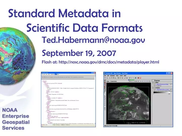
Standard Metadata in Scientific Data Formats. Ted.Habermann@noaa.gov September 19, 2007 Flash at: http://nosc.noaa.gov/dmc/docs/metadata/player.html. Observations of Metadata in netCDF Files. <attribute name="units" type="String" value="seconds since 1970-01-01T00:00:00Z" /> </variable>

E N D
Standard Metadata in Scientific Data Formats Ted.Habermann@noaa.gov September 19, 2007 Flash at: http://nosc.noaa.gov/dmc/docs/metadata/player.html
Observations of Metadata in netCDF Files <attribute name="units" type="String" value="seconds since 1970-01-01T00:00:00Z" /> </variable> <variable name="altitude" shape="altitude" type="float"> <attribute name="actual_range" type="float" value="0.0 0.0" /> <attribute name="fraction_digits" type="int" value="0" /> <attribute name="long_name" type="String" value="Altitude" /> <attribute name="standard_name" type="String" value="altitude" /> <attribute name="units" type="String" value="m" /> </variable> <variable name="lat" shape="lat" type="float"> <attribute name="actual_range" type="float" value="-75.0 75.0" /> <attribute name="coordsys" type="String" value="geographic" /> <attribute name="fraction_digits" type="int" value="1" /> <attribute name="long_name" type="String" value="Latitude" /> <attribute name="point_spacing" type="String" value="even" /> <attribute name="standard_name" type="String" value="latitude" /> <attribute name="units" type="String" value="degrees_north" /> </variable> <variable name="lon" shape="lon" type="float"> <attribute name="actual_range" type="float" value="0.0 360.0" /> <attribute name="coordsys" type="String" value="geographic" /> <attribute name="fraction_digits" type="int" value="1" /> <attribute name="long_name" type="String" value="Longitude" /> <attribute name="point_spacing" type="String" value="even" /> <attribute name="standard_name" type="String" value="longitude" /> <attribute name="units" type="String" value="degrees_east" /> </variable> <variable name="AGssta" shape="time altitude lat lon" type="float"> <attribute name="_FillValue" type="float" value="-1.0E32" /> <attribute name="actual_range" type="float" value="-1.9 34.0" /> <attribute name="coordsys" type="String" value="geographic" /> <attribute name="fraction_digits" type="int" value="1" /> <attribute name="long_name" type="String" value="SST, NOAA POES AVHRR, GAC, 0.1 degrees, Global, Day and Night" /> <attribute name="missing_value" type="float" value="-1.0E32" /> <attribute name="numberOfObservations" type="int" value="382399" /> <attribute name="percentCoverage" type="double" value="0.07074779916230983" /> <attribute name="standard_name" type="String" value="sea_surface_temperature" /> <attribute name="units" type="String" value="degree_C" /> </variable> </netcdf> <?xml version="1.0" encoding="UTF-8"?> <netcdf xmlns="http://www.ucar.edu/schemas/netcdf" xmlns:xsi="http://www.w3.org/2001/XMLSchema-instance" xsi:schemaLocation="http://www.ucar.edu/schemas/netcdf http://www.unidata.ucar.edu/schemas/netcdf-cs.xsd" uri="D:/AG2006270_2006270_ssta.nc"> <dimension name="time" length="1" /> <dimension name="altitude" length="1" /> <dimension name="lat" length="1501" /> <dimension name="lon" length="3601" /> <attribute name="acknowledgement" type="String" value="NOAA NESDIS" /> <attribute name="cdm_data_type" type="String" value="Grid" /> <attribute name="cols" type="int" value="3601" /> <attribute name="composite" type="String" value="true" /> <attribute name="contributor_name" type="String" value="NOAA NESDIS OSDPD" /> <attribute name="contributor_role" type="String" value="Source of level 2 data." /> <attribute name="Conventions" type="String" value="COARDS, CF-1.0, Unidata Dataset Discovery v1.0, CWHDF" /> <attribute name="creator_email" type="String" value="dave.foley@noaa.gov" /> <attribute name="creator_name" type="String" value="West Coast Regional CoastWatch Node" /> <attribute name="creator_url" type="String" value="http://coastwatch.pfel.noaa.gov" /> <attribute name="cwhdf_version" type="String" value="3.4" /> <attribute name="date_created" type="String" value="2006-09-28" /> <attribute name="date_issued" type="String" value="2006-09-28" /> <attribute name="Easternmost_Easting" type="float" value="360.0" /> <attribute name="et_affine" type="double" value="0.0 0.1 0.1 0.0 0.0 -75.0" /> <attribute name="gctp_datum" type="int" value="12" /> <attribute name="gctp_parm" type="double" value="0.0 0.0 0.0 0.0 0.0 0.0 0.0 0.0 0.0 0.0 0.0 0.0 0.0 0.0 0.0" /> <attribute name="gctp_sys" type="int" value="0" /> <attribute name="gctp_zone" type="int" value="0" /> <attribute name="geospatial_lat_max" type="float" value="75.0" /> <attribute name="geospatial_lat_min" type="float" value="-75.0" /> <attribute name="geospatial_lat_resolution" type="float" value="0.1" /> <attribute name="geospatial_lat_units" type="String" value="degrees_north" /> <attribute name="geospatial_lon_max" type="float" value="360.0" /> <attribute name="geospatial_lon_min" type="float" value="0.0" /> <attribute name="geospatial_lon_resolution" type="float" value="0.1" /> <attribute name="geospatial_lon_units" type="String" value="degrees_east" /> <attribute name="geospatial_vertical_max" type="float" value="0.0" /> <attribute name="geospatial_vertical_min" type="float" value="0.0" /> <attribute name="geospatial_vertical_positive" type="String" value="up" /> <attribute name="geospatial_vertical_units" type="String" value="m" /> <attribute name="history" type="String" value="unknown" /> <attribute name="id" type="String" value="LAGsstaS1day_20060927_W-135E-105S22N50" /> <attribute name="institution" type="String" value="West Coast Regional CoastWatch Node (http://coastwatch.pfel.noaa.gov)" /> <attribute name="keywords" type="String" value="EARTH SCIENCE > Oceans > Ocean Temperature > Sea Surface Temperature" /> <attribute name="keywords_vocabulary" type="String" value="GCMD Science Keywords" /> <attribute name="license" type="String" value="The data may be used and redistributed for free but is not intended for legal use, since it may contain inaccuracies. Neither CoastWatch, NOAA, nor the United States Government, nor any of their employees or contractors, makes any warranty, express or implied, including warranties of merchantability and fitness for a particular purpose, or assumes any legal liability for the accuracy, completeness, or usefulness, of this information." /> <attribute name="naming_authority" type="String" value="gov.noaa.pfel.coastwatch" /> <attribute name="Northernmost_Northing" type="float" value="75.0" /> <attribute name="origin" type="String" value="NOAA NESDIS OSDPD" /> <attribute name="pass_date" type="int" value="13418" /> <attribute name="polygon_latitude" type="double" value="-75.0 75.0 75.0 -75.0 -75.0" /> <attribute name="polygon_longitude" type="double" value="0.0 0.0 360.0 360.0 0.0" /> <attribute name="processing_level" type="String" value="3" /> <attribute name="project" type="String" value="CoastWatch (http://coastwatch.noaa.gov/)" /> <attribute name="projection" type="String" value="geographic" /> <attribute name="projection_type" type="String" value="mapped" /> <attribute name="references" type="String" value="NOAA POES satellites information: http://www.oso.noaa.gov/poes/index.htm . Processing link: http://www.osdpd.noaa.gov/PSB/PSB.html . Processing reference: Walton C. C., W. G. Pichel, J. F. Sapper, D. A. May. The development and operational application of nonlinear algorithms for the measurement of sea surface temperatures with the NOAA polar-orbiting environmental satellites. J.G.R., 103: (C12) 27999-28012, 1998. Cloudmask reference: Stowe, L. L., P. A. Davis, and E. P. McClain. Scientific basis and initial evaluation of the CLAVR-1 global clear/cloud classification algorithm for the advanced very high resolution radiometer. J. Atmos. Oceanic Technol., 16, 656-681. 1999. Calibration and Validation: Li, X., W. Pichel, E. Maturi, P. Clemente-Colà ;³n, and J. Sapper. Deriving the operational nonlinear multi-channel sea surface temperature algorithm coefficients for NOAA-15 AVHRR/3. International Journal of Remote Sensing, Volume 22, No. 4, 699 - 704, March 2001a. Calibration and Validation: Li, X, W. Pichel, P. Clemente-Colón, V. Krasnopolsky, and J. Sapper. Validation of coastal sea and lake surface temperature measurements derived from NOAA/AVHRR Data. International Journal of Remote Sensing, Vol. 22, No. 7, 1285-1303, 2001b." /> <attribute name="rows" type="int" value="1501" /> <attribute name="satellite" type="String" value="POES" /> <attribute name="sensor" type="String" value="AVHRR GAC" /> <attribute name="source" type="String" value="satellite observation: POES, AVHRR GAC" /> <attribute name="Southernmost_Northing" type="float" value="-75.0" /> <attribute name="standard_name_vocabulary" type="String" value="CF-1.0" /> The obvious difference in the quantity and quality of metadata available in these two netCDF files prompted me to begin thinking about how we can take advantage of improving content in metadata repositories as we write data into scientific data formats. Today I will share some of those thoughts. <?xml version="1.0" encoding="UTF-8"?> <netcdf xmlns="http://www.ucar.edu/schemas/netcdf" xmlns:xsi="http://www.w3.org/2001/XMLSchema-instance" xsi:schemaLocation="http://www.ucar.edu/schemas/netcdf http://www.unidata.ucar.edu/schemas/netcdf-cs.xsd" uri="D:/2006-12-01_00-00-00_2006-12-02_23-59-59-SST100-anal_temp--70.0_70.0_0.0_360.0-.5.NETCDF"> <dimension name="LON181_541" length="361" /> <dimension name="LAT" length="141" /> <dimension name="TIME1" length="2" isUnlimited="true" /> <attribute name="history" type="String" value="FERRET V5.41 4-Dec-06" /> <variable name="LON181_541" shape="LON181_541" type="double"> <attribute name="units" type="String" value="degrees_east" /> <attribute name="modulo" type="String" value=" " /> <attribute name="point_spacing" type="String" value="even" /> </variable> <variable name="LAT" shape="LAT" type="double"> <attribute name="units" type="String" value="degrees_north" /> <attribute name="point_spacing" type="String" value="even" /> </variable> <variable name="TIME1" shape="TIME1" type="double"> <attribute name="units" type="String" value="hour since 1997-01-01 00:00:00" /> <attribute name="time_origin" type="String" value="1-JAN-1997 00:00:00" /> </variable> <variable name="ANAL_TEMP" shape="TIME1 LAT LON181_541" type="float"> <attribute name="missing_value" type="float" value="999.9" /> <attribute name="_FillValue" type="float" value="999.9" /> <attribute name="long_name" type="String" value="Analysis Temperature" /> <attribute name="history" type="String" value="From CLASS_Descriptor" /> <attribute name="units" type="String" value="Deg. C" /> </variable> </netcdf> Metadata Provided with a Level 3 SST Product From SWFSC Metadata Provided with a Level 3 SST Product From CLASS
None All Metadata Definitions Granule Metadata - metadata that documents a specific entity, usually a file, archived or requested by a user from an archive. Historically granule metadata are closer to the data and, therefore, more specialized. Dates, spatial extents and local statistics are examples of granule metadata. Collection Metadata - metadata that documents an entire collection of granules or dataset. Generally more Standard. Examples include DIF/FGDC/ISO metadata records in Geospatial One-Stop or GCMD. Amount of Collection Level Metadata in Granule Where on this Spectrum Might We Belong?
Partnership Metadata Partnerships Data Provider Archive Granule Metadata - Created by Data Provider for Real-time customers. Partnership Collection Level Metadata - Created at archive for data discovery Direct Users Designated Community (Archive Users)
Archive Process Evolution Heterogeneous Format Dependent Tools Users Present Archive Submission Information Package (SIP) Standard Metadata Designated Community Rich Granule Inventory Standard Products Future Archive? Homogeneous Data and Metadata, Standard Tools
Metadata in this Process Collection Metadata Repository FGDC XML XSLT NcML + netCDF Writer Granule Metadata Repository Rich Inventory SIP AIP Data Submission Information Pkg Archive Information Pkg
Archive Information Package Content <attribute name="Conventions" type="String" value=""CF-1.0""/> <attribute name="Metadata_Conventions" type="String" value="FGDC, DublinCore"/> <attribute name="FGDC_Link" type="String" value="URL"/> <attribute name="institution" type="String" value="NOAA / NGDC"/> <attribute name="fgdc_publisher_name" type="String" value="NOAA / NGDC"/> <attribute name="dc_publisher" type="String" value="NOAA / NGDC"/> <variable name="Analysis Temperature"> <attribute type="string" name="fgdc_long_name" value="Analysis Temperature"/> <attribute type="float" name="fgdc_valid_min" value="-850"/> <attribute type="float" name="fgdc_valid_max" value="610"/> <attribute type="string" name="fgdc_units" value="degrees Celsius * 10"/> <variable name="Analysis Temperature"> <attribute type="float" name="min" value="150"/> <attribute type="float" name="max" value="220"/> <attribute type="string" name="units" value="Celsius/> <attribute type="float" name="scale_factor" value="0.1/> </variable> Convention Metadata Collection Metadata Granule Metadata AIP AIP AIP AIP AIP
Who Does What? Collection Metadata Repository FGDC XML XSLT NcML + • netCDF writer knows • collection to convention crosswalks so that convention metadata can be constructed from NcML • metadata crosswalks so that multiple metadata conventions can be supported in AIPs NcML holds collection elements 1. needed to support conventions 2. netCDF profiles for FGDC? DC? ISO? 3. User dependent - can this be written dynamically as part of WCS response? • netCDF writer adds convention metadata netCDF Writer Rich Inventory • netCDF writer adds granule metadata SIP AIP Data Submission Information Pkg Archive Information Pkg
THREDDS Metadata 1) The THREDDS Catalog Generator can extract selected collection or granule metadata from the files and include it in the catalog. 2) The Metadata_Link attributes could be extracted to support a THREDDS Metadata Service. THREDDS Catalog AIP AIP AIP AIP AIP
ISO Metadata InitiativeTypes + campaign + collection + exercise + experiment + investigation + mission + sensor + operation MD_AggregateInformation + platform + process + program + project + study + task + trial + aggregateDataSetName [0..1] : CI_Citation + aggregateDataSetIdentifier [0..1] : MD_Identifier + associationType : DS_AssociationTypeCode + initiativeType [0..1] : DS_InitiativeTypeCode ISO Objects AIP AIP AIP AIP AIP
Conclusion It seems likely that real-time and archive users can benefit from convergence of ideas that have developed around granule and collection metadata. I have proposed an approach to including collection metadata in netCDF files and making collection metadata available through metadata services in THREDDS Catalogs. Hopefully those ideas can contribute to this convergence. Questions or suggestions: ted.habermann@noaa.gov