Download
1 / 1
10 likes | 184 Views
Mitigation, Adaptive Management, and Lessons Learned at the Cow Creek Stream Restoration and Streambank Stabilization Project, Year 1 S.B. Lovern 1 *, G.A. Fox 1 , D.M. Maronek 2 , R.A. Chávez 1 , R.B. Miller 1

E N D
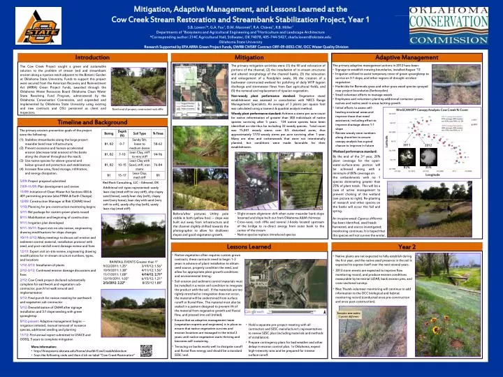
Mitigation, Adaptive Management, and Lessons Learned at the Cow Creek Stream Restoration and Streambank Stabilization Project, Year 1 S.B. Lovern1*, G.A. Fox1, D.M. Maronek2, R.A. Chávez1, R.B. Miller1 Departments of 1Biosystems and Agricultural Engineering and 2Horticulture and Landscape Architecture *Corresponding author: 214C Agricultural Hall, Stillwater, OK 74078, 405-744-5427, sharla.lovern@okstate.edu Oklahoma State University Research Supported by EPA ARRA Green Project Funds, OWRB CWSRF Contract ORF-09-0032-CW, OCC Water Quality Division Introduction Mitigation Adaptive Management • The primary adaptive management actions in 2012 have been: • Signage to establish mowing boundaries, installed August ‘12 • Irrigation utilized to assist temporary cover of green sprangletop to survive on 3:1 slope, and other regions of drought-stricken vegetation • Herbicide for Bermuda grass and other grass weed species sprayed near project boundaries (Sethoxydim) • Small volunteer efforts to manage weeds • Employees and volunteers planting additional container-grown natives and native seed in areas lacking growth The primary mitigation activities were: (1) the fill and relocation of portions of the channel, (2) the installation of in-stream structures and altered morphology of the channel banks, (3) the relocation and enlargement of a floodplain swale, (4) the creation of a backwater constructed wetland for polishing of daily WTP lagoon discharge and stormwater flows from East agricultural fields, and (5) the removal and replacement of riparian vegetation. Non-woody plant performance standard: Vegetative stand establishment was assessed in consultation with NRCS Range Management Specialists. An average of 3 plants per square foot was calculated using a transect & quadrat analysis method. Woody plant performance standard: Achieve a stems per acre count for native reforestation of greater than 300 individuals of native species surviving after 5 years. 134 native species have been identified on-site thus far including 32 woody species. Total count was 15,041 woody stems over 8.5 disturbed acres, thus approximately 1770 woody stems per acre surviving after 1 year. Many are elms and cottonwoods that were not intentionally planted, but conditions were made favorable for their establishment. The Cow Creek Project sought a green and sustainable solution to the problem of stream bed and streambank erosion along a riparian reach adjacent to the Botanic Garden at Oklahoma State University. Funds to support this project were secured from the American Recovery and Reinvestment Act (ARRA) Green Project Funds, awarded through the Oklahoma Water Resources Board Oklahoma Clean Water State Revolving Fund Program, administered by the Oklahoma Conservation Commission, and expended and implemented by Oklahoma State University using existing and new contractsand OSU personnel as client and inspectors. • Initial efforts to assess self-healing erosional areas and improve those that need assistance, including effort to improve drainage above 1:1 slope • Review woody stem numbers along shoreline to ensure canopy analysis has a good chance to improve in future • Wetland performance standard: • By the end of the 3rd year, 20% plant coverage for the open-water-surface-area portion will be achieved along with a minimum of 80% coverage on • the embankments with no 1 species dominating greater than 25% of plant totals. This will be a case of active management to prevent choking of the wetland (see picture to right). Re-planting of research and other species on the banks will occur this fall and spring. North end of project, constructed rock riffle Timeline and Background The primary erosion-prevention goals of the project were the following: Stabilize streambanks along the large project meander bend near infrastructure; Prevent excessive and human-accelerated erosion (decrease total erosion) of the banks along the channel throughout the reach; Use native species for above-ground and below-ground soil protection and stabilization; Increase flow area, flood storage, infiltration, and energy dissipation. 2011 2012 Before After Before 82% 35% • 5/09: Project proposal submitted • 7/09-11/09: Plan development and review • 11/09: Initiation of Clean Water Act Sections 404 & 401 permitting process (also FEMA & Earth Change) • 12/09: Construction Manager at Risk (CMAR) hired • 1/10: Planning for pre-construction monitoring begins • 3/11: Bid package for custom grown plants issued • 8/11: Mobilization and beginning of construction • 9/11: Irrigation plan developed • 9/11-10/11: Expert visit on-site review, engineering drawing modifications for slope changes • 10/11-2/12: Many meetings to discuss soil erosion and sediment control material, installation protocol with seed, and post-rainfall event damage review and fixes • 12/11: Expert visit on-site review, engineering drawing modifications for in-stream structure numbers, types, and locations • 1/12-2/12: Installation of plants • 2/12-3/12: Continued erosion damage discussions and fixes • 2/12: Cow Creek project declared substantially complete for earthwork and vegetation sub-contractor, punch list walk around and implementation • 3/12: Final punch-list review meeting for earthwork and vegetation sub-contractor • 5/12: Demobilization of CMAR after signage installation and 3:1 slope seeding with green sprangletop • 8/12-present: Adaptive management begins -- irrigation initiated, manual removal of nuisance species, additional seeding and planting • 11/12: First annual report submitted to USACE and ODEQ, 5 years to complete mitigation Red Rock Consulting, LLC – Edmond, OK Additional soil types represented: sandy lean clay (med stiff to very stiff), silty clayey sand (loose), sandy lean clay (soft), clayey sand (very loose), lean clay with sand (very soft to soft), sandy silty clay (soft), sandy lean clay (med stiff) After • Slight stream alignment shift when outer meander bank slope lessened and slope built out from Oklahoma A&M chimneys • Cross-vane, rock riffle and several J-hooks located upstream of the bridge to re-direct energy from outer bank to the center of the stream • Native species replace introduced species Before/after pictures: Utility pole visible in both (yellow box) -- slope was built out away from infrastructure and the channel slightly shifted towards the photographer to allow for shallower slopes and good vegetation growth. An invasive weed Cyperusdifformis has been identified, seed heads harvested, and source investigated; monitoring continues. It is hoped that this species will not survive the winter. Lessons Learned Year 2 • Native vegetation often requires custom grown contracts, these contracts need to begin 1-2 years in advance of plant installation to obtain seed source, properly condition the seed, and allow for appropriate plant growth conditions and environmental timing. • Soil erosion and sediment control materials must be installed in a moist-soil condition to integrate the product with the soil. If the materials are too tightly stretched or integration does not occur, the material will be undermined from surface runoff or fluvial flow. The material must also be staked in a pattern designed to prevent lift of the material from vegetative growth and fluvial flow, and pressed into soil (rolled). • Ensure that an adaptive management team (vegetation experts and engineers) is in place to ensure that native vegetation survives and erosion locations are managed in the initial 2 years until native vegetation starts thriving and becomes self-sustaining. • Terracing on banks works well to dissipate runoff and fluvial flow energy and should be a standard SESC tool. • Native plants are not expected to fully establish during the first year, and the native seed presence in the soil is expected to express itself over the next several years. • 2013 storm events are expected to improve flow monitoring record, and produce erosion conditions measurable by terrestrial LiDAR, bank erosion pins, and cross-sectional surveys. • Blue Thumb volunteer monitoring will continue to add information to the OCC biological and habitat monitoring record (conducted once pre-construction and once post-construction). RAINFALL EVENTS Greater than 1” 9/22/2011: 1.25” 10/9/2011: 1.38” 11/7/2011: 1.08” 12/19/2011: 1.03” 2/3/2012: 2.22” 3/19/12: 1.56” 4/11/12: 1.56” 4/14/12: 2.71” 6/15/12: 1.21” 8/25/12 1.88” Invasive non-native Cyperusdifformis • Hold a separate pre-project meeting with all contractors and SESC manufacturer’s representatives to review SESC plan (including materials and methods of installation). • Prepare contingency plans for bad weather and other delays in erosion control plan. In Oklahoma, expect high-intensity rains and be prepared for intense surface runoff. • More information: • http://biosystems.okstate.edu/home/sharlbl/CowCreekAddendum • Scan the following code and then click on label “Cow Creek Restoration”