Download
1 / 23
230 likes | 498 Views
Information Session for PAIG November 2010 Meeting Chee Ng & Conor Morrissey. Boundary Linkage Project. What is the Boundary Linkage Project?. It is a Positional Accuracy Improvement (PAI) project

E N D
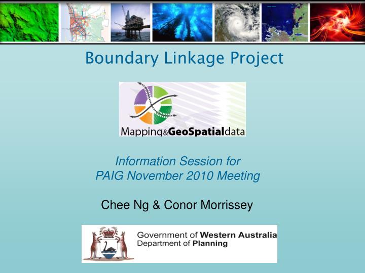
Information Session forPAIG November 2010 MeetingChee Ng & Conor Morrissey Boundary Linkage Project
What is the Boundary Linkage Project? • It is a Positional Accuracy Improvement (PAI) project • To correct the mis-alignment between the Cadastre and Department of Planning’s (DoP) custodial datasets • Region Schemes (MRS, PRS and GBRS) • WA Heritage Council Sites • Bush Forever • Structure Plans • Improvement Plans • Planning Control Areas • Redevelopment Acts and Areas • Clause 21, 27 & 32 • Custodial datasets are created and maintained, utilising the cadastre as the reference base • Make the Department’s dataset fit the ‘current’ cadastre
Boundary Linkage Issues • Presentation : Looks Bad • GIS Analysis : Slivers and incorrect information • Storage : Multiple versions of cadastre held • SLIP Map Viewer : Misalignment • SLIP – Interest Enquiry : Automated informative decisions • Making incorrect planning decisions
Boundary Linkage Project Objectives: • Assess and consolidate all custodial datasets in alignment with the latest spatially upgraded cadastre • DoP’s fundamental zoning/land-use datasets will be aligned with the spatial position of the Landgate Cadastral Land Boundaries as at 28 May 2010 • Implement a data management process that maintains this alignment with the cadastre on an ongoing basis • DoP’s datasets will be spatially upgraded and suitable for WA’s Shared Land Information Platform (SLIP) • Datasets can be interrogated using GIS analysis techniques to achieve results with a high degree of accuracy and confidence, in a more timely manner
Boundary Linkage Project Method of Approach: • Project Initiation • Identify requirements for the Project and the software • Custodial data review and assessment • Initial scoping of software vendors • Test case and assessment of data consolidation process • Suppliers to provide a solution on the Request for Quote (RFQ), which is based on the Department’s requirements/specifications • The company EnvitiaTM was selected for the Pilot Evaluation/Testing using MapriteTM software • The Greater Bunbury Region Scheme was used as the Pilot Dataset • Processing of Custodial Datasets • Start processing all Custodial Datasets using the recommended software • Implementation of Data Management and a process for maintaining updates of Custodial Datasets • Identify a suitable timeframe for updating the custodial datasets to the current cadastre
Boundary Linkage Project Progress: • Currently at Stage 3 and all custodial datasets to be aligned by end of December • ‘Aligned’ or ‘Shifted’ data to be available on SLIP early next year • This will depend on a number of factors including the legal requirement for approval of the Region Schemes.
MapRite PAI Software & Data Processing Overview
Boundary Linkage – Positional Accuracy Improvement (PAI) Dataset Processing Stages • Pre – Processing Dataset / Business Rule Analysis, Links, Configuration • Pre – Processing PAI Project Setup • Core Processing • Post Processing – Analysis of Results QA and editing • Post Processing – Export Output Data
PRE - PROCESSING • Identify misaligned DoP custodial datasets • Perform dataset analysis and configure business rules for dataset processing • What is the baseline data e.g. Cadastre, LGA • Is the baseline data available, what is the accuracy, currency, format…. • What is the difference (shifts) between the old and new cadastre • Catalogue potential “problem areas” / errors
PRE PROCESSING • Convert relevant data to Shapefile - MapRite also supports • MapInfo MIF/MID (.mif) • MapInfo TAB (.tab) • Envitia MasterMap (.map) • Oracle tables/views • Clip relevant cadastral Data • Separate dataset into subtypes (zones) if required • Example Greater Bunbury Region Scheme (GBRS) • Issue: Waterways zone has a different relationship to cadastre than all other zones and reserves • Solution: Customise configuration file and process waterways separately
PRE PROCESSING - PROJECT SETUP To begin processing, two versions of cadastre (existing and new) are required: • Initiate PAI Project Components • Old Map - Baseline Cadastre • New Map - Current Cadastre • Link Data – Shift Vectors • Input Datasets – e.g. Heritage • Project Config. – Customised File
CORE PROCESSING – Occurs in 3 steps • Step 1; this step essentially analyses your data, recording the relationship between it and the old map and also relationships between entities in the input datasets. • Step 2; this step reconstructs your data against the new map, using the information gathered in the pre-processing step. • Step 3; the final step calculates metrics and makes any final checks to ensure the data is optimally positioned.
POST PROCESSING – Visual Entity QA • MapRite - Traffic Light Flagging System • Generation of overall confidence factor for each entity • HIGH CONFIDENCE • Accept • MEDIUM CONFIDENCE • Review • LOW CONFIDENCE • Edit
POST PROCESSING – QA and Editing Operations Easy to use editor Line Trace Insert / Delete Vertices Insert / Delete Section Add Comments to Attributes
Boundary Linkage - MapRite PAI Progress Summary Processed DatasetsCurrent Processing • GBRS MRS • PRS Bush Forever • Heritage WA • Structure Plans • PCA • Redevelopment Act Areas and Schemes • Clauses