Download
1 / 34
350 likes | 399 Views
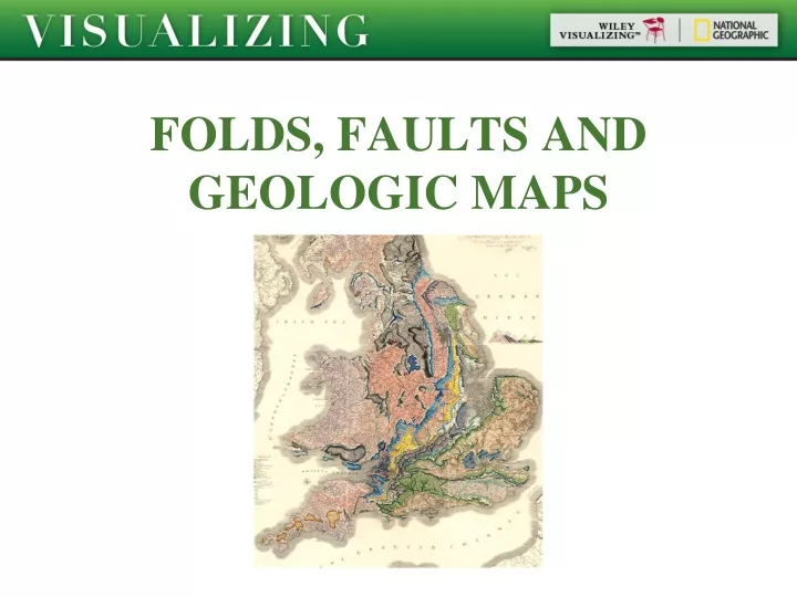
FOLDS, FAULTS AND GEOLOGIC MAPS. Objectives. Define three types of stress. Describe the differences between elastic, brittle, and ductile deformation. Define cratons and orogens. Define strike and dip. Define and describe synclines, anticlines, and other types of folds.

E N D
Objectives Define three types of stress. Describe the differences between elastic, brittle, and ductile deformation. Define cratons and orogens. Define strike and dip. Define and describe synclines, anticlines, and other types of folds. Distinguish between a topographic map and a geologic map.
Rock Deformation Stress The force acting on a surface, per unit area May be greater in certain directions than in others Pressure A kind of stress in which the forces acting on a body are the same in all directions
Rock Deformation Tension A stress that acts in a direction perpendicular to and away from a surface Compression Stress that acts in a direction perpendicular to and toward surface
Rock Deformation Shear A stress that acts in a direction parallel to a surface Strain A change in shape or volume of a rock in response to stress Uniform stress causes change in volume only Differential stress may causes change in shape
Rock deformation Elastic deformation Temporary change in shape or volume from which a material rebounds after the stress is removed
Rock deformation Ductile deformation Permanent but gradual change in shape or volume of a material, caused by flowing or bending
Rock deformation Brittle deformation Permanent change in shape or volume, in which a material breaks or cracks
Rock Deformation Main factors that affect rock deformation Temperature Confining pressure Rate of deformation Composition
Rock Deformation Where rock deformation occurs Craton A region of continental crust that has remained tectonically stable for a very long time Orogen An elongated region of crust that has been deformed and metamorphosed through a continental collision Isostasy The flotational balance of the lithosphere on the asthenosphere
Structural Geology Structural geology - the study of: Stress and strain Processes causing stress and strain Deformation and rock structures that result from stress and strain
Structural Geology Strike The compass orientation of the line of intersection between a horizontal plane and a planar feature (e.g. rock layer or fault) Dip The angle between the tilted surface and a horizontal plane
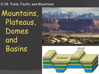
Structural Geology Faults and fractures Normal fault The block of rock above the fault surface moves downward relative to the block below
Structural Geology Faults and fractures Reverse fault The block on top of the fault surface moves up and over the block on the bottom Thrust fault A reverse fault with a shallow angle of dip
Structural Geology Strike-slip fault A fault in which the direction of the movement is mostly horizontal and parallel to the strike of the fault San Andreas Fault
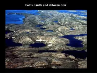
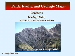
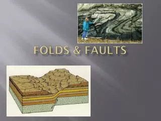
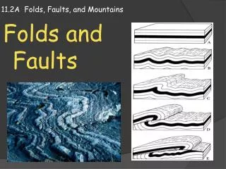
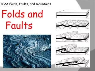
Structural Geology Folds A bend or warp in a layered rock Monocline A local steepening in otherwise uniformly dipping strata Anticline A fold in the form of an arch, with the rock strata convex upward and the older rocks in the core
Structural Geology Syncline A fold in the form of a trough, with the rock strata concave upward and the younger rocks in the core The geometry and the orientation of a fold is described by the: Axial plane Flanks Limbs Axis Hinge
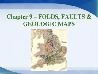
Geologic Maps Geologic map… Shows the locations, kinds, and orientation of rock units Shows structural features such as faults and folds
Geologic Maps Making and interpreting geologic maps Topographic maps… Show the shape of a ground surface, as well as the location and elevation of surface features, usually by means of contour lines
Critical Thinking Which orogens in North America would you expect to have the deepest roots, and how could you test your hypothesis? In the figure below, which strata in the photograph are the oldest and how can you tell?