Download
1 / 21
210 likes | 379 Views
The Spokane Valley – Rathdrum Prairie Groundwater Flow Model An Overview Akram Hossain Civil and Environmental Engineering, Washington State University. Modeling Groundwater Flow. Data Collection. Data Evaluation. Numerical Model. Conceptual Model. Uniqueness and Uncertainty.

E N D
The Spokane Valley – Rathdrum Prairie Groundwater Flow Model An Overview Akram Hossain Civil and Environmental Engineering, Washington State University.
Modeling Groundwater Flow Data Collection Data Evaluation NumericalModel Conceptual Model Uniqueness and Uncertainty Model Calibration
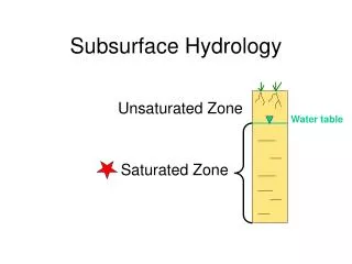
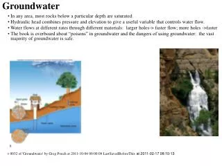
Data Collection Aquifer Geometry Horizontal extent Vertical extent Aquifer Property Hydraulic conductivity Storage Inflow to the Aquifer Recharge Seepage from river and lakes Contribution from tributary basins Return flow Outflow from the aquifer Flow to the river Withdrawal by pumping
Data Evaluation Identification of data gap Additional data collection Conceptual model development Conceptual Model A three-layer system: Layer 1 extends over the entire modeled area. Layer 2 is of limited extent. Layer 3 is also of limited extent too.
Numerical Model Requires the aquifer space to be subdivided into smaller elements for writing flow balance. In plan view it results in a grid consisting of cells. Grids of all the layers consist of cells of uniform size, 1320 ft by 1320 ft, as shown.
MODFLOW Packages Basic Package Discretization Package Layer-Property Flow Package Recharge Package Well Package General-Head Boundary Package River Package Streamflow-Routing Package Flow and Head Boundary Package Algebraic Multigrid Package Output Control Package
Hydrologic Packages Recharge Package The recharge package was used to simulate recharge to layer 1 from precipitation. It includes precipitation that infiltrates into permeable land surfaces and runoff from impermeable surfaces to recharge wells, infiltration basins, and adjacent permeable surfaces. Well Package The Well Package was used to simulate withdrawal from wells and return percolation from irrigation and septic systems. The flow values in the well file is the algebraic sum of withdrawals and recharge from irrigation and septic systems.
General-Head Boundary Package The General-Head Boundary package was employed to simulate groundwater outflow from the confined aquifer at the western end of the Little Spokane River.
River Package The river package was used to simulate the Little Spokane River, the Pend Oreille Lake, and the Coeur d’Alene Lake.
Streamflow-Routing Package The Streamflow-Routing Package was used to simulate the interaction between the aquifer and the Spokane River.
Flow and Head Boundary Package The Flow and Head Boundary package was employed to simulate flows to the aquifer from the tributary basins and from all the lakes except Lake Pend Oreille and Lake Coeur d’Alene.
Parameter Zonation Zonation scheme was adapted to better approximate spatial distribution of the following hydraulic parameters. 1. Hydraulic conductivity. 2. Specific yield. 3. Spokane River bed conductivity.
Model Calibration A numerical model’s ability to predict field conditions reliably and adequately depends to a large extent on successful calibration. Uniqueness and Uncertainty When a large number of parameters are estimated, it is essential to evaluate the uniqueness and uncertainty of the estimated parameters.