Download
1 / 10
100 likes | 204 Views
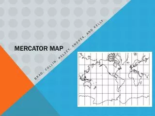
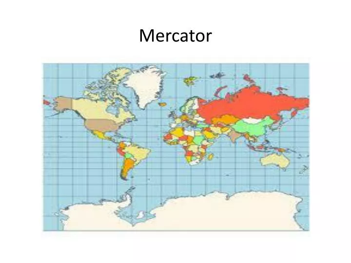
Mercator. Shows longitude and l atitude as straight, parallel lines I ncreasingly enlarges the sizes of regions according to their distance from the equator. Ex: Greenland is larger than Africa, whereas in reality Africa is 14 times bigger. Robinson.

E N D
Shows longitude and latitude as straight, parallel lines • Increasingly enlarges the sizes of regions according to their distance from the equator. Ex: Greenland is larger than Africa, whereas in reality Africa is 14 times bigger.
More accurately portrays high latitude lands and water to land ratio
Area accurate map • Controversial b/c it drastically alters the continents
Designed to present the entire world in one view. • Continents are viewed in their proper size with respect to one another. • Distance is not accurate
Looks like the Robinson Projection • BUT- lines of latitude in a Robinson projection are parallel straight lines, while in a Winkle Triple they are slightly curved, nonparallel lines • Goal is to minimize distortions in area, direction, and distance.