Download
1 / 25
250 likes | 413 Views
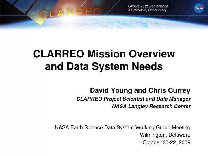
CLARREO Mission Overview and Data System Needs. David Young and Chris Currey CLARREO Project Scientist and Data Manager NASA Langley Research Center. NASA Earth Science Data System Working Group Meeting Wilmington, Delaware October 20-22, 2009. Decadal Survey defines CLARREO.

E N D
CLARREO Mission Overview and Data System Needs David Young and Chris Currey CLARREO Project Scientist and Data Manager NASA Langley Research Center NASA Earth Science Data System Working Group Meeting Wilmington, Delaware October 20-22, 2009
Decadal Survey defines CLARREO • NOAA CLARREO- CERES (Clouds and Earth’s Radiative Energy System) + - TSIS (Total Solar Irradiance Sensor) • NASA CLARREO - Solar reflected spectra (0.3% 2s) + - Infrared emitted spectra (0.1K 3s) + - Global Navigational Satellite System Radio Occultation (0.1K 3s)- Three 90-degree polar orbits with IR/GPS on all 3, solar on 1.
Decadal Survey defines NASA CLARREO • Societal Benefits:Enable knowledgeable policy decisions based on internationally acknowledged climate measurements and models through: • Observation of high accuracy long-term climate change trends • Use the long term climate change observations to test and improve climate forecasts. • Science Objectives: Climate Response, Forcing, Feedback • Infrared spectra to infer temperature and water vapor feedbacks, cloud feedbacks, and decadal change of temperature profiles, water vapor profiles, clouds, and greenhouse gas radiative effects • GNSS-RO to infer decadal change of temperature profiles • Solar reflected spectra to infer cloud feedbacks, snow/ice albedo feedbacks, and decadal change of clouds, radiative fluxes, aerosols, snow cover, sea ice, land use • Serve as an in-orbit calibration standard for broadband CERES, and operational sounders (CrIS, IASI)
Top Climate Change Uncertainties Set Priorities • Climate Sensitivityuncertainty isdriven by uncertain feedbacks:Factor of 3 uncertainty in responseto doubled CO2 • Climate Change Response: Clouds, Temperature Profile, Water Vapor Profile, Surface albedo (snow, sea-ice, land cover) • Radiative Forcings: Largest total forcing is greenhouse gases, largest current uncertaintyis aerosol forcing.
Science Objectives Determine Climate Variablesand Observation Information Content • Cloud Feedback: Shortwave and Longwave broadband radiative fluxes (Soden et al. 2008). (SR, IR spectra) • Water Vapor Feedback: Water Vapor Vertical Profile (IR, SR spectra) • Lapse Rate Feedback: Temperature Vertical Profile (IR spectra, GNSS-RO) • Snow/Ice Albedo Feedback: Snow/Ice Cover and Albedo (SR spectra) • Temperature Response: Temperature Profile (IR spectra, GNSS-RO) • Water Vapor Response: Water Vapor Vertical Profile (IR spectra) • Cloud Response: Cloud fraction, height, temperature, visible optical depth, infrared emissivity, particle phase/size (SR, IR Spectra) • Greenhouse Gas Infrared IR spectraEmission
Feedbacks Drive Space/Time Requirements • Land and ocean zonal annual means required for temperature lapse rate and water vapor feedbacks, surface albedo feedbacks • 1000 km regional scale required for cloud feedbacks • Seasonal cycle required for reflected solar: cloud feedback, snow/ice albedo feedback Soden et al. 2008
Tracing CLARREO Decadal Change Science Objectives to Mission Requirements • CLARREO will create benchmark climate data records using two complementary approaches • Benchmarks using only CLARREO data • Benchmarks using CLARREO for reference calibration of operational sensors • These two approaches provide a robust test of the CLARREO data records • Analogous to using independent measurements in metrology • Climate benchmarks require • Accuracy for decadal trend detection • Measurements traceable to international standards (SI-Traceable) on orbit • Unbiased sampling of the climate system • Information content sufficient for trend detection and attribution
Mission Formulation • The trade space for CLARREO observations is quite different from traditional earth science missions: • less spatial resolution and focus on larger spatial scales, NOT finer resolution • focus on longer time scales, not shorter • orbits selected to avoid climate change aliasing and to provide reference intercalibrationfor LEO/GEO sensors • the entire instrument design is developed for traceable calibration at climate accuracy • focus on providing climate benchmarks and calibration standards that will be used for decades
CLARREO Mission Concept • Two identical observatories co-manifested on an EELV • Two orthogonal 609 km polar orbits (90º inclination) • 3-year design life with spacecraft consumables to extend to a 5-year mission • Instrument payload • IR FTS spectrometer • Reflected solar spectrometer suite • GNSS RO • Extensive on-orbit calibration verification S-band Antenna GNSS Zenith Antenna GNSS Ram Antenna GNSS Wake Antenna Reflected Solar Electronics Reflected Solar Two-Axis Gimbal Reflected Solar Instrument Suite S-band Antenna Infrared Instrument Suite X-band Antenna Instrument Electronics Nadir 90 degree separation in LAN Orbits
Infrared Suite • Radiometric Accuracy: 0.1K 3-sigma • Mass: 87 kg, Power: 210 W • Dimension: 42x65x70 cm3 • Data Rate: 220 kb/sec • IFOV: 25 km footprint (nadir only) FTS Scan Mechanism Optical Bench Courtesy of J. Anderson Harvard University Integrating Sphere Calibration & Verification Blackbodies Scene Select Mechanism Sun Shades
CLARREO Infrared Measurements • Measures the infrared radiance spectra of the Earth and its atmosphere with systematic error that corresponds to < 0.1 K brightness temperature radiometric calibration uncertainty • Calibration accuracy attained by rigorous on-orbit verification system • Provides critical information to address cloud, water vapor, and lapse rate feedbacks and responses • Provides reference intercalibrationfor operational sounders
Reflected Solar Instrument Suite Detector Plane Thermal Radiator Sunshield • Radiometric Accuracy: 0.2% 3x Filter Wheel Control Electronics Filter Wheel Assembly 3x Optical Camera Assemblies Kopp, 2009 • Mass 85 kg • Power 116 W • Data Rate 13 Mbps • Spatial 0.5km IFOV, 100km swath • Three channels • Blue 320-640nm • Red 600-1200nm • NIR 1150-2300nm
CLARREO Reflected Solar Measurements • Measures the solar spectral reflectance of the Earth and its atmosphere relative to the solar irradiance spectrum • Calibration accuracy attained using the Sun as a calibration reference standard • Provides necessary information for reducing uncertainties in cloud feedback, surface albedo feedback, and land use changeradiativeforcing • Provides referenceintercalibration for operational sensors
GNSS Radio Occultation Measurements • Radio occultation of GNSS signals used to derive atmospheric refractivity • Accuracy is attained through a direct link to the SI standard of time • Provides critical information on temperature, pressure, and humidity profiles to address cloud, water vapor, and lapse rate feedbacks and responses • Mass 17 kg • Power 32 W • Data Rate: 117 kbps • Volume: • Receiver: 19x12x23 cm3 • RO Antenna: 48x87x2 cm3 • POD Antenna: 30 cm dia. x 4 cm
CLARREO Data Users • The primary users are global climate modelers • Data designed for validation and testing of models on decadal scales • Not process improvement • Not focused on data assimilation • Moving from characterization to prediction • GCM community have been engaged during formulation. Climate OSSE’s have been developed to help define measurement requirements • Ultimate users will be policy makers • Engage through IPCC framework • “Information Transparency” is critical • CLARREO Reference intercalibration will enable higher accuracy climate data records derived from operational sensors • Other potential users (may desire shorter latency) • Land use studies • Weather data assimilation (GNSS RO)
Science Data Products * MODIS and AIRS are on Terra, Aqua only: may not overlap with CLARREO mission; the remaining sensors are all planned for missions in the CLARREO time period #For IR, CLARREO calibrates CrIS, IASI which in turn calibrate leo and geo imager infrared channels.
Science Data Production Schedule • Telemetry downlink 500 Gbits/day/spacecraft (compressed) • L0 175 GBytes/day (2 spacecraft, uncompressed) • Data Availability*: • BetaEdition 1 • Level-1L+6 monthsL+12 months • Level-2 L+9 L+12 • Level-3 benchmark L+9 L+15 • Level-4 inter-calibrations L+12 L+18 • Data Latencies: • Level-0 48 hours after measurement • Level-1 12 hours from availability of Level 0 data product • Level-2 24 hours from availability of Level 0 data product • Level-3 1 week after month to process • Level-4 1 month after inter-calibration collection period • Estimated archive L0-L4 volume: 350GBytes/day; 128TBytes/year • * months from launch, Beta release not for publication, Edition 1 validated
Science Data Spacecraft CMD & TLM Data Sharing & Coord Space Segment Ground Segment Climate Science Community EDOS Box (Ebox) Ground Station White Sands Complex, NM Science Data System Poker Flats, AK / Svalbard, Norway / Wallops, VA Distributed Active Archive Center (DAAC) Level-0 Processing Facility, GSFC NISN EbNet Science Team Science Investigator Processing System (SIPS) NISN Cal-Val Team Science Computing Facility (SCF) Mission (Payload) Operations Center Spacecraft Operations Center Instrument Ops Team Spacecraft Ops Team Mission Planning System CMD and TLM System Analysis and Trending System Mission Planning System CMD and TLM System Analysis and Trending System NPOES NPP Launch Segment, VAFB METOP Space Weather Notification, GSFC Flight Dynamics Facility, GSFC Collision Avoidance Support, GSFC CLARREO Observatory Simulator Flight Software Vendors Reference Intercalibration Coordination I&T Facilities
Science Data System Interfaces DAAC: Distributed Active Archive Center EDOS: EOS Data Operations System IC: Inter-Calibration L0 – L4: Level 0 to Level 4 Science Data Products SCF: Science Computing Facility SIPS: Science Investigator-Led Processing System EPH: Ephemeris
Summary • CLARREO science objectives are tied directly to societal benefits • The CLARREO team has directly engaged the primary data users during formulation • The project is on schedule for a February 2010 MCR • The CLARREO team has developed a feasible and credible mission concept to meet the science objectives • Ready to work with this group at this early stage to optimally plan our data system • Learn more about CLARREO • http://clarreo.larc.nasa.gov/ • AGU session in December • Chris Currey’s presentation in Standards Breakout session today
“Man masters nature not by force, but by understanding.” - Jacob Bronowski, 1956
Extra Bonus Slides! Collect them all!
Themes From Yesterday • Martha • Focus on societal benefits • Identify and involve users • Tony • Move from characterization to prediction • Information transparency • Take the long view • Tsengdar • How modelers use data (improve processes and validate hindcasts)
Mission Concept Summary Inclination Change via Upper Stage Deploy CLARREO Observatory II Deploy CLARREO Observatory I 90 degree separation in LAN Orbits drift for 1 year, then return to 90 deg inclination angle 609 km Polar Orbit • Launch Site: Vandenberg Air Force Base • Launch Year:2016 earliest • Mission Lifetime: 3 yrs w/ 5 yr consumables • Altitude: 609 km • Inclination: 90 deg • Repeat Cycle Duration: 61-day • Max Eclipse Duration: 36 minutes Orbits • Intermediate-class Evolved Expendable Launch Vehicle (EELV) accommodating two identical CLARREO observatories • CLARREO observatories separated by 90 degrees in longitude of the ascending node (LAN) EELV Launch Vehicle