Download
1 / 46
490 likes | 829 Views
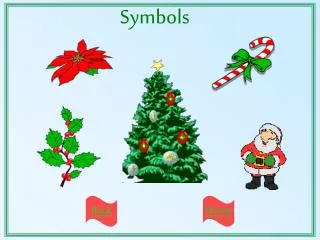
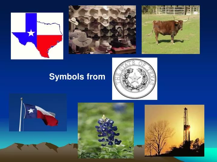
Symbols from. Day 1. Texas Symbols. Texas is a land of rich history and culture. Its symbols represent a people who are as diverse as the land is vast. Enjoy this presentation on Texas symbols!. The Cowboy Hat. Life on the Open Range Represents the historical importance of the Texas cowboys

E N D
Texas Symbols • Texas is a land of rich history and culture. Its symbols represent a people who are as diverse as the land is vast. • Enjoy this presentation on Texas symbols!
The Cowboy Hat Life on the Open Range • Represents the historical importance of the Texas cowboys • As popular today as at any point in Texas history
The Texas Longhorn Perfect Animal for the State • Strong • Bold • Unique
The State Flag Lone Star • Symbol of loyalty, independence, bravery, and strength • Official flag of the Republic of Texas in 1839
The Bluebonnet Blue as Can Be • State flower • Found along roadsides • Looks like a woman’s sunbonnet
The Texas Oil Industry Black Gold • Lots of wealth from oil • Other energy industries follow
Texas Symbol Response Choose a symbol below and write about what that symbol means to you.
Texas Regions • Texas is divided into 4 regions Gulf Coastal Region Central Plains High Plains Mountains & Basins
Create a Texas Regions Map • Now create a map of Texas, using your wax paper, showing where the regions are located. • Create a labeled map key.
Location of Coastal Region • Covers 1/3 of the land of Texas • Northeast border is the Sabine River • Southeast border is the Gulf of Mexico • West border is the Balcones Escarpment
Coastal Animals…. • Many kinds of animals live in the coastal region… To name a few… • Quail • Hawks • Owls • Hundreds of other birds • Bald eagle • White tail deer • Foxes • Skunks • River otters • Bobcats • Alligators in the marshes!!! Some weigh up to 500 lbs!!!
PLANTS • The land along the Gulf Coast is very near sea level. It is hard for water to drain off the land, since there is nowhere lower for the water to go. Much of the coast of Texas is made up of marshes----wetlands where a variety of tall grasses grow.
Way of life…. • The gulf coast is a major center of economic activity. The marshlands provide breeding grounds for ocean life, which make the fish and shrimp businesses very important. • The port of Houston is one of the 10 busiest ports in the world.
Oil & Gas • Along the coastal region you will find many oil rigs that are on-shore and off-shore…. • The ocean gives easy access to ship the oil and gas to where it needs to go..
Coastal Cities…… • Austin • Houston • Dallas (on the border of Central Plains) • San Antonio • Texarkana • Corpus Christi • Brownsville
Coastal Climate……. • Hot and damp, humid • Tornadoes, hurricanes • 30-55 inches of rain per year
Location of Central Plains • The Great Plains include the Llano Estacado, the Panhandle, Edwards Plateau, Toyah Basin and the Llano Uplift. • It is border on the east by the Caprock Escarpment in the panhandle and by the Balcones Fault to the southeast. Picture of Edwards Plateau
Central Plain - Animals • Bobcat • White-tailed deer • Turkeys • Screech Owl • Mexican Freetail Bat • Cliff Swallow
Central Plain - Plants • Blue bonnets • Indian Paintbrush • Texas Oak Trees • Mesquite Trees • Baldcypress Trees
Central Plains Climate • Central Texas is shaped by its many rivers and hills. The climate is subtropical. • In a single year the region can receive up to 48 inches of rain, and flooding is common near rivers and in low lying areas.
Central Plain Cities….. • Austin • Waco • Fredericksburg • Llano • The Hill Country is a popular name for the area of hills along the Balcones Fault and is a transitional area between the Great Plains and the Gulf Coastal Plains.
Location of Central Plains • The Great Plains include the Llano Estacado, the Panhandle, Edwards Plateau, Toyah Basin and the Llano Uplift. • It is border on the east by the Caprock Escarpment in the panhandle and by the Balcones Fault to the southeast. Picture of Edwards Plateau
High Plains Cities • Amarillo • Lubbock • Abilene • San Angelo • Wichita Falls
Location of High Plains • Northeast Texas • The Colorado and Red River border the High Plains. • Geographic Features: • Rolling grassy lands • Thick grasses • Cross Timbers area - large areas of hardwood trees • Limestone rock • Higher elevation because limestone doesn't wear down easily
Climate • Dry air • Tornadoes • 20-30 inches of rain per year
Way of Life • Farming - fruits, vegetables, watermelons, oats • Ranching - cattle, angora goats (mohair) • Cedar trees – fence posts • Oil and gas
Plants • Prickly pear • Yucca • Indian Paintbrush • Cactus
Animals • Pronghorn • Prarie Dog • Snakes • Horny Toad
Location • Far west Texas • East border near Pecos River • South border is the Rio Grande • North border is New Mexico
Cities • El Paso • Pecos • Kermit & Monahans in Permian Basin area • Fort Davis, Marfa, & Alpine in Mountain area
Climate • Driest part of state • 8 inches of rain per year, 20 inches of rain in the mountains • Hot days, cool nights
Way of Life • Ranching - cattle, sheep, goat • Farming - cotton, fruits, vegetables, cantaloupes (irrigation in El Paso and Pecos River Valley) • Oil and gas - part of Permian Basin
Plants • IT IS FLAT!!!!! • Some sagebrush
Animals • Javelina • Roadrunner • Antelope • Jack Rabbits • Deer • Big Horn Sheep
Create a New Map • Title • Map Key • 2 animals for each region (SS pg. 40) • 2 resources for each region