Download
1 / 33
330 likes | 512 Views
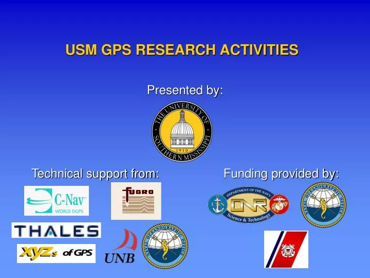
USM GPS RESEARCH ACTIVITIES. Presented by:. Technical support from:. Funding provided by:. USM GPS RESEARCH ACTIVITIES. Sunil Bisnath, David Wells, Stephan Howden, and David Dodd

E N D
USM GPS RESEARCH ACTIVITIES Presented by: Technical support from: Funding provided by:
USM GPS RESEARCH ACTIVITIES Sunil Bisnath, David Wells, Stephan Howden, and David Dodd Hydrographic Science Research Center, Department of Marine Science, The University of Southern Mississippi USM GPS Workshop 2004 16-18 March, Long Beach, Mississippi
OVERVIEW OF GPS RESEARCH PROJECTS • Design requirements for hydrographic GPS buoy • Evaluation of commercial Wide Area DGPS services • Creation of long baseline, carrier phase GPS database • Improve GPS tropospheric modeling • Common themes of research
NAVOCEANO BUOY EXPERIMENTS:PURPOSE • To observe effectiveness of determining water level from GPS for tidal datum determination • U.S. National Ocean Service requires water level gauges to measure to precision of 10 cm (95%)
NAVOCEANO BUOY EXPERIMENTS:DEPLOYMENTS ref. stn. and 2002 buoy deployment 2001 buoy deployment 5 km 2002/2003 buoy deployment
25.0 cm 38.8 cm UNFILTERED BUOY RTK GPS VERSUSTIDE GAUGE HEIGHT: APRIL 2003 • ~15 km baseline • WL float sol’n.
6.3 cm 9.5 cm FILTERED BUOY RTK GPS VERSUSTIDE GAUGE HEIGHT: APRIL 2003 • ~15 km baseline • 30 min. MA filter
BASELINE PROCESSING CONCLUSIONS TO-DATE Filtered, RTK solutions: • Simple filtering greatly improves solutions • PPK far superior than RTK for unfiltered data, but marginally better than RTK for filtered data • Under certain conditions, commercial RTK GPS can on its own estimate water level at desired accuracy
TRANSITION FROMEXPERIMENTAL TO OPERATIONAL BUOY • Determine tidal datum: Capability shown by experiments. • Minimum sensor suite: Heave and tilt sensors recommended. • Buoy types: Deployable from survey launch. • Power management: Batteries rather than solar power. • Communication links: PPK or WADGPS rather than RTK.
WHY EVALUATE THESE SERVICES? • High-precision, commercial, carrier phase-based Wide Area Differential GPS (WADGPS) services introduced • Marine charting and navigation spatial resolution requirements becoming more stringent, particularly in shallow water • Both manufacturers and users interested in independent, comprehensive evaluations
SERVICES EVALUATED • C-Nav. • Developed by C&C Technologies, Inc. • State space approach • Starfix-HP. • Developed by Fugro Chance Inc. • Multi-baseline approach • SkyFix XP. • Developed by Thales GeoSolutions Group Ltd. • GeoSolutions since sold to Fugro • State space approach
Max. = 341.2 Bias = 0.6 1 = 4.6 r.m.s. = 4.7 95% = 8.8 Max. = 81.5 Bias = 0.6 1 = 6.2 r.m.s. = 6.2 95% = 12.9 Max. = 334.4 Bias = 1.3 1 = 13.2 r.m.s. = 13.2 95% = 26.1 STARFIX-HP STATIC TESTS:POSITION SOLUTION 25 JULY – 7 AUG. 2003 (All values in centimeters)
convergence C-NAV STATIC INITIALIZATION TESTS:POSITION SOLUTION 19-21 AUG. 2003
POTENTIAL USAGE FOR SERVICES • Great potential: • Greatly reduced baseline restrictions. • No base station infrastructure requirements. • Hydrographic surveys up to 1st order, but not special order. • Desirable improvements: • Shortened solution convergence period. • Precision. • Accuracy. • Quantified system integrity.
COASTAL GPS DATABASE • Why: Comprehensive database of diverse, high-quality coastal PPK data not available • Ideal: Multiple baselines up to 200 km. GPS and weather data collected in: all weather conditions; various climates; all seasons • Use: Validate new tropospheric modeling approaches; aid in driving evolution of long baseline, marine differential models • Access: Once assembled, available to GPS researchers • Size: Expected to eventually contain ~0.5 Tb of data
FERRY DATA COLLECTION • Bay of Fundy • Long / short baseline pairs • Spatial and temporal diversity • Temperate • Collocation of GPS / met. sensors / NWP • 1.5 – 200 km baselines • 12 month data collection FRED HLFX The Princess of Acadia
BUOY DATA COLLECTION • Northern Gulf of Mexico • Long / short baseline pairs • Single set of GPS geometries • Sub-tropical • Collocation of GPS / met. sensors / NWP • 10 – 100 km baselines • 12 month data collection + BUOY BASE
WHY CONCENTRATE ON THE TROPOSPHERE? • Mis-modeling of differential troposphere seen as largest limiting error source in coastal PPK GPS • Large spatial and temporal variability in differential delay, especially significant for difficult to model “wet” component • Improved means of modeling required • Methods for applying modeling improvements in processing required
STRATEGY FORIMPROVED TROPOSPHERIC MODELING • Review performance of existing GPS tropospheric delay models • Determine feasibility and potential of estimating residual tropospheric delay • Evaluate application of in situ meteorological sensor measurements • Analyze level of benefit of employing regional weather data • Customize subset of these strategies
IMPROVED PPK GPS ALGORITHMS • To validate modeling improvements and to make them useful • Using commercial software: • “DynaPos” from The XYZ’s of GPS, Inc. • “GrafNav” from Waypoint Consulting Inc. • Enhancement of academic software: • “UNBRTK” from University of New Brunswick. • “USMOTF” under development at University of Southern Mississippi
EXAMPLE OF IMPROVEMENT:NOAA EXPERIMENTAL TROPOSPHERIC PRODUCT • NOAA developing nationwide troposphere and ionosphere delay products • Tropospheric product based on available weather information and estimated tropospheric delay from GPS network • Input: user location and time • Output: wet and hydrostatic tropospheric delay • Southern Miss beginning an assessment of quality and utility of product
NOAA zenith wet delay • 22 July 2003 • U.S. Northeast • Zenith delay range: 10 to 30 cm • Slant delay range: 10 to ~300 cm
THEMES • Require higher accuracy and integrity for GPS-based positioning in coastal areas – for individual projects and for integration of projects • Tropospheric mis-modeling needs to be reduced to extend GPS baselines • Need to define current capabilities • Need to improve performance
DEFINITION OF COASTAL GPS ACCURACY Increasing lat., long., hgt. error Increasing baseline length
IMPROVEMENT OF COASTAL GPS ACCURACY Increasing lat., long., hgt. error Increasing baseline length