Download
1 / 28
280 likes | 418 Views
Available Tools and Utilities. NHD Tools. NHD Applications. NHDPlus.

E N D
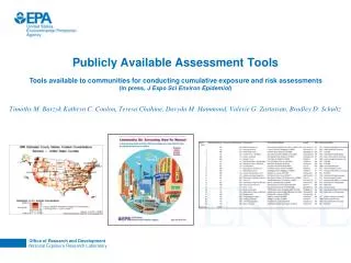
NHDPlus Since 2002, Horizon Systems has been helping the Environmental Protection Agency build the NHDPlus. NHDPlus is an integrated suite of application-ready geospatial data sets that incorporate many of the best features of the National Hydrography Dataset (NHD), the National Elevation Dataset (NED), the National Land Cover Dataset (NLDC), and the Watershed Boundary Dataset (WBD). The NHDPlus consists of nine components: • Greatly improved 1:100K National Hydrography Dataset (NHD) • A set of value added attributes to enhance stream network navigation, analysis and display • An elevation-based catchment for each flowline in the stream network • Catchment characteristics • Headwater Node Areas • Cumulative drainage area characteristics • Flow direction, flow accumulation and elevation grids • Flowline min/max elevations and slopes • Flow volume & velocity estimates for each flowline in the stream network.
NHD GEO Edit Tools • The key to implementing stewardship is the availability of an editing tool that can deal with the unique characteristics of NHD data. • The NHD GEO Edit tools allow stewards to upgrade the NHD while preserving the integrity of the model and the geometric network. • Recently completed working through bugs in Version 1.4. • Version 1.5 will be the version we will use for training sessions.
NHDinGEO Data Organization • Hydrography Feature Dataset consists of six Feature Classes: • HYDRO_NET_Junctions – Nodes between NHDFlowlines used by the geometric network for flow navigation. • NHDFlowline – The core linear network of the surface water drainage system primarily consisting of streams, and artificial paths through polygons. • NHDWaterbody – Polygons representing areal hydrographic waterbody features such as lakes. • NHDPoint – Points representing hydrographic landmark features. • NHDLine – Line features representing linear hydrographic landmark features. • NHDArea – Polygons representing areal hydrographic landmark features.
NHDinGEO Data Organization • Hydrologic Units Feature Dataset: • Region 2-digit HUC • Subregion 4-digit HUC • Basin 6-digit HUC • Subbasin 8-digit HUC • Watershed 10-digit HUC • Subwatershed 12-digit HUC
Event Feature Classes ftp://nhdftp.usgs.gov/SubRegions/High/NHDH1601.zip
Attribute Tables – Feature Details FCode - Five digit integer value comprised of the feature type and combinations of characteristics and values. NHDFlow - Flow table values are derived from the topologic connectivity of the geometric network and attribute values of NHDFlowline features.
Attribute Tables – Feature Details NHDFlowlineVAA – NHDFlowline Value Added Attributes are entirely derived from the NHDFlowline features and the Flow table values. NHDVerticalRelationship – Only NHDFlowline features can participate in vertical relationships.
NHD Metadata In the NHD geodatamodel, metadata information is contained in four tables: • NHDFeatureToMetadata • NHDMetadata • NHDSourceCitatation • ReachCrossReference The NHDFeatureToMetadata table is a link between the features and their metadata. The NHDMetadata table contains the general metadata characteristics for each collection of features. The NHDSourceCitation table lists the sources associated with each metadata instance. The ReachCrossReference table holds the reach lineage information that users may be familiar with from the NHD RCL table.