Download
1 / 22
280 likes | 596 Views
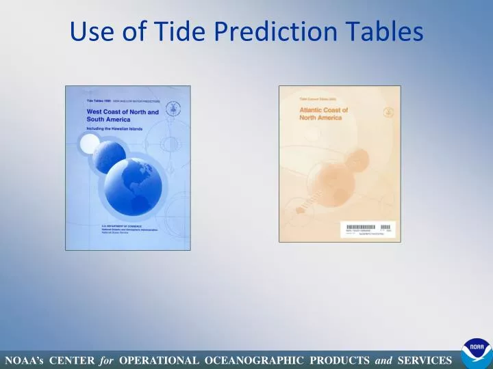
Use of Tide Prediction Tables. Enhancing Navigation. Providing the Nation’s Tide and Tidal Current Predictions 3,142 Tide Predictions Published Annually 2,821 Tidal Current Predictions Published Annually. Predictions from Published Tables.

E N D
Enhancing Navigation Providing the Nation’s Tide and Tidal Current Predictions • 3,142 Tide Predictions Published Annually • 2,821 Tidal Current Predictions Published Annually
Predictions from Published Tables • East Coast of North and South America Including Greenland • West Coast of North and South America Including Hawaii • Europe and West Coast of Africa Including the Mediterranean • Central and Western Pacific Ocean and Indian Ocean
Table 1 Last Quarter First Quarter Feet and Centimeters Full Moon New Moon One year of predictions for Reference Stations; Three Months per page Phases of the Moon 24-Hour Clock (Military Time) Height of tides referenced to Mean Lower Low Water (MLLW) Times are Local Standard Time - NOT adjusted for Daylight Savings
Table 2 Secondary Stations grouped geographically Index Number Latitude/Longitude Time & Height Adjustments Reference Station Ranges and Mean Tide Level
Secondary Station Calculations High Low High Low Water Water Water Water Times Times Height Height Craney Island………. +0 13 -0 01 *1.04 *1.08 Adjustments Reference Station Secondary Station Low Tide 0237 0.0ft High Tide 0853 2.6ft Low Tide 1459 0.1ft High Tide 2102 2.5ft -0 01 *1.08 +0 13 *1.04 -0 01 *1.08 +0 13 *1.04 Low Tide 0236 0.0ft High Tide 0906 2.7ft Low Tide 1458 0.1ft High Tide 2115 2.6ft
Secondary Station Calculations: A) 0518 EST is the predicted time of Min Before Flood at Ref. Station. 05:18 EST –1 hour 18 minutes = 0400 EST. [So, 0400EST is the predicted time of Min Before Flood at the Lynnhaven Inlet Bridge.] B) 0755 EST is the predicted time of the Max Flood Current at the Ref. Station 0755 EST – 1 hour 10 minutes = 0645 EST. [So, 0645 EST is the predicted max flood current at the Lynnhaven Inlet Bridge] C) A flood current of 0.8 k is the predicted speed at the CB Entr. Ref. Station at 0755 EST 0.8 k x 0.7 factor = 0.56 knots [At 0645 EST, a 0.6 knot current is predicted at the Lynnhaven Inlet Bridge] Secondary Tidal Current Station Calculations PAGE 52 PAGE 143
Custom Tide Predictions • 3 Formats available for daily high/low tide predictions • International Format • Standard Page Format • Manuscript Format • 2 Options available for daily high/low tide predictions • AM/PM Time – or – 24-Hour Clock • Standard Time – or – with Daylight Saving Time adjustment
Station Number “90” – 1st Tide is a High Tide “91” – 1st Tide is a Low Tide Date Month Sequence number Year Times and Heights of Tides Listed Sequentially Format: 6 (i5, f4.1) International Format • A format based on recommendations by the IHO (International Hydrographic Organization) for the exchange of tide prediction data between countries. • Data is provided as columns of numbers, all fields are “fixed field width”. • One line of data per day of predictions • Each tide listed sequentially. • Only an electronic media Can be adjusted to show AM/PM Time and Daylight Saving Time.
Standard Page Format • Designed as a “page readable format”. • Includes headers with station name, months, days of the week, and notations as to time reference used. • Times and heights of tides listed sequentially across the page. • Provided on electronic media or printed page. Can provide times in AM/PM or 24-Hour Clock. Can be adjusted for Daylight Saving Time.
Manuscript Format • Same Format used in the Published Tide Tables for the daily Reference Station predictions. • 3 Months of predictions per page. • Provided as printed page or on electronic media as PostScript file or PDF file. Can be adjusted to show AM/PM Time and Daylight Saving Time.
Custom Tidal Current Predictions • 3 Formats available for daily high/low tide predictions • International Format • Standard Page Format • Manuscript Format • 1 Options available for daily high/low tide predictions • Standard Time – or – with Daylight Saving Time adjustment (All times are listed in 24-Hour Clock)
Station ID Date Slack Time, Max Time, Speed Format (i4, i4, f5.1) Month Sequence number Year International Format • A format based on recommendations by the IHO (International Hydrographic Organization) for the exchange of tide prediction data between countries. • Data is provided as columns of numbers, all fields are “fixed field width”. • One line of data per day of predictions • Each tidal current phase listed sequentially, starting with Slack. • Only an electronic media Can be adjusted for Daylight Saving Time
Standard Page Format • Designed as a “page readable format”. • Includes headers with station name, months, days of the week, Flood and Ebb directions, and notations as to time reference used. • Times and speeds of current listed sequentially across the page. • Provided on electronic media or printed page. Can be adjusted for Daylight Saving Time
Manuscript Format • Same Format used in the Published Tidal Current Tables for the daily Reference Station predictions. • 3 Months of predictions per page. • Provided as printed page or on electronic media as PostScript file or PDF file. Can be adjusted for Daylight Saving Time
Interval predictions • Tide and Tidal Current predictions can be generated on an interval basis. • Intervals available are: 5, 6, 10, 12, 15, 20, 30, and 60 minute. • Formats will vary dependant on the interval selected. • Tidal Reference Stations can be generated directly, all others must be inferred from high/low predictions or max/min current predictions.
NOAA Electronic Version Enhancement of Hard Copy Tide Tables 2011 NOAA Tide Predictions: Pass Christian Yacht Club, Mississippi Sound (Reference station: South Pass, Corrections Applied: Times: High +2 hr. 36 min., Low +2 hr. 4 min., Heights: High *1.37, Low *1.37) http://tidesandcurrents.noaa.gov/tides11/
NOAA Electronic Version Enhancement of Hard Copy Tide Tables
Graphical Tide Tables http://tidesandcurrents.noaa.gov/tide_predictions.shtml