Download
1 / 13
130 likes | 238 Views
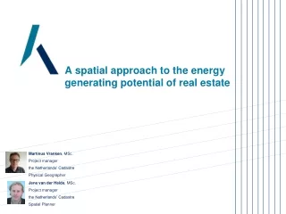
A spatial approach to the energy generating potential of real estate. Martinus Vranken , MSc. Project manager the Netherlands’ Cadastre Physical Geographer. Jene van der Heide , MSc. Project manager the Netherlands’ Cadastre Spatial Planner. Cables and pipelines.

E N D
A spatial approach to the energy generating potential of real estate Martinus Vranken, MSc. Project manager the Netherlands’ Cadastre Physical Geographer Jene van der Heide, MSc. Project manager the Netherlands’ Cadastre Spatial Planner
Cables and pipelines Cadastre, Land Registry and Mapping Agency
Customised work and advice Urban area Infrastructure Rural area Cadastre also provides customised work and advice, predominantly to authorities. This refers to data selections and aggregations. Authorities obtain customised information which helps them develop spatial planning policies.
Use case in progress Assignment: mapping the State and City buildings and energy characteristics in downtown The Hague to support their initiative to reduce and stabilise energy costs. • Setting up GIS environment • Data collection and processing • Defining business case • Open tender on market • Transition to new energy supply • Reduced and stabilised energy costs
Cadastre key registers and national facilities Topographic key register: BRT and BGT Public Services on the Map: PDOK Addresses and Buildings key register: BAG Cable and Pipeline Centre: KLIC WOZ value: Used for tax Public Resitrictions: WKPB Spatial Plans: RO-online Cadastral key register: BRK Energy label: Energielabels Nation wide - Reliable – Interoperable – Accessible - ...
Involved parties and their data • Cadastre • Topography • Ownership and building information • Energy labels • Underground grids electricity, gas and heat • Monuments • Ministry of the Interior and City of The Hague • Energy consumption • Employees • Surfaces suitable for solar panels • 3D model • Province of South Holland • Heat pump facilities • Solar probability map • Wind probability map • Ministry of Economic Affairs • Geothermal facilities • Permits for geothermal concessions
Why Arcgis Online? • Sharing data • Co-operation • Visualisation • Story telling Cadastre is moderator of the platform Cadastre provides data and creates information
ArcGIS Online Group Cadastre Real estate with monument status Buildings and topography State and municipality owned real estate Building characteristics and energy labels Study area downtown The Hague Heat grid Results up to now
Next steps • Setting up GIS environment • Data collection and processing • Defining business case • Open tender on market • Transition to new energy supply • Reduced and stabilised energy costs
Sky Studio’s – West London – Great Britain Office building – Dezhou – Shangdong Province Source: greendiary.com Source: greendiary.com Eneco Head Quarters – Rotterdam – The Netherlands The Hague 2040? Source: greendiary.com Energy generating real estate: future looks Water Tower - Bussem - The Netherlands Source: greendiary.com Source: greendiary.com
Lessons learned and issues • Visualisation through a geo information platform is vital to facilitate the business case; • Insight into the energy and heat exchange possibilities between buildings • Exploring the possibilities of solar, wind and geothermal energy • A government initiated geo information platform can be a starting point for market parties to build and rely on.
Questions • Smart City = Rich City? • Similar or comparable projects abroad? • What cities or countries are front runners and why?