Download
1 / 59
680 likes | 958 Views
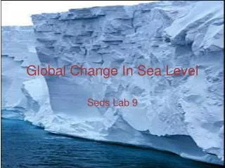
Quaternary Sea-level Change. I. Appropriated and Inappropriated Technology. A. Stratigraphy Context of Study Materials. There are lots of good types of data to work with and there are lots of pitfalls. 1. Morphostratigraphic units

E N D
I. Appropriated and Inappropriated Technology A. Stratigraphy Context of Study Materials There are lots of good types of data to work with and there are lots of pitfalls. 1. Morphostratigraphic units Coral-reef terraces and former strand-line complexes in clastic sediments are examples of morphostratigraphic units. 2. Layer-cake stratigraphy (column) a. Bad examples of this practice exist especially where geologists correlate on the basis of questionable radiometric dates rather than on the basis of physical characteristics or stratigraphic continuity. b. Deep-sea cores from many portions of the world ocean sample an extremely reliable "layer-cake stratigraphy".
3. Peats It can be easily dated using the C-14 method and it is difficult to move peats around as sea-level moves up and down. 4. Mollusk shells a. If mollusc samples are to have stratigraphic integrity, one must be able to demonstrate that the shells have not been transported by rising sea-level, subsequent current activity, seagulls, or man. b. Contamination 5. Corals a. Reef-crest corals (Acropora palmata) can be outstanding indicators of paleosea-level. b. The coral did not live above sea-level; but beyond that, things get complicated. 6. Beach Rocks The claim that "beach rock" identifies a former intertidal environment must be held to close scrutiny.
B. Geochronology/Chronostratigraphy 1. C-14 dating One would hope that all the material would have met selection criteria; but in fact this is not the case and much of existing data must simply be regarded as irrelevant to the questions under consideration. 2. Uranium-series dating a. One simply cannot trust dates on sparse samples from a single or a few terraces. b. One simply should not trust uranium-series dates on materials that were collected from within the modern freshwater phreatic lense or that can be demonstrated to have resided in a paleophreatic lense at some time in the history of the sample. 3. Magnetic stratigraphy 4. The SPECMAP Time Scale 5. Other methods: nanno fossil, thermoluminescence dating(TL), optical stimulated luminescence dating(OSL), electron resonance dating, fission track, amino acid.....
II. The 180 to 18 kaBP Time Interval • pick up information concerning maximum sea-level fluctuation from glacial to interglacial conditions • pick up important calibration concerning the relative importance of ice-volume variation and temperature variation in the observed d18O curve from deep-sea cores
A. Coral-Reef Terrace Sequences On the basis of the record within the range 14C dating, it appears that only the d18O signal in deep-sea cores covaries with the sea-level signal from submerged shoreline. a. well-dated morphostratigraphic units 1. Barbados (Mesolella et al., 1969; Bender et al., 1979) 2. New Guinea (Bloom et al., 1974; Aharon, 1983) 3. Haiti (Dodge et al., 1983) 4. the New Guinea terrace sequence contains several younger terraces that are not represented on Barbados or Haiti because the uplift rate of Barbados and Haiti is considerably less than the uplift of the New Guinea terrace sequence
b. The Constant Uplift Rate Hypothesis 1. with the work of Stockmal(1983): this assumption seems reasonable for a relatively simple tectonic setting such as Barbados, but this assumption is not easily justified for such complex areas as New Guinea or Haiti 2. we should be thankful for the uplifting of these terrace; but should not rely on the "constant uplift hypothesis" to tell us anything about relative sea level 3. this hypothesis remains substantially ad hoc and can considered valid at this time only on an empirical, statistical basis