Download
1 / 39
390 likes | 512 Views
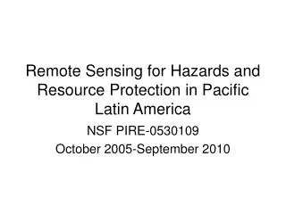
Remote Sensing for Hazard Mitigation and Resource Protection in Pacific Latin America. Project Overview. PIRE 0530109. Develop “great international research partnerships” Train globally engaged workforce Improve internationalization at “institutional level”

E N D
Remote Sensing for Hazard Mitigation and Resource Protection in Pacific Latin America Project Overview PIRE 0530109
Develop “great international research partnerships” Train globally engaged workforce Improve internationalization at “institutional level” First Announced in January 2005 www.nsf.gov=>International Programs=>PIRE Program
Proposal Germination 40 years of Bill Rose’s et al. volcanological research in Latin America + 1st year of PCMI program in Geohazards + fledgling interests by Aqua Terra Tech Enterprise to work internationally (starting in Boaco, Nicaragua) + new NSF PIRE Program Announcement = Proposal
Goals for International Hazards Work Advance remote sensing techniques and applications Develop new collaborations in Pacific Latin America Determine the impact on US participants
Project Particulars • Awarded October 2005 (1st PCMI Geohaz cohort had already started service, 2nd cohort on campus) • 5 years of funding for 1.5 post-docs, 3 Ph.D. students, 9 PCMIs/yr, travel, and assessment/evaluation. Took approximately 1 year to get first post-docs and Ph.D. students • Due to some staffing departures, we were not fully staffed until the midpoint (year 2.5); biggest impact on assessment • Midpoint reverse site visit (more about this later)
Types of MTU Participants Faculty & Staff Ph.D. & “regular” M.S. Students PCMI Students (on-campus & PCVs) Undergraduate Students (Enterprise, Research Assistants, & UPRM Summer Interns) geo.mtu.edu/rs4hazards=>People
MTU Project Participants • Faculty: 8 involved through mentoring and committees • Post-Doctoral Researchers: 1 for the past year, 2 previously for 1 year each • PhD Students: 5 current, all “near” completion • PCMI Students: 19 participated in program, 3 graduated to date, 4 new to start F09 • MS Students: 9 participated in program, 6 graduated, 2 near completion, 2 new for F09 • Undergraduate Students: 15 participated, 4 from University of Puerto Rico--Mayaguez
International Collaborator Groups geo.mtu.edu/rs4hazards=>Partners
Mid-Project Evaluation Reverse Site Visit 20 May 2008
NSF PIRE Program Objectives • Research and educational excellence • Deeper collaborations • Research experiences for U.S. students and faculty • Engage resources within and across institutions • Develop new replicable models for collaborative research and education • Raise the profile and importance of research and education in the United States
Primary Strengths & Accomplishments from the Reverse Site Visit at Project Midpoint • Breadth and depth of the educational component, esp. Peace Corps (PCMI) component • Activities integrate PhD/MS/BS and PCMI and use the strengths of both • Well represented by gender and has a healthy component of Hispanic students from Puerto Rico • Strong ties exist to some host institutions Excerpts of Report to NSF from 5/20/08 Reverse Site Visit
Major Recommendations • More detailed and focused research plan with measurable milestones and anticipated products • More detailed science plan and management structure with clear timelines • More formalized structure for contacts with international collaborators • External assessment, perhaps an external advisory panel Excerpts of Report to NSF from 5/20/08 Reverse Site Visit
Research & Educational Excellence • Educational progress has exceeded expectations (student retention, experiences) • Several individual research projects are well advanced but a rationalization to the goals and aims for the project is needed • Focus and achieve depth rather than diversify • Commit resources to web-based resources, formal publications, and presentations at conferences Excerpts of Report to NSF from 5/20/08 Reverse Site Visit
Project Website Aim is Utility News (aimed at increasing visibility) People (links to PCMs blogs) Resources (presentations, theses, papers, posters, photos & video) Outreach materials (workshops & pre-college activities/info) geo.mtu.edu/rs4hazards
Recommendations to Galvanize Science Strategies • Define the science plan and clear milestones for the next 2.5 years • Create a flow chart to track the progress of outputs from the program • Redefine the science goals and objectives in light of the personnel changes to the program, while maintaining hazards and remote sensing foci Excerpts of Report to NSF from 5/20/08 Reverse Site Visit
MTU PIRE Project Strategies Outputs Participation Activities Outcomes – Impact ShorttermLong term Inputs Proposal-outlined goals: Advancement in RS techniques and their application in Latin America Develop an effective new collaborative arrangement among researchers in Guatemala, El Salvador, Nicaragua, and Ecuador. Determine impact of the international research and educational experiences on US student (graduate and undergraduate) participants. Define SO2 gas flux using UV and IR Undergraduates 10 MTU 4 Univ. Puerto Rico at Mayaguez 1 University of Mexico GMES Faculty/staff Interpret critical signals in seismo-acoustic data Correlation of gas flux seismic, acoustic & thermal data Develop volcanic gas monitoring programs Counterpart agencies Guatemala INSVUMEH CONRED Univ. del San Valle Univ. de San Carlos El Salvador SNET Univ. del Salvador LAGEO S.A. Nicaragua INETER CIRA SNV Omotepe field station Costa Rica Univ. de Costa Rica Area amenazasvolcanicas Panama Univ. de Panamá InstitutoGeográficoNacional Ecuador EscuelaPolitécnicaNacional INHAMI EMAAP-Q CLIRSEN Creation of magmatic systems models Model system processes Forecast activity of open vent volcanoes Creation of catalog of eruptive activity Examine emissions background levels Develop satellite- and ground-based programs of topographic monitoring Design of effective plan to increase community awareness of volcanic hazards. Deploy long-term siesmo-acoustic station Master’s students 9 (7 graduated) Field map & age-date pyroclastic flow/lahar/ashfall deposits Volcanic hazards and gas monitoring Characterize eruptive history Development of automated SO2 image series computer program Perform risk assessment/eruption hazards of several PLA volcanoes Evaluate geo. setting for at-risk populations Creation of archival database for seismo-acoustic, gas flux, and thermal data Evaluate community risk perception; compare to actual risk Development of sustained natural hazard monitoring programs using satellite imagery and geophysics. US Peace Corps Master’s International students 19 (3 graduated) Identify effective strategies for disaster preparedness Integration of methods developed into current volcano monitoring methods by PLA volcanologists Assess early warning systems under various eruption scenarios PhD candidates 5 current Map surface expressions of lineaments using satellite imagery Establish remote sensing –based protocol to map surface expressions of geological lineaments in non-ideal settings Development and application of remote sensing tools for water resource exploration Correlate lineaments with geologic /geophysical maps Post-docs 3 (1 current, 2 have left) Hydrogeology Develop a collaborative international approach to conduct research to improve knowledge of aquifer systems and establish a foundation for research and monitoring Evaluate infiltration/exfiltration potential of fractures using thermal imagery Construction of lineament maps identifying potentially water-bearing fractures locations that may be exploited for water supply Research Ground truth lineament maps Academic institutions (US/foreign ) Perform pumping tests in existing wells Integrate satellite imagery, field surveys, and geotechnical analysis to characterize landslide potential. Geoscience institutions (US/foreign ) Analyze landslides as a function of seismic activity Identification of regional trends in landslide evolution on geographic and temporal scales Determine location of past slope failures and define regions of high susceptibility to future slope failures using satellite sensors, topographic studies, and geotechnical analyses Peace Corps support Guatemala El Salvador Honduras Nicaragua Costa Rica Panama Ecuador Determine landslide potential as a function of drainage morphology, soil type, & slope Landslide Hazards Comprehensive characterization of factors associated with landslides Use case studies to identify factors controlling landslides Monitor volcanic ashfall to predict future slope failures Conduct remote sensing workshops on remote sensing applications to research 5-year time scale Sept 2005-Ocotober 2010 Facilitate international organization/ institution communication Common to all research Promotion of data-sharing dialogue between members of PLA countries Development of collaborative international research and education Funding NSF PIRE 0530109 Investigate current on-line data-repository/ archival systems Offer research options with short and long term field campaigns abroad for participants Students become more culturally aware/sensitive Students more confident in applying knowledge US students better prepared for careers in global workplace Develop curricula to prepare students for work/navigating cultural differences Education Students more appreciative of foreign collaboration Students choose education/careers in int’l geoscience Partner with foreign academic and geoscience institutions to achieve research goals Students publish work; present work at conferences
Research Strategies: Focus & Depth • Volcanic Hazards • Landslide Hazards • Water Resources • Risk Perceptions/Crisis Management
Focus: Volcanic Hazards • Comprehensive monitoring of volcanic activity and eruptive behaviors • Risk Assessment/Eruption Hazards Depth: Continued Monitoring & Repeated Field Campaigns • Guatemala: Fuego, Pacaya, Santiaguito • El Salvador: Santa Ana
Fuego John Lyons Guatemala How Fuego Works Jemile Erdem Fuego’s Seismicity
Adam Blankenbicker Guatemala Santiaguito Dome Growth Kyle Brill Santiaguito Hazards
Hans Lechner El Congo, El Salvador Using GPS array to monitor Santa Ana Volcano Coatepeque Caldera Izalco Santa Ana
Focus: Landslide Hazards • Evaluate potential • Use remote sensing to characterize and monitor slopes and land use Depth: Risk Perceptions • Guatemala • El Salvador • ?
York Lewis El Salvador Landslide studies
Focus: Water Resources • Develop a protocol to use satellite imagery to characterize aquifer systems • Evaluate approach by field mapping and pumping tests/hydrogeochemistry Depth: Delineate Fracture Zones • Nicaragua: Boaco • Ecuador: Quito Aquifer System
Social Geology Volcanic risk perceptions in Pacific Latin America—Kate Graves, Social Sciences MS, 2007 Community Participatory Hazards Mapping in El Salvador—Luke Bowman, Geology MS Student Volcanic Risk & Crisis Management at Volcan de Fuego —Rudiger Escobar-Wolf, Geology Ph.D. Student
PCMI Research Project Evolution • Students undertake preparatory activities in advance of PC service • Country placement is made by Peace Corps and site placement by an APCD (who factors in community needs) • Research activities depend on site placement and PC service projects
Lara Kapelancyk Nicaragua Ometepe Island Volcanoes
Volcan Baru Julie Herrick Pamama Volcán Baru Debris Avalanche
Recommendations for Enhancing Partnerships • Strengthen the intellectual content of the collaborations • Establish a formal structure for regular contact with the foreign partner institutions • Devise a plan to extend student diversity in the program to include in particular other Hispanic groups within the USA, beyond the University of Puerto Rico Excerpts of Report to NSF from 5/20/08 Reverse Site Visit
Increasing Intellectual Strength of Collaborations through Workshops MTU PIRE Organized • July 2007 Costa Rica: Remote Sensing Applied to Volcanic Hazards • March 2008 El Salvador: FLIR Imaging • July 2008 Ecuador: Remote Sensing Fundamentals for Hydrogeology • January 2010 Costa Rica (NSF PASI): Remote Sensing for Volcanic Hazards MTU PIRE Invited Participation • November 2008 Mexico: Chemistry of Volcanic Gases Workshop • March 2009 Indonesia: Remote Sensing of Volcanic Hazards • July 2009 Peru: Adapting to a World Without Glaciers • July 2009 Colombia: Volcanic Hazards
Collaboration with the University of Puerto Rico—Mayaguez (UPRM) • Dr. Lizzette Rodriguez, B.S. & M.S. Geology from UPRM, Ph.D. Geology from MTU, Assistant Professor at UPRM • Since summer of 2005, MTU has hosted 7 UPRM Geology Undergrads, MTU faculty visit annually for recruiting and discussing collaborations with faculty • 2 new MS and 2 new PCMIs from UPRM will join project F09
Collaborative Initiatives • MOUs • Workshops • Visits • By Counterparts • To Field Sites • Joint/Exchange Degree Programs Bill Rose will describe more
Recommendations for Project Assessment & Evaluation • Put in place an external advisory panel for the project • Start an external formal evaluation of the project • Essa Gross will present more on the assessment on Tuesday Excerpts of Report to NSF from 5/20/08 Reverse Site Visit
Meeting Schedule Tuesday 9:30 am Water Resources 11 am Internal Assessment Noon Lunch 2 pm Evaluators Meet 5 pm End for the day Monday 9 am Project Overview 10:15 am Volcanic Processes Noon Lunch w/Students (Atrium) 1 pm Risk Perceptions 2:45 pm Focus Group (PhD Students) 3:45 pm Focus Group (PCMI Students) 5 pm End for the day Wednesday 9:30 am Report to PIs 11 am Depart