Download
1 / 17
170 likes | 303 Views
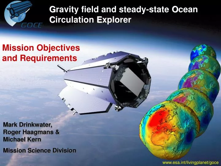
G ravity field and steady-state O cean C irculation E xplorer. Mission Objectives and Requirements. Mark Drinkwater, Roger Haagmans & Michael Kern Mission Science Division. www.esa.int/livingplanet/goce. Scientific Context of Mission.

E N D
Gravity field and steady-state Ocean Circulation Explorer Mission Objectives and Requirements Mark Drinkwater, Roger Haagmans & Michael Kern Mission Science Division www.esa.int/livingplanet/goce
Scientific Context of Mission Oceanographydetermination of dynamic ocean topography, absolute ocean circulation, and mass and heat transfer Solid Earth Physicsanomalous density structure of lithosphere and upper mantle, and better constraints for modelling of Earth’s interior and from the above, improved rate estimates of Sea Level Rise Ice Sheetsimproved knowledge of ice sheet mass balance Geodesyunified height systems, “levelling by GPS” (i.e. orthometric heights) Mark Drinkwater, R. Haagmans & M. Kern – November 2006GOCE
Scientific Objectives – Part 1 • Determination of absolute ocean circulation requires knowledge of the static geoid, or mean sea-surface (representing the ocean at rest) • Ocean ‘dynamic topography’ is the difference between the altimeter-measured ocean surface and the geoid. • 1 mGal gravity anomaly corresponds to ~1mrad slope in ocean surface, or a geostrophic surface current velocity of ~0.1 m/s Ocean ‘dynamic topography’ Mark Drinkwater, R. Haagmans & M. Kern – November 2006GOCE
To provide high spatial resolution information on gravity anomalies in relation to density structure of the lithosphere and upper mantle To information of relevance to the study of Earthquakes, Volcanoes and other natural hazards To provide information on high spatial harmonics in post-glacial rebound and improvements in ice sheet mass balance estimates Scientific Objectives – Part 2 Mark Drinkwater, R. Haagmans & M. Kern – November 2006GOCE
Scientific Objectives – Part 3 • To provide a unified global height reference surface from which ‘pseudo-levelled or ‘orthometric’ heights can be derived. GOCE geoid + Local measurements = Detailed regional geoid Mark Drinkwater, R. Haagmans & M. Kern – November 2006GOCE
Scientific Objectives – Part 4 • Unification of tide gauge records achieved with knowledge about post-glacial rebound and by GPS levelling, (to avoid spurious sea-level rise/fall estimates). NL, 1953 Mark Drinkwater, R. Haagmans & M. Kern – November 2006GOCE
Mission Requirements • To determine the Earth’s gravity field with an accuracy of 1 mGal (1 mGal = 10-5 m/s2 ) • 1 “milli-Galileo” is ~ 10-6 of the acceleration of gravity, g • Requires determining the 3d rate of change of gravity between pairs of accelerometers with a desired sensitivity of ~4 mE (milli-Eötvös) in each axis Where 1 E = 1 mGal / 10 km ≈ 10-9 s-2 (i.e. m/s2 /m) • Noise specification for single accelerometer in MBW: 2 x 10-12 m/s2 /Hz0.5 (c.f. CHAMP ~10-9; GRACE ~10-10) • To determine the geoid (= equipotential surface for a hypothetical ocean at rest) with 1-2 cm accuracy • achieve this at a resolution or half wavelength scale of 100 km (approx. degree and order 200) Mark Drinkwater, R. Haagmans & M. Kern – November 2006GOCE
Electrostatic Gravity Gradiometer (EGG): Measures the components of the gravity gradient tensor in the gradiometer reference frame within a bandwidth of 5-100 mHz Satellite-to-Satellite Tracking Instrument (SSTI): Geodetic-quality GPS receiver allows orbit reconstitution with an accuracy of ~1 cm in all directions and recovery of lower order harmonics Measurement Approach GOCE combines satellite gradiometry and high-low satellite-to-satellite tracking in a low Earth orbit of ± 250km altitude, with unique continuous operation of Drag-Free Attitude Control to combat the effects of air drag EGM96 gradients; Mean value removed Mark Drinkwater, R. Haagmans & M. Kern – November 2006GOCE
Gradiometer Principle Mark Drinkwater, R. Haagmans & M. Kern – November 2006GOCE
Gravity Field Requirements Table Gravity Field Requirements for Science (see SP-1233(1), July 1999) Mark Drinkwater, R. Haagmans & M. Kern – November 2006GOCE
Requirements: Solid-Earth Physics GRACE gravity field Mark Drinkwater, R. Haagmans & M. Kern – November 2006GOCE
Requirements: Oceanography GRACE geoid Mark Drinkwater, R. Haagmans & M. Kern – November 2006GOCE
Requirements: Geodesy GRACE geoid Mark Drinkwater, R. Haagmans & M. Kern – November 2006GOCE
Science and Applications seismic tomograpy topography deformations laboratory solid earth ocean ice geodesy sea level gravity anomalies geoid gravity anomalies geoid + + + + ocean altimetry ice topography positioning (GPS) tide gauges altimetry mean ocean circulation bedrock topography levelled heights unified height system post glacial Rebound mean ocean circulation ice mass balance orbits unified height systems anomalous density structure constraints on mass & heat transport mass balance of ice sheets gravity anomalies INS + orbits Mark Drinkwater, R. Haagmans & M. Kern – November 2006GOCE
GOCE Scientific Issues Mark Drinkwater, R. Haagmans & M. Kern – November 2006GOCE
Level 2 Data Products • Externally calibrated and corrected gravity gradients • Global Earth gravity potential modelled as spherical harmonic series up to deg/order 200 – corresponding to 100km spatial res. (incl. coefficients and error estimates) • Global ground-referenced gridded values of: • geoid heights (Earth geoid map) • gravity anomalies (Earth gravity map) • geoid slopes • Variance-covariance matrix of final GOCE Earth gravity field model Mark Drinkwater, R. Haagmans & M. Kern – November 2006GOCE
Only mission with satellite gradiometry (3D) and drag-free control in low orbit (250km) GOCE will provide global static gravity field with homogeneous quality of unprecedented accuracy and resolution Key step in improving ocean, solid Earth and sea-level modelling Large impact on national height systems and surveying applications on land and sea Essential benchmark technique for understanding mass distribution and change Uniqueness and Relevance Mark Drinkwater, R. Haagmans & M. Kern – November 2006GOCE