Download
1 / 32
320 likes | 528 Views
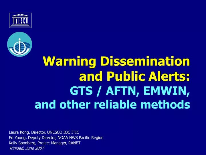
Warning Dissemination and Public Alerts: GTS / AFTN, EMWIN, and other reliable methods. Laura Kong, Director, UNESCO IOC ITIC Ed Young, Deputy Director, NOAA NWS Pacific Region Kelly Sponberg, Project Manager, RANET Trinidad, June 2007. Early Warning Messages.

E N D
Warning Dissemination and Public Alerts: GTS / AFTN, EMWIN, and other reliable methods Laura Kong, Director, UNESCO IOC ITIC Ed Young, Deputy Director, NOAA NWS Pacific Region Kelly Sponberg, Project Manager, RANET Trinidad, June 2007
Early Warning Messages • “Early warning systems must be understandable, trusted by and relevant to the communities which they serve.” • “Warnings have little value unless they reach those people most at risk – who must be trained to react to it.” Ms. Amy Minsk Intl Federation for the Red Cross/Red Crescent Societies, Mar 2005
Early Warning Messages • “Once a tsunami warning is issued, the message needs to reach people rapidly.” • “Highly efficient notification and alert systems that use multiple communication channels ranging from sirens to police and citizen-based patrols and the mass media, have been developed by coastal communities prone to tsunamis and related hazards, like earthquakes.” Tsunami Teacher, Chapter 3.3.6.4 “Tsunami Notification”
Factors to Consider in Developing a Warning Capability Targeting populations-at-risk, • Who are recipients • Where they are located • What they are doing • Time of day • Season (e.g., tourist season) • What they rely upon to receive local news and information • What special needs they have • How well they understand / accept the warning in order to take action
Early Warning Systems • Satellite Communications Systems EMWIN (Emergency Managers Weather Information Network). Uses NOAA GOES 11-12 satellites RANET (Radio-Internet: Communications and Dissemination of Environmental Information for Rural and Remote Community) . Uses Worldspace AsiaStar Satellite • Satellite/land/sea: GTS / AFTN - very fast reliable • Radios and Sirens: VHF, FM, HF Radio Systems • Phone/Cell Phone/Paging Systems: Automated Text-Voice, SMS Text Messages, Cell Broadcasts • INTERNET and WEB Warning Dissemination • Backup Comms – Satellite Telephone Systems
What is EMWIN? • The Emergency Managers Weather Information Network is a wireless, priority-driven computer weather data broadcast system that takes advantage of minimal wireless bandwidth. • EMWIN provides rapid Satellite, VHF Radio, and Internet dissemination of: • Alerts / Warnings < 1 minutes • Forecasts ~ 2- 5 minutes • Graphics ~ 10 – 15 minutes • Imagery ~ 10 – 15 minutes • Other (as time permits) • In severe weather, non-warning products lower priority
How it works • Data are collected from a variety of sources: • 1. Gateway • 2. Weather Wire • 3. FTP • 4. Internet • They are assembled at EMWIN servers and : • 1. Prioritized into high , mid , low priority products • 2. Split into 1k packets • 3. Assembled into 9.6kbs serial data stream
How it works cont. • The data stream is sent to Wallops Command and Data Acquisition Station (WCDAS), NESDIS where it is Up linked to GOES satellite • EMWIN products can be retransmitted: • Transmitted via radio frequency (local re-broadcast) • Sent on the Internet (Byte Blaster)
NWS EMWIN Architecture GOES SPACE CRAFT NWS GATEWAY SYSTEM A & C DEDICATED ANALOG LINE DEDICATED ANALOG LINE/T1 backup WALLOPS CDAS WEATHERWIRE SYSTEM BYTE BLASTER NETWORK B & D Tertiary System EMWIN PC NETWORK INTERNET CLOUD EMWIN INTERNET PUSH BITSTREAM EMWIN FEEDSOURCES
GOES FOOTPRINT GOES 11 (WEST) GOES 12 (EAST)
EMWIN Users • NWS Forecast Offices and Warning Coordination Meteorologists (WCM’s) • WCM’s use EMWIN as a tool to promote the NWS to public and Local and National Emergency managers • Canadian Met Service, South and Central American countries, Caribbean nations, Pacific Island nations, NWS Pacific region • Schools , amateur meteorologists, EMT’s, hobbyists of all ages, storm spotters, storm chasers, Skywarn Network
EMWIN Users • Many TV Stations in the mid-west, especially tornado alley • Police Stations, Fire Stations, Emergency Centers, Emergency response personnel • Re-broadcasters, paging networks • Worldwide Internet Users via Byte Blaster network • Weather Channel (media) • U.S. Air force uses in remote areas
EMWIN in the Pacific • EMWIN provides advance warning of tsunami and typhoons. • We’ve received testimonials noting that after a severe weather event the only weather system still functioning is EMWIN. • But, we have also learned that backup power or emergency UPSs powering EMWIN and other systems need to function if the local power fails (e.g. from a strong earthquake).
EMWINVHF Re-transmission • Re-transmitted locally using NWS or National Guard VHF frequencies to local communities • Re-broadcasters can filter national data stream and re-insert local emergency data or relay it in its’ entirety • Texas counties use EMWIN in Police cars • Florida’s network (FWIN) uses heavy filtering and employs 1200 baud as its’ retran data rate - very effective network used statewide by Emergency Managers.
Typical VHF Re-transmission System 1690.725MHz 1690.725MHz GOES WEST dish GOES EAST dish Internet or Intranet cloud Receiver Custom local EMWIN Data stream 153.950KHz To Paging Network VHF Transmitter EMWIN SERVER
Typical Radio Re-broadcast User 153.950KHz VHF EMWIN 0-100 mi from transmitter line of sight Internet cloud EMWIN VHF Radio Receiver Optional Alarm Controller Internet access to Byte blaster network To Alarm Units Standard Pentium PC
Typical EMWIN Satellite User EMWIN SATELLITE Dish Internet cloud Optional Alarm Controller Receiver Internet access to Byte blaster network To Alarm Units Standard Pentium PC
Byte Blaster Server EMWIN SATELLITE Dish Internet cloud Optional Alarm Controller Receiver Internet access to Byte blaster network To Alarm Units Standard Pentium PC
Why EMWIN works so well • Equipment inexpensive -EMWIN system w/o PC (as little as $1,400) • System needs little to no infrastructure. • Runs on a laptop. • Solar powered version exists. • Signal is “Weather Proof” due to L-Band transmission. • User Equipment relatively compact - very rugged. • Data-stream free, repeatable - can be customized for local retransmission. • EMWIN non-proprietary. • Multiple inexpensive software displays available. • Large / knowledgeable user community to help monitor performance and answer user questions (EMWIN user list)
Who are we? The RANET program began in Africa in 1998/9, following the experience of Seasonal Outlook Forums. It was recognized that benefits from advances in science and applications could only be realized if populations outside central cities could be reached. • Africa: 1998/99/00 -> present • Pacific: 2003 -> present • Asia, Indian Ocean: 2005
Who are we? • RANET is a cooperative effort of various national, regional, and international partners, who seek to: • Make weather and related environmental information more accessible and useful to rural and resource poor populations in order to aid day-to-day resource decisions and prepare against natural hazards. • Improve the dissemination capacities of national hydro-meteorological and related national services, NGOs, and other information producers, thereby increasing the profile of and active value of these organizations to local populations.
What we do? • RANET INCLUDES: • Web and Internet • Community FM Radio • HF Radio • SMS (Cellular Text) Messaging • Other Equipment Use and Maintenance • RANET Community Building: Newsletters, etc • Web Hosting • Network Development and Management • Maintain Satellite / Associated Server Systems • Pilot and Training Activities • Test and Identify Communication Solutions
Core principles? Core principles? RANET IS A CONCEPT Ensuring sustainability and maintenance of systems is a priority of all RANET activities, therefore we encourage local ownership and use of communication systems for multiple purposes such as education, health campaigns, community discussions, etc.
Core principles? Core principles? RANET IS A CONCEPT RANET also works to build upon and augment existing networks and means of communication.
Wantok Community FM Radio Station A Professional Quality FM Radio Station • A complete broadcast station in a suitcase • Ideal for a Community FM Radio Station • Readily accepts any audio source • Can be solar/wind powered for remote communities The Wantok Suitcase FM Radio Broadcast System. Hakupu Village, Niue FM station on the air… Funded by NOAA, and NZAID
Wantok Community FM Radio Station Applications for the Wantok SBS-1 • Low cost, low power community radio station • Education and training • A tool for Socio-Economic Development • Ideal for Disaster Alerting and Response • Gets important information to the end user Owned by the Community - for the Community The Wantok Suitcase FM Radio Broadcast System
HF Radio Email What is HF Email? (two way communications) • Email received - sent via a HF Radio Transceiver • Requires a special radio modem • Modem interfaces to PC or laptop • Software can interface with many applications, e.g. Outlook Express, our mSTAR automatic weather station Niue HF email system, quickly installed after TC Heta Funded by Met Office, UK
HF Radio Email Why HF Radio Email • Cost effective two-way remote communications sys • Easy to install and operate • Some Pacific NMS already have suitable HF Radios • Many staff already have HF radio experience Typical HF radio Email system set-up
Commercial satellite - Iridium A Reliable Portable Internet Backup Solution (two way communications) • Constellation of 66 LEO satellites • Small Cellular phone type handset - SMS capable • Can access Iridium Direct Internet Gateway • Built in Modem • Rugged external marine antenna • All weather capability • Can use any Internet Email or Browser Client Niue Iridium Backup Coms System – installed April 2005
Meteorological & Disaster Mitigation Communications: “Blueprint” Primary communications • EMWIN for Intl/Natl Warnings - GTS uplink w/unique WMO product header • Target: “selected locations” / secondary (FM) • FM Community radio for redistribution + civil defence type siren for villages • FM solar/hand cranked radios • Local ISP for outbound comms Back up communications • HF Radio email and/or • Commercial satellite email FM solar/hand cranked radio
Sirens and VHF Radio AlertingGetting the Warning Message Out to the Public