Download
1 / 56
2.23k likes | 4.56k Views
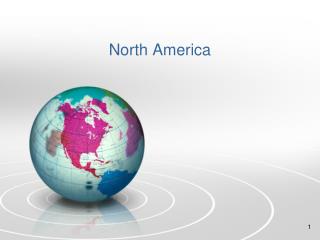
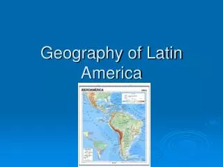
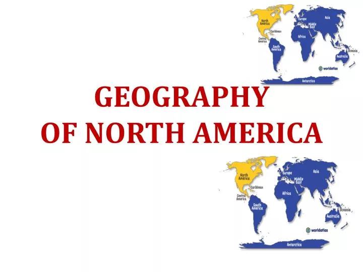
GEOGRAPHY OF NORTH AMERICA. The Arctic Ocean lies to the north of this region. North America, third largest of the seven continents, including: Canada (the 2nd largest country in area in the world), the United States (3rd largest), and Mexico (14th largest). Greenland, the largest island.

E N D
North America, third largest of the seven continents, including: Canada (the 2nd largest country in area in the world), the United States (3rd largest), and Mexico (14th largest). Greenland, the largest island
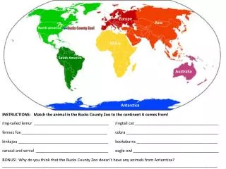
North America, includes (23) countries and dozens of possessions and territories. Positioned in the planet's northern and western hemispheres, it's bordered in the north by the Arctic Ocean, in the east by the Atlantic Ocean, in the southeast by the Caribbean Sea and Gulf of Mexico, and in the west by the Pacific Ocean. Additional North American countries:Antigua and Barbuda,Barbados,Dominica,Grenada,Haiti,St. Kitts & Nevis,St. Lucia,St. Vincent & the Grenadines,Trinidad & Tobago
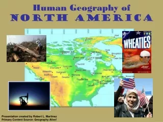
Namesake: Americo Vespucci, the Italian explorer Major Languages: English, French and Spanish Population: 528,720,588 (2008 est) It's the fourth most populous continent, after Asia, Africa, and Europe Population Density: 22.9 km2 (59.3 sq mi)
The term shield refers to the large core of very old rock that lies at the base of each continent.
In North America, this rock core was exposed thousands of years ago. During the ice ages, glaciers scraped across the land, taking the soil with them. They left just a thin layer of soil in eastern and central Canada.
Plains are flat or gently rolling areas of land. Much of the soil that glaciers scraped from the Canadian Shield ended up on the plains of Canada and the United States.
The glaciers that scraped the shield also dug hug holes that became the Great Lakes.
Alaska Range: Mountains of south-central Alaska that extend from the Alaska Peninsula to the border of the Yukon Territory, Canada. The highest point in North America,Mt. McKinley, 20,320 ft. (6,194 m) is located here. Appalachian Mountains: The Appalachians, about 1,500 miles in length, extend from central Alabama in the U.S. up through the New England states and the Canadian provinces of New Brunswick, Newfoundland and Quebec.
Mount McKinley (also known as Denali) is the highest mountain on the North American continent. Its summit is 20,320 feet (6,194 meters) above sea level. It is located in the USA, in the state of Alaska.
Significant Appalachian ranges include: • The Cumberland Mts. in Tennessee • The Blue Ridge Mts. in Virginia • The Alleghenies in Pennsylvania • The Catskills Mts. in New York • The Green Mts. in Hampshire • The highest point is Mt. Mitchell in North Carolina at 6,684 ft (2,037 m) Brooks Range: Mountains of northern Alaska. Highest point: Mt. Isto, 9,060 ft. (2,760 m)
Canadian Shield: This plateau region of eastern and northern Canada and the Great Lakes area of North America mainly includes rough and rocky surfaces, and large areas of coniferous (evergreen) forests. In addition, the northern regions along the Arctic Circle are comprised of rocky frozen tundra. The highest elevation is estimated at 1,640 ft (500 meters).
Cascades: A mountain range stretching from northeastern California across Oregon and Washington. Major peaks included Mt. Hood, Mt. Ranier, and Mt. St. Helens. Continental Divide: In North America the Western Continental Divide is an imaginary line that sits atop a continuous ridge of mountain summits that divide the continent into two main drainage areas.
Coast Range: Mountains running along the Pacific Ocean coastlines of California, Oregon, Washington. They also extend along the western border of British Columbia, Canada, and the southern edge of Alaska, all the way to Kenai Peninsula and Kodiak Island.
Coastal Plain This area of the southern and southeastern U.S extends to the continental shelf and is generally characterized by level (flat) land with assorted mixed forests. The coastal areas include bayous, deltas, marshes, mud flats and swamps.
Great Plains: The Great Plains of North America slope east from the Rockies and extend to the edge of the Canadian Shield and the western edges of the Appalachians. The land is generally smooth with large treeless areas and shallow river valleys. Minor hills and mountains are found in the Ozark Plateau of Missouri, and in the Boston Mountains and Ouachita Mountains of northwestern Arkansas and eastern Oklahoma. Sandhills and buttes cover parts of the north central U.S. in Nebraska.
Rocky Mountains: The Rocky Mountains, about 3,000 miles in length, extend from the U.S State of New Mexico up through the western United States and on into the northernmost reaches of Canada's British Columbia.
The highest point in the Rockies is Mt. Elbert, located 10 miles southwest of Leadville, Colorado. It stands at 14,433 ft (4,399 meters).
Sierra Madres: Sierra Madres include two major ranges, and one smaller one. The Sierra Madre Occidental runs parallel to Mexico's Pacific Ocean coastline, with several peaks exceeding 10,000 ft. (3,034 meters) The Sierra Madre Oriental runs parallel to its Gulf of Mexico coastline, with a few mountains reaching 10,000 ft. (3,034 meters)The Sierra Madre del Sur range is located in the southern Mexican states of Guerrero and Oaxaca.
Additional mountain ranges in Central America and the Caribbean include:Cordillera Central (Dominican Republic) Cordillera de Talamanca (Costa Rica) Cordillera Isabelia (Honduras/Nicaragua) Maya Mountains (Belize) Sierra de Bahoruco (Haiti) Serrania de Tabasara (Panama) Sierra Maestra (Cuba) Sierra Nevada: This mountain range of eastern California is about 400 miles in length. The highest point is Mt. Whitney at 14,494 ft. (4,418 meters).
Hundreds of rivers and their tributaries slice across North America. Here we highlight the major ones, and offer a brief description. Brazos: This Texas river begins in the northern part of the state in Stonewall County, and flows southeast into Brazoria County and the Gulf of Mexico. It's (840 miles) (1,351 km) in length. Churchill: This river of central Canada rises in northwestern Saskatchewan, then flows east into Manitoba, and on into Hudson Bay. It passes through numerous lakes and is known for the rapids along its path. It's (1,000 miles) (1,609 km) in length.
Colorado: Beginning in the Rocky Mountains of northern Colorado, it moves southwest, ending in the Gulf of California. It's (1,450 miles) (2,333 km) in length and over the centuries formed numerous canyons along its winding path. The most famous of these is the Grand Canyon in northern Arizona. The river has more than 30 electric power plants along its run, as well as dozens of dams and reservoirs.
Columbia: This wide, fast-flowing river begins in the Canadian Rockies of southeast British Columbia, Canada, flowing south through the State of Washington, then forming the natural border between Washington and Oregon. It ends in the Pacific Ocean and is (1,152 miles) (1,857 km) in length. Hydroelectric power development in the river basin brought inexpensive electricity to the Pacific Northwest, but it severely affected salmon spawning and local fish migration.
Fraser: This river of British Columbia, Canada, begins in the Canadian Rockies near Yellowhead Pass, then flows in a variety of directions (generally south), finally turning west to empty into the Strait of Georgia, just south of Vancouver. It's (850 miles) (1,368 km) in length.
Mackenzie: It's the longest river in Canada and dissects the Northwest Territories. It flows generally northwest into Mackenzie Bay and the Beaufort Sea. This historic river was discovered by Sir Alexander MacKenzie, and along its path are thick, green forests and dozens of major lakes. It's (1,200 miles) (1,800 km) in length. If then combined with its tributaries - the Slave, Peace and Finlay rivers - it extends to (2,635 miles) (4,240 km), and becomes the second longest river in North America, second only to the Mississippi/Missouri river system combination at (3,877 miles) (6,236 km) in length.
Mississippi: It is the major river of North America and the United States at (2,339 miles) (3,765 km) in length. It flows from northwestern Minnesota south to the Gulf of Mexico, just below the city of New Orleans. It is a significant transportation artery and when combined with its major tributaries (the Missouri and Ohio rivers) it becomes the third largest river system in the world at (3,877 miles) (6,236 km) in length.
Missouri: It begins in southern Montana in the Rocky Mountains, first flowing north then generally southeast across the heart of the United States, ending at the Mississippi River, just to the north of St. Louis, Missouri. It is the longest river in the United States (2,500 miles) (4,023 km).
Ohio: Formed by the confluence of the Allegheny and Monongahela rivers in Pittsburgh, Pennsylvania, the Ohio flows generally southwest. It forms the natural borders of Ohio and West Virginia, Ohio and Kentucky, as well as parts of the borders of Indiana, Illinois and Kentucky. It empties into the Mississippi River at the Illinois border and is (975 miles) (1,569 km) long.
Rio Grande: It is one of the longest rivers in North America at (1,885 miles) (3,034 km). It begins in the San Juan Mountains of southern Colorado, then flows south through New Mexico. It forms the natural border between Texas and the country of Mexico as it flows southeast to the Gulf of Mexico. In Mexico it is known as Rio Bravo del Norte. Used for drinking water by both countries, the river is becoming more polluted as population centers that dot the river grow in size, and then dump sewage and pesticides into the water.
St. Lawrence: This river flows northeast out of Lake Ontario and on into the Gulf of St. Lawrence. It's (760 miles) (1,225 km) in length and permits the passage of deep-water ships between the Atlantic Ocean and the Great Lakes. It includes a series of man-made canals, locks and dams, and is considered one of the most vital shipping routes on the planet. Additional details on the St. Lawrence River and the Great Lakes.
Yukon: It begins in the southwestern edge of the Yukon Territory of Canada, and then flows northwest across the border into Alaska. This massive river continues southwest across central Alaska, ending at the Bering Sea. Even at a length of (1,265 miles) (2.035 km), most of it is navigable, however, it remains frozen from October through mid-June.
The United States spans 6 time zones. It shares the main four time zones with Canada (Eastern Time,Central Time, Mountain Timeand Pacific Time).
Climate: Weather varies widely across the continental USA, as well as in Alaska and Hawaii. In general terms, summers are hot and humid in the plains and southern states, while the southwest is very hot and quite dry. Endless summers are southern California and Florida trademarks, while in the Pacific northwest and New England states, summers are warm with cool mornings and pleasant evening conditions enters in the southern states are mild, while in the north, northeast, plains states, and in the western mountains, conditions are often quite cold with heavy snow and sub-freezing temperatures.
Severe weather in the form of thunderstorms is a normal spring and summer occurrence; devastating tornadoes are also common in the spring and summer months, especially in the central part of the U.S. Hurricanes occasionally strike the eastern coastline and Gulf of Mexico states from June through October.
Climate varies widely across this large region, which reaches from the chilly Arctic to the warm waters of the Gulf of Mexico.
The northern parts of this landmass fall in tundra and sub arctic climate zones. In sub arctic climates, winters are very long, cold, and snowy. Summers are very short. They may be cool and rainy.
The tundra climate zone is even more severe. Here it is cold all year, even in summer. Winter temperatures are usually well below 0 degrees Fahrenheit. In summer, the high temperatures may not be far above freezing 32 degrees Fahrenheit.
Most of Canada and Alaska have either a tundra or a sub-arctic climate. But the climate warms up as you move farther south.
The area closest to the continental United States enjoys a mostly humid continental climate. Winters are still freezing cold, but summers can be hot and steamy.
Mangrove trees grow in the swamps of Everglades National Park in Florida.
Across the central part of the United States is a wide band of temperate grassland. This area was once thick with prairie grasses.