Download
1 / 37
370 likes | 630 Views
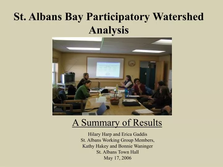
St. Albans Bay Participatory Watershed Analysis. A Summary of Results. Hilary Harp and Erica Gaddis St. Albans Working Group Members, Kathy Hakey and Bonnie Waninger St. Albans Town Hall May 17, 2006. With participation from: Agency of Agriculture, State of Vermont

E N D
St. Albans Bay Participatory Watershed Analysis A Summary of Results Hilary Harp and Erica Gaddis St. Albans Working Group Members, Kathy Hakey and Bonnie Waninger St. Albans Town Hall May 17, 2006
With participation from: Agency of Agriculture, State of Vermont Agency of Natural Resources, State of Vermont - Basin Planning - River Management Bellows Free Academy Citizens City of St. Albans Farmers Franklin County Conservation District Natural Resources Conservation Service, USDA Northwest Regional Planning Commission St. Albans Area Watershed Association Town of St. Albans Town of Georgia UVM Extension
Overall Project Goals • Identify current phosphorus loads to streams • Identify the importance of historical v. current management • Identify cost effective nutrient management strategies • Involve a diverse group of St. Albans community members and stakeholders • Disseminate the results and engage the public in discussion
Participatory Modeling Process Meeting 1: Define Goals (1/05) Meeting 2: Hydrology (3/05) Meeting 4: Phosphorus (11/05) Worked Individually w/ Working Group Members Stream Monitoring (04 -05) Soil Testing (04-05) Meeting 3: Regulations & Management (5/05) Meeting 5: Scenario development (1/06)
Watershed Analysis Aggregate Watershed Calcs Spatial Watershed Model • Tile drainage • Surface erosion • Surface runoff • Road sand washoff • Wastewater discharge • City stormwater • Farmstead discharge • Geese
Spatial Watershed Model Horizontal Transport (H20, P, N, SS) Landuse Spatially Dependent Parameters Avail P Wind Elevation Slope Temperature Time Series Data (Climate) Precipitation Soil Spatial data Local Dynamics Hydrology (snow), plants, phosphorus
Summary of Watershed Analysis • Large net imbalance in watershed (70+ mt P/year) • Road Sand – most important developed source • Dissolved P - most important agricultural source • Driven by high soil P concentrations representing land management for past 5-8 decades • Need to correct mass-imbalance in the watershed • Will take decades to adjust soil P levels • In-stream erosion is important process not captured by model - current area of research
Summary of Social Process Findings • Historic dimensions of conflict surrounding natural resource issues • Collaborative processes during the computer modeling process brought stakeholders together across distinct planning categories • Stakeholders described increases in general understanding, as well as increased awareness of others’ goals • Timing played an important role in the success of this project
The Long-term Issue INPUTS: Animal Feed/Bedding + Atmospheric Dep.+ Urban Fertilizer + Households 111+ mt/year 121+ t/year + Ag Fertilizer OUTPUTS: Milk+ Wastewater sludge 43+ mt/year 47+ t/year Other Ag Products+ Annual Accumulation of at least 68+ mt/year 75+ t/year - = TMDL Allocation for St. Albans Watershed 8 mt/year
Overall Summary of Model Results City Stormwater Forest Runoff & Erosion 5% City Surface Runoff 1 % Developed Surface Runoff 2% City Surface Erosion <1% Developed Road Sand 10% City Road Sand 3% Direct Barnyard Discharge 12% Ag Surface Runoff (Dissolved P) 43% Ag Surface Erosion 8% Geese <1% Ag Tile Drainage 8% Wastewater Discharge 9% In-stream erosion ?????????????
Modeled Sources of P to Streams Landuse Distribution In-stream erosion ????????????? Total Metric Tons: 10.25 Total US Tons: 11.30 Percent of Watershed Total: 100% ****Plus in-stream erosion
Developed Landscape NON-CITY STORMWATER Total Metric Tons: 1.1 Total US Tons: 1.2 Percent of Watershed Total: 11% ****Plus in-stream erosion WASTEWATER DISCHARGE Total Metric Tons: .9 Total US Tons: 1.0 Percent of Watershed Total: 9% CITY STORMWATER Total Metric Tons: 0.43 Total US Tons: 0.47 Percent of Watershed Total: 4% ****Plus in-stream erosion
Stormwater Non-Point Sources Surface Erosion Dissolved Runoff Road Sand Washoff
Agricultural Non-Point Source Annual P in Non-point sources Tile Drainage Surface Erosion Dissolved Runoff Total Metric Tons: .77 Total US Tons: .85 Percent of Watershed Total: 7.5% Total Metric Tons: .85 Total US Tons: .93 Percent of Watershed Total: 8.3% Total Metric Tons: 4.37 Total US Tons: 4.82 Percent of Watershed Total: 43%
Direct Barnyard Discharge Total Metric Tons: 1.28 Total US Tons: 1.41 Percent of Watershed Total: 12%
TARGET REDUCTION * Doesn’t include impact on in-stream erosion **Discrepancy between monitoring and model is likely in-stream processes
Social Process Results: Conflict Relationship Conflict Interest Conflict Cognitive Conflict Values Conflict Blame Responsibility Regulations Financial Lack of Understanding Family History Resistance to change Addressed Through Taking responsibility Engagement of different people A neutral process Positive Conversations Increased Understanding Not addressed Important considerations: Timing, other processes
Social Process Results: Integration TECHNICAL SOCIAL Tying information together Causal Relationships Future Decision Making Increased awareness of others’ perspectives Working together across distinct planning categories
MANY THANKS To all of the stakeholders who have given us their time and energy and who care deeply about solving environmental problems in St. Albans
St. Albans Watershed Analysis To download this presentation or for more information: www.uvm.edu/~landmod Contact: Erica Gaddis (egaddis@uvm.edu) Hilary Harp (hharp@uvm.edu)
Why Low Impact Development? • Practices reduce stormwater generation by maintaining predevelopment hydrology • Basic Principle: Designing after nature • Located at the lot level • Previous focus on 10 and 100 year storm events have drained the system • Can help eliminate the volumes of discharge – potentially reduce size of permits COST FOR ESTIMATED REDUCTION: Costs: Green roofs $15-20/ft2 Porous Concrete$2 - $6.50/ft2 Target Store green roof
City Stormwater MODEL ESTIMATED REDUCTION: Metric Tons: .06 - .31 US Tons: .06 - .35 Percent of Watershed Total: 0.53 - 3% Sediment Separator Addresses city component of road sand washoff $620,000 total (+land value) Diversion Structure Installation of proposed diversion structure Removal rate not yet known $15,050 for plantings + engineering and construction of structure MODEL ESTIMATED REDUCTION: Metric Tons: .05 US Tons: .06 Percent of Watershed Total: 0.51% Stormwater Retention Water is retained at the water quality volume in the landscape (rain barrels, rain gardens, etc.) Vary substantially. $3-4/ft2 residential$10-40/ft2 commercial
In-Stream Erosion Diversion Structure Installation of proposed diversion structure Removal rate not yet known $15,050 for plantings + engineering and construction of structure MODEL ESTIMATED REDUCTION: Metric Tons: ??? US Tons: ??? Percent of Watershed Total: ??? Stormwater Treatment Water is retained at the water quality volume in the landscape (rain barrels, rain gardens, etc.) Vary substantially. $3-4/ft2 residential$10-40/ft2 commercial
City and Non-City Developed MODEL ESTIMATED REDUCTION: No Road Sand Used Sand is replaced by an alternative w/o P With no sand used, reduction in cost Liquid Deicers vary in cost (Magic Salt)
Agriculture and Development Dissolved Runoff Tile Drainage MODEL ESTIMATED REDUCTION: Eliminate Fertilizer Use Eliminate use of urban lawn fertilizer and agricultural fertilizer Influences soil P concentration over time to reduce dissolved P runoff Reduction in cost due to less fertilizer used MODEL ESTIMATED REDUCTION: Phosphorus Filters (A. Drizzo) Implemented in ditches to capture surface runoff and tile drainage $50,000 for Tile Drainage, $200,000 for Surface Runoff (for entire watershed)
Agriculture Surface Erosion Buffers and Land Displacement Add 30 m buffers to all agricultural lands Increase manure application up to 136% MODEL ESTIMATED REDUCTION: Metric Tons: 0.7 US Tons: 0.78 Percent of Watershed Total: 6.86% • Description • Model assumption • Data sources • Results • Costs Trees $2500/acre, Grass $150/acre
Direct Barnyard Discharge MODEL ESTIMATED REDUCTION: Metric Tons: 1.02 US Tons: 1.13 Percent of Watershed Total: 9.8% Farmstead Treatment Reducing current farmstead phosphorus discharge by 80% Require significant investment to improve existing treatment $250,000 for “an average size farm” ~$6 million estimate for watershed
Annual P in Non-point sources Stormwater Non-Point Sources Surface Erosion Dissolved Runoff Road Sand Washoff