Download
1 / 48
480 likes | 660 Views
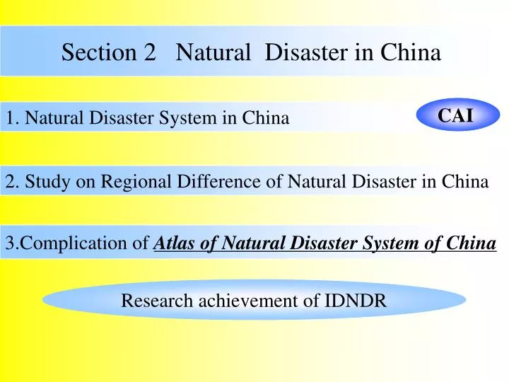
Section 2 Natural Disaster in China. 第二节 中国自然灾害. 一、中国自然灾害系统. CAI. 1. Natural Disaster System in China. 二、中国自然灾害区域分异研究. 2. Study on Regional Difference of Natural Disaster in China. 三、中国自然灾害系统地图集编制. 3.Complication of Atlas of Natural Disaster System of China.

E N D
Section 2 Natural Disaster in China 第二节 中国自然灾害 一、中国自然灾害系统 CAI 1. Natural Disaster System in China 二、中国自然灾害区域分异研究 2. Study on Regional Difference of Natural Disaster in China 三、中国自然灾害系统地图集编制 3.Complication of Atlas of Natural Disaster System of China Research achievement of IDNDR
1. Natural Disaster System in China 1.1 Concepts 由于自然原因造成人员伤亡、 财产损失、社会失稳的一种或一系列现象。 Natural Disaster One or several phenomena caused by physical factors, such as casualties, property loss, and society imbalance.
Disaster System Regional disaster system is a complex various one on the earth, consisted of hazard-formative environment(A), hazard-affected body(B), hazard (C), and disaster effect (D). Relationship
致灾因子是对人类及其经济社会、自然资源造成损害的自然异常变化。致灾因子是对人类及其经济社会、自然资源造成损害的自然异常变化。 孕灾环境是由大气圈、岩石圈、水圈、生物圈共同组成的综合地球表层环境。 灾情:因灾导致的生命、财产、资源损失的情况。 承灾体是灾害的承受体,包括人在内的物质文化环境、自然资源。 图1.1 自然灾害系统示意图 Hazard-formative factors are triggered by environmental changes, which damage natural resources, humans and their economic society Hazard-formative environment is an integrated one on the earth, consisted of atmosphere, lithosphere, hydrosphere, and biosphere. Disaster effects: loss of life, property, and resource caused by natural disaster Hazard-formative environment Disaster effect Hazard-affected body Hazard-formative factor Hazard-affected bodies include material culture environment and natural resource Disaster effect Relationship of each part in natural disaster system Process of natural disaster
AHazard-formative Environments Atmosphere (troposphere,stratosphere, etc. ) Structure Hydrosphere (surface water, groundwater) Lithosphere (soil, weathering crust, lithosphere,terra Biosphere (plants, animals, microorganism) Properties of hazard-formative environment Human circle (race, nation, religion, the poor/rich, boundary, living map) Zonality/azonality (baseband/ marginal band) Fluctuation/ Mutagenicity (periodic/quasiperiodic/random) Gradual change/ tendency (grads/cumulation) Technology circle (architecture, internet system, transportation system)
BHazard-affected Bodies 人口、经济 土地利用(城市、 厂矿、农田、 牧场、森林、 道路、机场、 港口等) Population,economy, land use(city, mine, arable land, grazing land, forest, road, airport, harbor)
致灾 圈层 划分 Hazards in different circles coldness storm typhoon sandy storm frost hail hydrosphere &atmosphere drought freezing hazard dry-hot wind sea ice flood seawater invasion ice-snow storm surge biosphere poisonous grass pest&disease forest fire rodent pest landslide lithosphere debris flow collapse earthquake land subsidence ground fissure wind and sand flow CHazard-formative Factors Earthquake Climatic disasters (flood, etc) Crop disaster Marine disaster Forest biological disaster Geological disaster Others Categories (Ma Zongjin, 1994)
Water logging Plant Diseases &Insect Pest Bank Destroy Landslide Machine Malfunction Water and soil erosion Rainstorm Strong wind Rock Slide Flood Rainstorm Typhoon Rainstorm Surge Debris Flow Seawater Pollution Power shutoff High Wave Flood Overflow Bank Destroy Fire Machine malfunction Infrastructure Damage Disaster Chains Typhoon-Storm Disaster Chains
致灾因子 正常水位 洪水位 承灾体 居住地 耕地 灾情1 淹没农田:200ha 毁损房屋:20间 死亡人口:20人 灾情 放大 人类活动:进入高风险区 承灾体变化 灾情2 淹没农田:1000ha 毁损房屋:500间 死亡人口:300人 图2.17 人类活动对灾情的放大机制 DDisaster Effects Causality,psychological influence 直接、间接经济损失 Direct and indirect economic loss 生 态 环 境 破 坏 Ecological environment destroy 1st effect: Farmland submerged: 200ha Houses destroyed: 20 Death toll: 20 Architecture damage 建 筑 物 破 损 灾 情 放 大 High-risk area High-risk area Magnify disaster effects Human activity at high-risk areas, Different hazard-affected body High-risk area High-risk area Hazard-formative factor Ave. level 2nd effect: Farmland submerged: 1000ha Houses destroyed: 500 Death toll: 300 Level in floods Hazard-affected bodies Residential area Arable land
heavy high risk Various intensity of hazards Most serious regions light Hazards 某种 自然 灾害 low risk high Least serious regions Economic level Various intensity of vulnerability low low risk strong Defense ability high risk weak
1.2 Characteristics of Natural Disaster System in China (CAI) Introduction to Natural Disaster in China Interface of disaster Regional Natural Disaster System in China Regional maps(theory-practice) (Multi-angle, multi-platform, penetrative, dynamic) Regionalization of Natural Disaster in China
Ⅴ Ⅵ Ⅳ Ⅲ Ⅱ Ⅰ Main Disaster Chains Typhoon-storm-wind Typhoon-storm surge Drought-insect disaster Drought-fire- Cold wave- snow disaster Cold wave- frost Earthquake-landslide Storm-landslide-debris flow Storm-flood Flood-water logging
Hazard-formative Mechanism Monsoon areas Fringe of Inner Mongolia plateau Near sand-origins Transitional belt of two temperature zones Intense evaporation Hazard-affected environments Winter monsoon passage Unstable hydrothermal conditions Low plant coverage Hazard-formative factors Cold wave Drought Dust storm Hazard-affected bodies Main agricultural regions Commodity grain bases Center of politics, economy, and culture, Dense population and cities Overuse underground water, land subsidence, and seawater encroachment Disastrous effects Serious climatic disaster Mechanism of Climatic Disaster Formation and Effects in North China
Hazard-formative mechanism 致灾机制 Boundary of two earthquake belts Mountainous at the boundary of two ladders Influence of southwest and southeast monsoon Boundaries of three plates Alps and glaciers Hazard-formative environments Active tectonic movement Complex landform and unstable land surface Sufficient water source storm Hazard-formative factors Earthquake Landslide Debris flow Hazard-affected bodies More development of mountainous areas Dense buildings, population,and properties Subconscious of disaster preparedness among constructors 成灾机制 Disastrous effects Serious geological disaster Mechanism of geological disaster formation and effects in North China
Hazard-formative Mechanism Located across three ladders Many mountains and windward slope at boundaries of ladders Inconvenient drainage due to flat platform Coast area in the east Influence of southwest and southeast monsoon Hazard-formative environments Sufficient precipitation Landform and physiognomy Soil and geology Influence of marine disaster Hazard-formative factors Storm Storm surge Flood & waterlog Hazard-affected bodies Forest denudation, water and soil loss Sand filling up, enclosure of lakes for farmland, poor ability to store floodwater Core regions of China’s economy Disastrous effects Serious hydrological disaster Mechanism of Hydrological Disaster Formation and Effects at Yangtze River Drainage
2 Regional Difference of Disasters in China 2.1 Regional Difference of Hazards 1)Way of Research Mode1-Fig.1 Drawing eigenvalue isoline Models Database of counties Parameters Model2-Fig2 Regional law of hazards Information sources Pile up Model3-Fig3 Basic acknowledgement Regional disaster reduction Acta Gographica Sinica,1994,Vol. 49 (1)
2)Eigenvalues and Model of Hazards Diversity:Degree of regional cluster of natural hazards(D) D=n/N “n” represents categories of natural hazards of a county in a special period. There are 102 types of natural hazards totally on the mainland of China. “N” represents categories of natural hazards of the country in a special period
Relative Hazard Intensity: It is the destroy and damage of hazards that causes regional disasters. S: relative intensity or degree of hazards in some county P: relative intensity or degree of the certain hazard “i” Si area proportion of the certain hazard “i”, 0.01to1.0, or 1% to 100%
Coverage Index: The scope of a region’s influence from every hazard Si: area proportion of the certain hazard “i”
Integrated Hazard Index: The whole condition of hazard cluster, relative intensity, and scale of a county affected by hazards. H=D/Dmax+S/Smax+C/Cmax
Diversity 3)Regional Difference of of Hazards in China
Max of diversity is 8 times of min of it(4%-30%) for a great regional difference • Centralized in north China, extending to the northeast, northwest and southeast coast. Most of regions with diversity over 20% are located between 25 ° -45 ° latitude-north. • The lowest of the country appears at the north Tibet, while the lowest of mid-east in China exists at the southwest • Basic Acknowledgement • Transition belt: relative cluster of hazard, e.g.mid-latitude region, sea-land transition belt, farming-pastoral zone. • Regions with high values continues as the transition belt of several natural environments: North China becomes most multitudinous of hazards in China. • Not all regions with bad natural conditions have many forms of hazards
Coverage Index 4)Regional Difference of Natural Hazards in China
It is different from east to west. • The trapeziform area, connected with Qiqihaer, Haerbin, Tianshui,and Hangzhou, has become the high-value region(>10) of our country. Northeast Plain, North China Plain and Loess Plateau have become high-value centers(>16). • The southeast coast and area around Yunnan, Guizhou and Sichuan provinces are relative high-value regions. But the north Tibet Plateau is the low-value center, which enlarges forth. • Basic Acknowledgement • Relationship between hazard coverage index and diversity is positive-relative, which is dominant at North China. • Hazard-affected regions in area distribution, such as atmosphere, hydrosphere, and biosphere, always have high coverage index.
Hazard Intensity 5)Regional Difference of Natural Hazards in China 5)自然致灾因子 区域分异 • Regional difference • Regions with relative high intensity (>3.0): • Centralized distribution from North China to Southwest • Coastal regions and Xiang-gan area • Southwest of Qinghai-Tibet Plateau • North of Da Hinganlin • Middle and north Qinghai-Tibet Plateau and the continent at the northwest are areas with relative low intensity
Basic Acknowledgement: • Earthquake active belts are responding to relative high intensity • Rainstorm centralized areas and relative high intensity areas overlap, e.g.typhoon belt at coastal regions, rainstorm belt at mountains of Hebei, Taihang Mts., Dabie Mts., rainstorm belt at west Sichuan and Hunan. • Regions with high frequency of floods are all with relative high intensity • Regions mostly distributed with debris flow and landslide, the second ladder east to Tibet Plateau, are always with relative high intensity. • Relative intensity is controlled by several main hazards, so there is at least one dominant hazard at every region.
3 5 4 1 6 3 4 6 2 Integrated Index 6)Regional Difference of Natural Hazards in China 6)自然致灾因子 区域分异 High value region of frequency High value region of relative hazard inducing intensity High value region of hazard affected index Regionalization boundary of natural hazard inducing factors
Characteristics • North China is the most serious area, which has high values of indexes above • Coastal region is the second most serious area with disasters • The farming-pastoral zone and plains of the north are full of hazards. • The southwest is the heavy-affected area. • Basic Acknowledgement • Not all the regions that have poor natural environment and fragile eco-environment have heavy intensity and high occurrence of hazards. • sensitive belts during natural environment evolution are not all with heavy intensity and high occurrence of hazards . • As the transition belts of two main natural hazards, the north China is a typical serious area with high values at three aspects. • Hazards in China can be divided into nine primary hazard regions.
2.2 Regional Difference of Natural Disasters in China • 1)There are 50816 counties with over 40 hazards from 1949 to 1990 in China. And the six most frequent disasters are stated as follows: • drought disaster,17501 times,34.4% • flood 7641 times,15.0% • rainstorm 6463 times,12.7% • wheat insect 3243 times,6.40% • ice hail 3028 times,5.95% • cotton bollworm 2635 times,5.18% 1) “Journal of Natural Disasters”1996,Vol.5(1) Atlas of Natural Disaster System of China 2003, Science Press
2)Regional Difference of Diversity of Natural Disasters in China Fig.2 Diversity of Natural Disasters in China (1949-1990)
Characteristics • (hazard diversity/ disaster diversity) • Centers with high value of diversity move southward. • value of diversity at southeast coastal regions decreases • Hu Huanyong line is an obvious dividing line between the west and east ? • Causes Analysis(categorized by disaster-affected bodies) • Centers with high values moves southward from wheat area to rice area, which indicates diversity is influenced by cultivation system and land use. • Hu line is the dividing line of disaster-affected bodies. • Disaster diversity of coastal areas reduces because of the improvement of economic ability to resist disasters. • North of northeast with high value is relative with low disaster resistance ability Fig.2 Diversity of Natural Disasters in China (1949-1990)
Variation of Regional Difference Disaster reduction
3)Regional Difference of Disaster Occurrence Ratio in China • Characteristics • Erlian-Chayu line is the dividing line from east to west, west of which is low occurrence at most areas. • There is high occurrence at Huai River drainage area. • Basic Acknowledgement • The difference is impacted by integration of climate and physiognomy at large scope, while it is influenced by hazard-affected bodies and their ability of disaster preparedness. • The low ratio in Guizhou, a southwest province, indicates that fragile natural environment foreordains high occurrence of disasters. • Zhejiang is the region with the lowest occurrence, which is relative to fixed hazards and high disaster resistance ability. Fig.2 Occurrence Ratio of Natural Disasters in China (1949-1990)
4) Regional Difference of Disaster Effects Index and Hazard Index in China • Characteristics • Disastrous effects and hazards are both serious at northern and western North China and southern and eastern South China, which are both double high values regions • Low value areas of two indexes are well corresponding, such as Zhejiang, Guizhou, and Guangxi karst. Qinghai and Tibet are the hugest areas with the lowest values. • There is more distinct difference from east to west in disaster effects than coverage areas. hazard disaster High Middle Low • Basic acknowledgement: • In spite of the close relationship between hazards and disasters, disastrous effects are more impacted by human activities, such as scope, way, and degree of land use, and the society’s vulnerability as well.
Variation of regional difference Disaster reduction
2.3 Design and complication of “Atlas of Natural disaster of China” 1) Achievements ATLAS OF NATURAL DISASTER OF CHINA DIGITAL MAPS OF NATURAL DISASTER OF CHINA ATLAS OF NATURAL DISASTER SYSTEM OF CHINA DIGITAL ATLAS OF NATURAL DISASTER SYSTEM OF CHINA
2) Chinese Disaster Database Database facing disaster science Hazard-formative environment Driving force Cases Disaster science Dynamics Mechanism Hazard-formative factors Disaster database Warning Process of formation Hazard-affected bodies Database of process Disastrous effects Database of systems Database of Statistics Informational technology
Databases on which the atlas depends Hazard database Newspaper database on natural disasters Disaster reduction information database Property database Database of disastrous effects County System of natural disasters in China Historic databases of disasters Characteristics Disaster database of the seven main rivers Socio-economic database Special data Administrative division of China Database of natural disaster cases
Database on which disaster assistance zoning depends Series of maps Zoning results ——Systematic database Zoning indexes——Secondary database Foundation——Original database
Introduction to the Atlas Atlas of Natural Disaster of China consists of two parts, integrated natural disaster system, and main natural disasters system,which has 445 maps and 101 diagrams in total. There are 56 maps and 37 graphs in the first part, which is composed of five series of maps of hazard-formative environment, hazard-affected bodies, hazards, disaster effects and disaster reduction. There are 380 maps and 64 graphs in the second part, composed of six series of maps on earthquake, flood, typhoon, snow, dusty storm, and ice-hail.
Expression of natural disaster system: content and structure Maps of hazard-formative environment(7) Integrated natural disaster system Maps of hazard-affected bodies(20,30) Hazard-formative environment Maps of hazards(4) Maps of disastrous effects(20,4) Atlas of natural disaster of China Hazard-affected bodies Maps of disaster reduction(5,3) Maps of earthquake system(64,11) Hazard Main natural disasters system Maps of flood system(169,19) Disastrous effects Maps of typhoon system(66,14) Hazard-formative environment Hazard-affected bodies Hazard Disastrous effects Maps of snow disaster system(21,5) Cases Maps of dusty storm system(41,12) Maps of ice-hail disaster system(19,3)
Expression of natural disaster system: symbols and surface Maps’ surface Symbols
Expression of natural disaster system: overlaying maps Hazard (Bi) Hazard-formative environment (Ai) Disastrous effects (Di) Hazard-affected (Ci) Hazards /Hazard-affected bodies Disastrous effects/hazard-affected bodies Hazard-formative environment/Hazard- affected bodies
T1 . . . . . . T2 T3 T4 A1 A2 A3… Condition change Expression of natural disaster system:pattern and process Special distribution
Atlas of Natural Disaster System of China Science Press, Aug. 2003 Contribution of undergraduates/graduates Map show