Download
1 / 21
210 likes | 213 Views
Learn about the study of Earth's climates and the factors that affect past, present, and future climatic changes. Explore the definition of climate, factors affecting temperature and precipitation, and the Koeppen classification system.

E N D
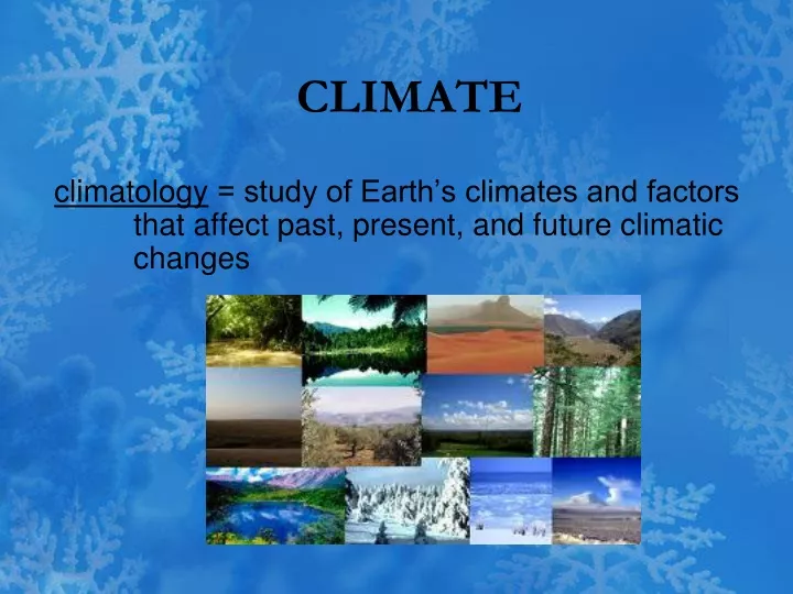
CLIMATE climatology = study of Earth’s climates and factors that affect past, present, and future climatic changes
climate = average of all weather conditions of an area over a long period of time 1. conditions include average temperatures, air pressure, humidity, and days of sunshine for a period of 30 years 2. also defined by number of hours of sunlight; direction, speed, and steadiness of wind; occurrence of severe weather conditions and even amount of pollution 3. two main factors are temperature and precipitation 4. normals = determined by data gathered and averaged on monthly or annual basis for period of at least 30 years a. use with caution since weather conditions on any given day may differ widely from normal b. only apply to specific place where meteorological data were collected
5. average temperatures = used to find out how hot or cold a climate is a. found by adding two or more readings and dividing by number of readings b. calculated daily, monthly, and yearly 6. daily temperature range = difference between highest and lowest temperatures of day 7. yearly temperature range = difference between average of warmest month and coldest month
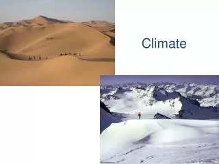
Factors that affect temperature: 1. latitude = distance in degrees (north or south) from equator a. areas close to equator receive most radiant energy → warm climates b. areas farther away from equator receive less radiant energy → colder climate c. tropics: receive most radiation d. polar zones: sun strikes at low angle which causes to receive low amounts of radiation
2. elevation (altitude) = distance (height) above sea level a. as get higher air becomes less dense b. can’t hold as much heat in air so it gets colder c. temperatures drop about 1oC for every 160 meters moving higher 3. ocean currents = water that flows in definite path in ocean a. surface temperature of water affects temperature of air above it b. land areas near warm water currents will have warmer temperatures c. those traveling away from equator are warm water currents d. those traveling toward the equator are cold water currents
Factors that affect precipitation (rainfall): 1. prevailing winds = wind that blows more often from one direction than from any other direction a. different winds carry different amounts of moisture b. warm air holds more moisture than cold air c. direction of prevailing wind affects the amount of moisture carried - winds that blow from water carry more moisture than those that blow from land
2. mountain ranges: acts as a barrier to prevailing winds a. causes air to rise and cool; when it cools it can’t hold moisture b. windward side = side facing toward wind 1) receives a lot of precipitation 2) has a wet climate c. leeward side = side facing away from wind 1) has little precipitation due to relatively dry air; dry climate 2) area is called a rain shadow 3) deserts common on this side of mountain 3. air masses: average weather conditions in and near regions of formation are similar to those exhibited by air mass a. dependent on whether form over land or water b. differences in amount of solar radiation due to distinct regions of origin
CLASSIFICATION Koeppen classification system = based on average monthly values of temperature and precipitation, also includes distinct vegetation found in different climates 1. developed by Wladimir Koeppen (Russian) 2. contains six major divisions: tropical, mild, dry, continental, polar, and high elevation 3. areas within the major climate zones will also be affected by precipitation 4. each zone can have various climatic types within Ex: continental, semiarid, mountain
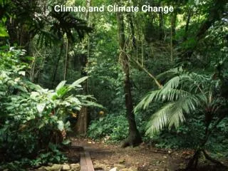
Major Division Characteristics: 1. tropical climates: extend 15o to 25o north and south from equator a. have warmest average yearly temperatures; no winter b. precipitation is usually very heavy; annual rainfall > 60 in. (152 cm) c. have high temperatures and high humidity d. constantly under influence of maritime tropical air e. have transition zones that border rainy tropics north and south of equator = tropical wet and dry zones f. includes savannas, grasslands, & deserts g. many deserts are located on the western coasts of continents Ex: Atacama Desert in Chile and Peru
2. dry climates: largest zone, covers ~30% of Earth’s land area a. exist 20o to 35o north and south of equator; often surrounded by mountains b. includes most of world’s deserts; cover 12% of Earth c. continental tropical (cT) air dominates d. low amounts of precipitation most months of year; vegetation is scarce e. two subtypes: deserts (arid regions) and steppes (semi- arid regions) 1) steppes = grassland that cover 14% of Earth surface 2) steppes are more humid than deserts, usually separate arid regions from bordering climates
3. mild climates: classified in 3 subtypes: humid subtropical climates, marine west coast climates, and Mediterranean climates a. humid subtropical climate: 1) influence by subtropical high pressure systems normally found over oceans in summer 2) warm, muggy weather prevails during warmer months and dry, cool conditions predominate during winter b. marine west coast climates 1) dominated by constant inland flow of air off ocean 2) creates mild winters and cool summers c. Mediterranean climates: found in Italy, parts of Spain, and other places 1) influenced by Mediterranean Sea 2) summers generally warm due to lack of cool ocean currents since Mediterranean Sea has relatively warm water temperatures
4: continental climates: classified in 3 subtypes: warm summer climates, cool summer climates, and subarctic climates a. located in zone dominated by polar front; have clashing tropical and polar air masses b. can experience rapid and sometimes violent changes in weather c. summer and winter temperatures can be extreme d. presence of warm, moist air causes summer to be generally wetter than winters
5. polar climates: ~66.5o north and south latitudes to poles; coldest regions on Earth a. year round cold temperatures; warmest month is < 10oC; no summer b. there is little precipitation c. loses energy to atmosphere due to reflection and large area d. in winter have constant heat loss when have 24 hours of darkness Ex: icecaps of Greenland; Antarctica 6. high elevations: variation of polar climate a. solar radiation is offset by decrease in temperature with altitude b. found in higher elevations of mountains (highlands and uplands)
SMALL SCALE CLIMATE CHANGES: microclimate = climate of a small area that differs from surrounding climate Ex: a) city compared to surrounding country area b) shopping mall c) your backyard heat islands = area where climate is warmer than in surrounding rural areas 1. can be created by presence of many concrete buildings and large expanses of asphalt 2. occurs because larges areas of asphalt and concrete radiate far more heat into air than do grasslands, wooded areas, and bodies of water 3. causes mean temperatures in large cities to be significantly warmer than in surrounding areas 4. can increase cloudiness and total precipitation in city
SHORT TERM CLIMATE CHANGES: seasons = short term periods of climatic change caused by regular variations in daylight, temperature, and weather patterns 1. reflect changes in amount of solar radiation reaching an area 2. tilt of Earth’s axis as it revolves around Sun causes different areas of Earth to receive different amounts of radiation 3. throughout year seasons are reversed in northern and southern hemisphere
El Nino = warm ocean current that occasionally develops off western coast of South America 1. high pressure system and its trade winds weaken drastically 2. allows warm water from western Pacific to surge eastward toward the South American coast 3. hot, moist air in upper atmosphere is responsible for dramatic climatic changes 4. allows jet stream to shift farther south, bringing violent storms to California and Gulf Coast 5. drought conditions are brought to areas which are normally wet 6. positive effect: can keep tropical disturbances from increasing to hurricane strength in Atlantic Ocean
LARGE SCALE CLIMATE CHANGES: 1. three natural factors responsible: slow drifting of continents, changes in sun’s energy output, variations in position of Earth relative to sun 2. ice ages = average global temperatures decreased by ~5oC a. global climates become colder and snowfall increases b. alternates with warm periods = interglacial intervals c. most recent ended 10,000 years ago 3. solar activity: a. Maunder minimum = period of very low sunspot activity b. less energy put out by sun when number of sunspots decrease or all disappear c. low activity can cause a cooling while increased activity coincides with warmer than normal climates
4. Earth’s orbit a. change in tilt of Earth’s axis (23.5o) and orbit b. orbit shape appears to change from elliptical to more elliptical, then more circular over 100,000 year cycle c. orbit elongates, Earth passes closer to Sun, temperatures become warmer than normal d. orbit more circular, Earth farther from Sun and temperatures dip below average e. axis tilt can vary from 22.1o to maximum of 24.5o every 41,000 years f. decrease in angle of tilt might cause decrease in temperature difference between winter and summer
5. Earth’s wobble a. over period of ~26,000 years, Earth wobbles as it spins on its axis b. currently axis points toward North Star, Polaris; due to wobble axis will tilt toward Vega by about year 14,000 6. volcanic activity: dust particles and acid droplets in upper atmosphere block solar energy a. due to explosive volcanic eruptions b. can stay suspended for 1 to 7 years
7. change in sizes and positions of oceans and continents a. affects wind patterns, ocean currents, and amount of solar energy reflected back to space from land and water b. when more land is covered with snow more sunlight is reflected back 8. greenhouse effect = natural heating of Earth’s surface caused by certain atmospheric gases a. heat trapped by gases in Earth’s atmosphere b. includes carbon dioxide, water vapor, methane, nitrous oxide, and chlorofluorocarbons (CFC’s) c. does help to keep planet warm so life can exist; but increases gases can cause planet to be too warm d. global warming = rise in global temperatures
HUMAN ACTIVITIES: 1. burning of fossil fuels (natural gas, petroleum, and coal) cause too much carbon dioxide and other gases to build up in atmosphere 2. deforestation = clearing of forests around the world a. plants help remove carbon dioxide b. burning of trees adds more carbon dioxide faster than plants and oceans can remove it