Download
1 / 17
170 likes | 172 Views
Learn how to seamlessly incorporate open source statistical packages, such as R and Python, into ArcGIS for advanced spatial analysis and data visualization. Explore the most useful tools and best implementation practices, including integrating Spatial Analyst, geostatistics, and spatial statistics. Access data modules, use advanced analysis techniques, and output feature classes with ease. Discover the benefits of the highly active community behind R and ArcGIS integration, with over 6000 libraries available.

E N D
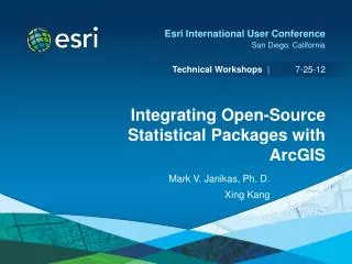
Integrating Open Source Statistical Packages with ArcGIS Mark V. Janikas Liang-Huan (Leo) Chin
Introduction • Traditional Spatial Analysis • Spatial Analyst • Geostatistics • Spatial Statistics • Most Useful Tools • Best Implementation
Spatial Analytics in ArcGIS: Moving Forward • Python • Spatial Analyst • Raster NumPy • SciPy • Spatial Statistics and Geostatistics • Data Access Module • Vector NumPy • Spatial Statistics Data Object and Utilities • Matplotlib, NetCDF4-Python • Effort to Support Scientific Community • SciPy, PANDAS, PySAL
The Great and Extendable Python • Direct • Numeric/Scientific Python Modules • http://wiki.python.org/moin/NumericAndScientific • +60 Modules Listed • Check Compatibility… Then Plug and Play • pip, GitHub, easy_install, svn • Unofficial Windows Binaries for Python Extensions – Christoph Gohlke, UC Irvine • http://www.lfd.uci.edu/~gohlke/pythonlibs/ • Conda Effort
Output Resulting Feature Class with Ease https://github.com/Esri/gis-stat-analysis-py-tutor
R Integration • Highly Active Community • Over 6000 Libraries • Old Method (Indirect) • Out of Proc • Python as the Glue • New Method • In Proc • Native Data Access • Honors Selection Sets and Projections • Vector Data • Charts and Graphs • GUI Interface
R-ArcGIS Links • https://r-arcgis.github.io • https://github.com/R-ArcGIS
Installation Via Python Toolbox R Package Manager
Sample Tools • Model Based Clustering • Spatial Statistical Data Analysis for GIS Users • Konstantin Krivoruchko, Esri Press • Tool Help/Documentation • Two More Examples to Come • Community
Moving Forward • Listen to our Users • Build the Best Tools Around • Support their Endeavors • Python • Aim to be Agnostic to Python Versioning • Conda • R • The Community Must Lead the Way