Download
1 / 24
240 likes | 364 Views
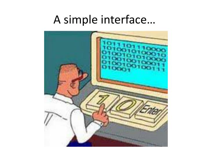
A simple interface…. Integrated CZO data system. Synthesizing information management experience and software from CZO partners and neighboring earth science projects into a standards-based system for publishing environmental data to emphasize the “critical zone” nature of our shared data sets.

E N D
Integrated CZO data system Synthesizing information management experience and software from CZO partners and neighboring earth science projects into a standards-based system for publishing environmental data to emphasize the “critical zone” nature of our shared data sets
CZO Data Publication System Local CZO DB Local CZO DB Local CZO DB CZO Data Repository and Indexing (CZO Central) External cross-project registries CZOData Products Standard CZO Services DataNet CZO Desktop Applications Harvester Ontology Archive Shared vocabularies CZO Metadata CZO Web-based Data Discovery System CZO Desktop Matlab R Standard CZO data display formats Excel Web site Web site Web site ArcGIS Modeling Spatial, hydrologic, geophysical, geochemical, imagery, spectral…
Local CZO DB Local CZO DB Local CZO DB Status of the prototype Hydrologic and meteorological time series CZO hydrologic themes CUAHSI HydroCatalog Water data services WaterML 1.x/2.0 CZO Desktop Applications CZO Web-based Data Discovery System Harvester Hydrologic Ontology Archive Shared vocabularies CZO Metadata HydroDesktop Matlab R Standard CZO data display formats Excel Web site Web site Web site ArcGIS OpenMI Hydrologic and meteorological stations
HISCentral Content (11/2010) 65public services 18,000+ variables 1.96+ million sites 23.3 million series Referencing 5.1 billion data values Map integrating NWIS, STORET, & Climatic Sites Available via HISCentraldiscovery services Available via GetValues requests
Federal Agency Water Data Services at HISCentral (10/2010) * Estimated
Growth in GetValues calls for all services reporting to HIS Central
Specifics of hydrologic data • Surface water • Spatially sparse, time series, regular measurements, with gaps • Timestamps important, accurate • Different temporal aggregations, different retention policies, QA levels (from raw data to different levels of processing) • Multi-parameter series; complex sites; multiple offsets • Groundwater level • Spatially dense, but often a single observation • Precise timestamp not critical (and sometimes approximate) • Precipitation time series • Many 0s, often sparse storage model is better • Water quality • Sparse in space and time • Managing samples is different; • Chemistry-analytical and biology-analytical • Complex ontologies of parameters and methods
Local CZO DB Local CZO DB Local CZO DB Geochemical Samples Depth-resolved geochemistry EarthChem Data Engine & Portal Geochemical web services, EarthChemML CZO Desktop Applications Harvester IGSN management Archive Shared vocabularies Metadata CZO Web-based Geochemical DB CZODesktop Matlab R Standard CZO data display formats Excel Web site Web site Web site ArcGIS Modeling Geochemical samples
CZO Web Services Model . . . WaterML 2.0 EarthChemML, EML,GeoSciML
Extending CUAHSI HIS for CZO requirements • New data publication model and Community Water Data Repository (at SDSC) • Extended controlled vocabularies (at Utah State) • HydroDesktop tuned to CZO data (at Idaho State)
CZO data publication model(vis-à-vis CUAHSI HIS) • CUAHSI HIS: • Install a HydroServer, then: This is done by local data managers • CZO: • Manage your own data system, and generate display files Attach Blank ODM Database Done behind the scenes Transform Raw Data Load Data into Database Community Water Data Repository Wrap Database with Web Service Register Web Service Harvest catalog, tag variables Tag variables, in rare cases Download Data Download Data
Extending CUAHSI HIS for CZO requirements • New data publication model and Community Water Data Repository (at SDSC) • Extended controlled vocabularies (at Utah State) • HydroDesktop tuned to CZO data (at Idaho State)
International Standardization of WaterML Hydrology Domain Working Group - working on WaterML 2.0 - organizing Interoperability Experiments focused on different sub-domains of water - towards an agreed upon feature model, observation model, semantics and service stack Iterative Development Timeline WaterML 2 RFC(Mar’11) Groundwater IE • GSC+USGS • Dec 09 – Dec 10 Surface Water IE • CSIRO+many • Jun 10 – Sep 11 Forecasting IE • NWS+Deltares? • Sep 11 – Sep 12? Water Quality IE Water Use IE Nov’10 http://external.opengis.org/twiki_public/bin/view/HydrologyDWG/WebHome
Interoperability Levels • Registration of “resources” (services and other), and search (e.g. with some portal) • Resources have some standard metadata (e.g. Dublin Core); otherwise they are managed by individual software; services are different. OGC services; each with GetCapabilities (e.g. services in GeoPortal) • Resources have additional levels of registration: spatial, temporal and semantic + some derived info (spatio-temporal frequency/resolution) • Resources have different content, but returned via standard services – services have compatible interfaces (e.g. OGC) • Compatible semantic and spatial tagging at the level of service content (i.e. individual observations) – different models, but time is in UTC, projection is specified, semantics is tagged (e.g. with IGSN) • Compatibility at the level of generic data models (i.e. everything follows a model of observation, like O&M) • Compatibility at the level of domain schemas/object models (e.g. WaterML/WaterML 2) • Compatibility at the level of databases (e.g. everything in ODM)
Standards • O&M: • Observation = act associated with a discrete time instant or period through which a number, term or other symbol is assigned to a phenomenon • Phenomenon = property of an identifiable object, which is the feature of interest of the observation • Observation uses a procedure (instrument, sensor, algorithm, etc.) • Observation has a result = estimate of the value of some property of the feature of interest • Observation: featureOfInterest & observedProperty & procedure & result
SOS • Observation Offering: specified by instances of observation, observed property, procedure and feature of interest • Operations: • getCapabilities (detailed info about Observation Offerings) • describeSensor • getObservation • Also a few optional requests, incl. getFeatureOfInterest, getResult • There is an SOS Lite profile (Simon Jirka, ChristophStasch) • Also: SOS Usage profile for the Hydrology Domain (Stefan Fuest) • Other: • Sensor planning service; sensor alert service, sensor event service,
WaterML 2.0 • WaterML 2.0 is an application schema of GML 3.2.1, which makes extensive use of the O&M specification (ISO 19156). • Describes: • observations (what/when/where/how/results/context); • time series (values/units/data types/data quality/accuracy/period of record/publisher and owner), • observation processes (sensors/algorithms/models/manual methods), • locations (stations and locations/operators/datums/types of observations/history/time zone/resources), • grouping of measuring locations (i.e. networks), • groupings of observations and time series.
How WaterML 2 restricts O&M • FOI of an observation can be a “spatial sampling feature” only (in most current cases, it is “WaterSamplingPoint”, which has a “shape” pointing to location or linking to respective representation of the point) • Result of an observation can be only TimeSeries as defined in WaterML2 (can be seen as a discrete coverage where the domain is a temporal axis and the range is all possible values of the ObservedProperty – usually represented as an ordered set of time-value pairs) • Observation procedure is restricted to WaterML2 “WaterObservationProcess” (types of processes include: sensor, algorithm, manual method, simulation, unknown) • Metadata is how it is described in “ObservationMetadata” (observation-specific metadata includes: intended sampling interval, status (e.g. validated, approved, provisional), sampled medium, maximum gap (determines whether two observations or series can be concatenated), and arbitrary name-value pairs for additional attributes (soft typed))
Some WaterML 2 discussion issues • Time series structures supported by WaterML 2.0, for different use cases. • for a single parameter time series, from regular measurements with no missing observations to extremely irregular measurements, and also accommodating additional value-level metadata • There are a few additional requirements, related to reporting timestamps for aggregate values and to reporting value accuracy/confidence. • Additional encoding requirements apply to multiple-parameter time series (accommodating regular or irregular time gaps and missing parameters, large numbers of grouped parameters, fixed or variable sets of parameters, etc. – ideally returning grouped parameters for each timestamp “in close XML document proximity”. • Lite encoding? Even lighter encoding? • Naming of classes. Currently the classes are named “WaterMonitoringObservation”, “WaterMonitoringPoint”, etc. • Dealing with missing values. It may be useful to distinguish missing values and absent values (absent = explicitly not found). • There are several vocabularies in use; they need to be harmonized for IEs to work. (out of scope for WaterML 2.0, but needs to be addressed at some level.)
Some SOS discussion issues • Making GetCapabilities response lightweight (compared to standard SOS usage where this request returns ObservationOfferings – which can be overwhelming for networks with large number of stations). In the proposed usage, FeatureOfInterest will be initially defined as the entire observation network. • Disambiguating key SOS terms such as procedure, observed property, feature of interest, offering. • Reconciling feature models: so far, SW IE is using the INSPIRE Hydrography data model. Need to see how it maps to NHD+. • SOS GetResults returning a lite version of time series (SOS allows this). GetResults is an optional SOS request, and can be customized to return just the values (almost no metadata) • Identifying some combination of WFS/WMS discovery calls, to compensate for GetCapabilities shortcomings (i.e. routing features via WFS GetFeature – though WFS aren’t fast either, and semantics needs to be settled). • Protocol support. SOS2 will provide both SOAP and REST (basically, the model we are moving to in HIS). In addition, exchange of CSV information should be supported (either based on SWE-Common or flat CSV files). • Better discovery support: retrieve sampling features given [station] name, code, HUC, other user-defined or standard polygon, bounding box, period of record, or other metadata; retrieve series given variables/location/POR; retrieve variables given locations and POR; retrieve procedures; etc. This is lacking in standard SOS, though SOS2 outlines a large list of optional service calls.