Download
1 / 10
100 likes | 246 Views
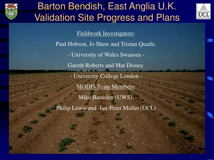
Barton Bendish, East Anglia U.K. Validation Site Progress and Plans. Fieldwork Investigators : Paul Hobson, Jo Shaw and Tristan Quaife. - University of Wales Swansea - Gareth Roberts and Mat Disney. - University College London - MODIS Team Members : Mike Barnsley (UWS).

E N D
Barton Bendish, East Anglia U.K.Validation Site Progress and Plans Fieldwork Investigators: Paul Hobson, Jo Shaw and Tristan Quaife. - University of Wales Swansea - Gareth Roberts and Mat Disney. - University College London - MODIS Team Members: Mike Barnsley (UWS). Philip Lewis and Jan-Peter Muller(UCL)
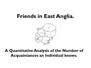
Barton Bendish Site Location The site is north of Cambridge close to F.C.-managed Thetford Forest
Utilisation of 1999 fieldwork data Method • TM data being used to land cover map East Anglia • ground data collected at sites across the region. • map ground measured parameters to l-cover map • spatial extrapolation methods. Results • Performed land cover mapping. • Purchasing `99 TM/ETM+ data (left) for 2 dates - July and September. • Complete in the next few months Landsat 5 TM scenes of East Anglia with land cover mapping sites indicated by red squares. (11th July 1999)
EOS Core Validation Site : Barton Bendish, Norfolk, UK • Site characteristics • heterogeneous at moderate resolution • negligible relief • limited number of agricultural cover types • Measured parameters • LAI (LAI-2000) • Albedo (Kipp and Zonen CNR-1 net radiometer) • % cover (35mm photography 50mm and hemispherical lenses) • Radiometry (ASD FR and PSII) • atmospheric parameters (Cimel Sunphotometer from NERC EPFS) • Other information • yield • crop varieties and planting dates • some treatment data Map of Barton Bendish (BB) farm indicating cover type and those fields where measurements are taken (denoted by a field number).
Field measurements made during the 1999 campaign Date of Location Cover type Measurements collection 14/0499 Farm Office ------------ Cimel 15/04/99 Field 110 Winter Wheat LAI 19/04/99 Farm Office ------------- Cimel 19/05/99 Fields 205, 206, 110 and Winter Barley, Peas, Winter Albedo, LAI, radiometry Farm Office Wheat and Cimel 20/05/99 Fields 309, 109, 224 and Sugarbeet, Spring Barley and Albedo, LAI, radiometry, % Farm Office Spring Beans cover and Cimel 26/05/99 Fields 224, 206, 205 and Spring Beans, Peas and Albedo, LAI, radiometry, % Farm Office Winter Barley cover and Cimel 27/05/99 Fields 105, 109, 104, 110, 224, Sugarbeet, Spring Barley, Albedo, LAI, radiometry, % 309 and Farm Office Winter Wheat and Spring cover and Cimel Beans 23/06/99 Fields 206 and 205 Peas and Winter Barley LAI and %cover 24/06/99 Fields 224, 309, 105, 109, 104 Sugarbeet, Spring Beans, LAI and %cover and 110 Spring Barley and Winter Wheat 30/06/99 Fields 105, 109, 206, 205, 110, Sugarbeet, Spring Barley, LAI, Cimel , radiometry and 104, 224, 309 & Farm Office Winter Barley, Winter albedo Wheat, and Spring Beans 21/07/99 Fields 309, 224, 206 and 205 Sugarbeet, Spring Beans, LAI and differential GPS at Peas and Winter Barley measurement locations 22/07/99 Fields 105, 110, 109 and 104 Sugarbeet, Winter Wheat, LAI and differential GPS and Spring Barley And measurement locations Note : the measurements given may not be available for each field on the given date, summaries are available @ http://ggpooh.swan.ac.uk/research.php3
Image data for `99 season • SPOT 4 VEGETATION • Number images = 478 • Latitude = 30N to 60N • Longitude = -11E to 11E • Projection = UTM • First date = 17/5/1999 • Last date = 01/10/1999 AVHRR HRPT (Still to be delivered from NERC) Cloud-free composite SPOT4-VGT data
Planned data buy for `99/00 season • 1 * TM 5 floating scene (Jul. 99) - awaiting delivery • 2 * ETM+ scene (Sept. 99) - awaiting delivery • 2-3 ETM+ scenes for `00 season on top of provision from MODLAND • Poss. SPOT-HRVIR scene • (with provision of 1 * ETM+ and 1 * Ikonos scene) Barton Bendish Thetford SPOT-4 HRVIR FCC July 11th 1999
`00 Fieldwork Plans • Sampling through growing season (April - August) • on site for 2 weeks every month OR • on site for 2/3 months during height of growing season; • measurements and sampling as for `99 growing season; • land cover • Airborne campaigns planned for April/May and June/July (proposal under consideration) • multi-angular data (ATM) and VIS/NIR hyperspectral (CASI) • use airborne data to provide independent estimates of BRDF and spectral/broadband albedo.
`00 Fieldwork Plans • Proposal submitted for X, C, L band polarimetric SAR (ESAR) and 350-2500nm hyperspectral (HYMAP) and LiDAR during either April/May or June/July • Airborne data to be used in providing independent estimates of the BRDF, broadband and spectral albedo over a 5 * 5km area for validation. Also used to map biophysical parameters to examine scaling issues and validate LC classification. • In addition to data purchased from MODLAND, further ETM+ scenes will be purchased to provide a temporal dataset through the growing season. • GSFC/Aeronet Cimel in situ (should be running off mains electricity after problems with batteries)
Further Information Database connections, current status, plans etc. are being made available online @ http://waimea.swan.ac.uk/ Established links for past work can be found @ http://ggpooh.swan.ac.uk http://ggentoo.swan.ac.uk http://www.geog.ucl.ac.uk/~groberts/