Download
1 / 4
40 likes | 174 Views
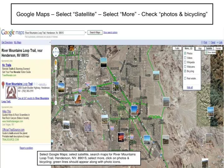
Google Maps – Select “Satellite” – Select “More” - Check “photos & bicycling”. Select Google Maps; select satellite, search maps for River Mountains Loop Trail, Henderson, NV. 89015; select more, click on photos & bicycling; green lines should appear along with photo icons.

E N D
Google Maps – Select “Satellite” – Select “More” - Check “photos & bicycling” Select Google Maps; select satellite, search maps for River Mountains Loop Trail, Henderson, NV. 89015; select more, click on photos & bicycling; green lines should appear along with photo icons.
Google Maps – Photo postings Place cursor over a photo and click; photo opens with title and owner; click on by nevhiker or view in Panoramio to see larger photo & more…
Google Maps – Trail Heads & Info To see trail heads turn on “What’s Around here?” under the “New” button. Little buttons pop up and a listing down left side appears. Hit review or “more info” & see what happens