Download
1 / 34
350 likes | 579 Views
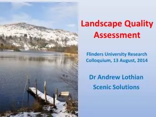
The Hertfordshire Landscape Character Assessment. Applications and implications. This presentation. Introduction to 2001-5 landscape character assessment How it differs from the predecessors Using landscape character assessments current applications potential applications

E N D
The Hertfordshire Landscape Character Assessment Applications and implications
This presentation • Introduction to 2001-5 landscape character assessment • How it differs from the predecessors • Using landscape character assessments • current applications • potential applications • implications of increased use
What is it? • process of looking at the landscape systematically, based on national guidance • analysis (physical,historical,cultural,social) • classification of landscape into types, or areas • careful description • evaluation - as a separate strand • leads to a mosaic of areas on a map and relevant information about each area
Why do it? • not a statutory requirement but… • promoted by Countryside Commission/ Agency • strongly encouraged by PPG7 & GPG • regarded as an improved basis for strategy/policy for the wider landscape • seems to be popular with stakeholders and other authorities, e.g. CPRE, HBF
Who is involved? • Nationally: Countryside Agency has produced guidance on methodology • Locally: • County & District councils • Landscape planning consultants • Community representatives • Very locally: Town/Parish Councils & Developers
How much has been done so far? 67% rural Herts since 2001 100% by 2005
What does an area statement look like? See http://www.hertsdirect.org/landscape
Why the latest assessments are better than their predecessors
Testing landscape change for impact on landscape character Just one example: Tewin plotlands
This is what the character description says • A consistent parkland character overlies any change in topography throughout this sinuous ribbon of floodplain pasture and woodland. Twentieth-century development and the busy transport network mask this character in some places.
These should be the key characteristics • ribbon of floodplain pasture/woodland • isolated farms/mills along + on slope foot • dense boundary planting stopping views • limited commercial diversification in valley • pasture in river valley with some arable • arable on gentle valley slopes • abrupt transition to urban edge
This is the expected field pattern • Field boundaries are either estate fencing or overgrown hedgerows, usually of oak or ash. Boundaries are more often oak or ash copses or plantation, to screen views in, frequently mature or over-mature. Field sizes vary from small (pasture) to medium (arable).
This is what the community thinks • This is a distinctive and valued valley landscape. (HCC/MORI survey 2001) • 'The whole of the beautiful valley from Welwin (sic) to Hertford, including Digswell, Tewin Water, Panshanger and Cole Green, belonging to the same noble family...while each possesses its independent privacy and seclusion, their united woods and lawns will by extending through the whole valley, enrich the general face of the county.'(Repton)
These are the strategic guidelines • protect historic parkland character • screen from neighbouring development • retain and manage pasture • maintain watercourse and riverbanks • link wetland habitats • support agri-environmental schemes
But this is what plotlands do • Reduce the validity of character summary • Affect more than 2 key characteristics • Introduce an untypical field pattern • add nothing towards the strategic guidelines • affect a significant part of Area 42 VERDICT: Plotlands are not in character
Some limitations of character approach • Reliant on planning context including • extent of Article 4 declarations, • uptake by change agents (e.g landowners, DEFRA) and regulators • community support • Incomplete coverage (e.g. nr Stansted, and urban areas)
What are they being used for? • Advise Local plan policy • Provide a context for other documents (e.g. WCCF Plans, Parish Plans, EIAs) • Countryside Interpretation • Helping classify the suitability of areas for mineral extraction (this required a further evaluation stage undertaken by HCC’s CDU)
What else might they be used for? • Educating e.g. re. historic environment • Informing AONB action plans • Storing other data • Inspiring local “Friends” groups or area wardens (?)
Some implications • Early to say, but • New lease of life for landscape policies; there was no “do nothing” option • Systematic & inclusive = more acceptable • Detailed and networked data resource • Offers win-win “sustainable” solutions • May lead to better designated areas