Download
1 / 16
160 likes | 258 Views
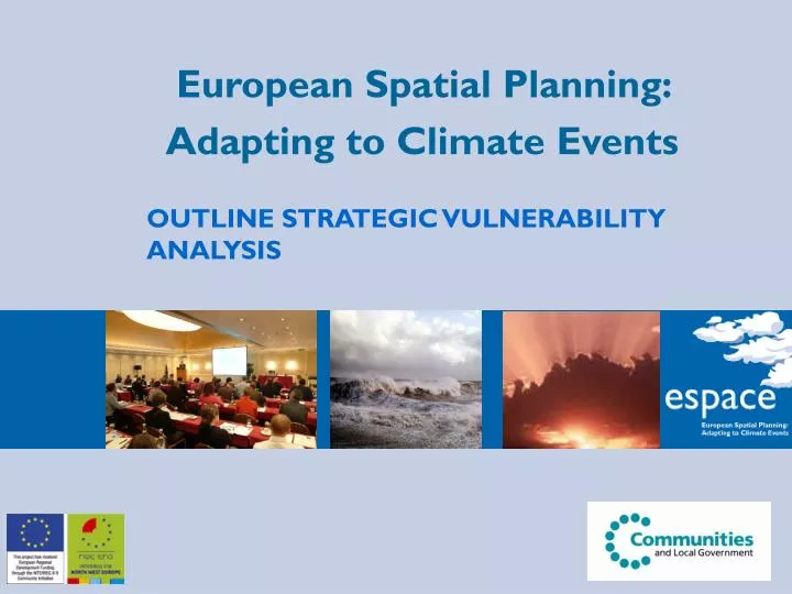
European Spatial Planning: Adapting to Climate Events. OUTLINE STRATEGIC VULNERABILITY ANALYSIS. OUTLINE STRATEGIC VULNERABILITY ANALYSIS (illustrated as part of a National Spatial Planning Flow Diagram with an emphasis on Water Management). Before the plan process begins.

E N D
European Spatial Planning: Adapting to Climate Events OUTLINE STRATEGIC VULNERABILITY ANALYSIS
OUTLINE STRATEGIC VULNERABILITY ANALYSIS (illustrated as part of a National Spatial Planning Flow Diagram with an emphasis on Water Management) Before the plan process begins To achieve truly ‘sustainable development’, make climate change adaptation a core activity in spatial planning CC adds an extra dimension to planning - it can challenge basic assumptions on availability of land (change the shape of the country) and its uses over medium and long term. Adopt 2 main approaches :- Change & Risk Management Prepare to review national planning laws, policies, codes etc to ensure climate risks are considered over whole of the decision lifetime
At the start of the Plan making process Carry out high level national vulnerability analysis and if necessary develop national view of where fundamental change is needed. (Need to do a VA first to inform development of national spatial plan) Eg National Flood risk Assessment (although scope will need to be widened)
National Vulnerability Analysis Will CC affect basic assumptions of your plan because it is such a fundamental issue? Do reality check for worst-case CC effects - Could there be limits to adaptation? Proceed to step x No Eg NW little low lying land - low vulnerability to water shortage Eg E Anglia low lying land - vulnerability to water shortage Yes Identify Critical adaptation thresholds eg what responses to coastal flood risk management will cease to be effective given x metres sea level rise Eg Case Study TE2100 Thames Estuary limit is x metres sea level rise.
National Vulnerability Analysis continued down ‘Yes’ branch Eg East Anglia - is it strategic national food resource? can it be defended given x metres sea level rise? Identify preferred approach to critical end game issues (i.e. Doing the ‘big thinking’.) Eg Identify preferred areas for migration in long term bear in mind migration from EC as result of CC (nomadic planning) Feed results into nationalspatial plan making or develop national outline adaptive plan?
Tested through SEA Plan Making Set objectives for plan to include CC adaptation Plan Strategy that can adapt to different futures if indicated by vulnerability. (i.e. decision ‘pipelines’ approach to managing uncertainty) Eg Case Study TE2100High level options relate to differing rates of change of CC Implementation would be delegated to regions through Regional Spatial Strategies
TE2100 CASE STUDY • Project has established the effectiveness of different responses - over time - related to thresholds of risk eg sea level rise - in different parts of the estuary - in different combinations (portfolios)
Acceptable level of risk Managing Flood Risk through the century Risk Time 2100 2006 2050
Max water level rise: 0m 1m 2m 4m 3m Route 1 Improve Thames Barrier and raise d/s defences Route 2 Over-rotate Thames Barrier and raise d/s defences Flood storage, improve Thames Barrier, raise u/s & d/s defences Existing system Flood storage, over rotate Thames Barrier, raise d/s defences Raise Defences Flood storage, raise d/s defences Route 3a New barrier, retain Thames Barrier, raise defences Route 3b New barrier, raise defences Route 4 New barrage Note: Each box represents one or more portfolios of responses The arrows indicate paths for adapting options for different sea level ranges
Max water level rise: 2050 2100 0m 1m 2m 4m 3m All four Routes suitable in 2100 Route 1 Improve Thames Barrier and raise d/s defences Route 2 Over-rotate Thames Barrier and raise d/s defences Flood storage, improve Thames Barrier, raise u/s & d/s defences Existing system Flood storage, over rotate Thames Barrier, raise d/s defences Raise Defences Flood storage, raise d/s defences Route 3a New barrier, retain Thames Barrier, raise defences Route 3b New barrier, raise defences Route 4 New barrage Medium High Climate Change Scenario Note: Each box represents one or more portfolios of responses The arrows indicate paths for adapting options for different sea level ranges
Max water level rise: 2050 2100 0m 1m 2m 4m 3m All four Routes suitable in 2100 Route 1 Improve Thames Barrier and raise d/s defences Route 2 Over-rotate Thames Barrier and raise d/s defences Flood storage, improve Thames Barrier, raise u/s & d/s defences Existing system Flood storage, over rotate Thames Barrier, raise d/s defences Raise Defences Flood storage, raise d/s defences Route 3a New barrier, retain Thames Barrier, raise defences Route 3b New barrier, raise defences Route 4 New barrage Alternative Routes for achieving the plan Medium High Climate Change Scenario Note: Each box represents one or more portfolios of responses The arrows indicate paths for adapting options for different sea level ranges
Max water level rise: 2050 2100 0m 1m 2m 4m 3m Only Route 4 suitable in 2100 (unless SoP reduced) Route 1 Improve Thames Barrier and raise d/s defences Route 2 Over-rotate Thames Barrier and restore interim defences Flood storage, improve Thames Barrier, raise u/s & d/s defences Existing system Flood storage, over rotate Thames Barrier, raise u/s & d/s defences Raise Defences Flood storage, restore interim defences Route 3a New barrier, retain Thames Barrier, raise defences Route 4 Route 3b New barrier, raise defences New barrage High++ Climate Change Scenario Note: Each box represents one or more portfolios of responses The arrows indicate paths for adapting options for different sea level ranges
Max water level rise: 2050 2100 0m 1m 2m 4m 3m Only route 4 suitable in 2100 (unless SoP reduced) Route 1 Improve Thames Barrier and raise d/s defences Route 2 Over-rotate Thames Barrier and restore interim defences Flood storage, improve Thames Barrier, raise u/s & d/s defences Existing system Flood storage, over rotate Thames Barrier, raise u/s & d/s defences Raise Defences Flood storage, restore interim defences Route 3a New barrier, retain Thames Barrier, raise defences Route 4 Route 3b New barrier, raise defences New barrage The final plan could be a combination of options High++ Climate Change Scenario Note: Each box represents one or more portfolios of responses The arrows indicate paths for adapting options for different sea level ranges