Download
1 / 31
320 likes | 595 Views
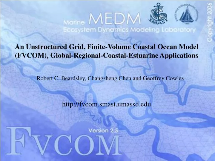
An Unstructured Grid, Finite-Volume Coastal Ocean Model (FVCOM), Global-Regional-Coastal-Estuarine Applications. Robert C. Beardsley, Changsheng Chen and Geoffrey Cowles. http://fvcom.smast.umassd.edu. Outline. Introduction to FVCOM Multiscale applications

E N D
An Unstructured Grid, Finite-Volume Coastal Ocean Model (FVCOM), Global-Regional-Coastal-Estuarine Applications Robert C. Beardsley, Changsheng Chen and Geoffrey Cowles http://fvcom.smast.umassd.edu
Outline Introduction to FVCOM Multiscale applications Northeastern Regional Association of Coastal Ocean Observing Systems (NERACOOS) - Northeast Coastal Ocean Forecast System (NECOFS) - Inundation Pilot Study (with NWS) (Scituate, MA; Saco, ME) - Water Quality (DO) (Long Island Sound) - Observing system design experiments Recent FVCOM developments NECOFS needs Summary
Critical Issues in Coastal Ocean Modeling Irregular geometry Mass Conservation ? Steep topography Intertidal wetlands
FDM i i+1 x Finite-Difference, Finite-Element and Finite-Volume Methods (FDM, FEM, FVM) FEM FVM Integration Difference Variation
F F u,v u,v u,v F F F u,v u,v u,v F F y u,v u,v u,v u,v FVCOM: Unstructured-grid, Finite-Volume Coastal Ocean Model (Chen, C. R. H. Liu and R. C. Beardsley, JAOT, 2003) • All variables are computed in the integral form of the equations, which provides a better representation of the conservative laws of mass, momentum and heat in the coastal region with complex geometry. • The numerical computational domain consists of non-overlapping unstructured cells. • Combines the best from the finite-element method for the geometric flexibility and finite difference method for the simplest discrete computation. • Both current and tracer remain the second-order accuracy.
Upgrading: non-hydrostatic version and semi-implicit version
Pan-Arctic Ocean FVCOM In the region where the mean water is deeper or equal to 100 m, 10 same thickness layers in the upper 30 m (with a layer thickness from 2 to 5 m) and 5 same thickness layers in the lower 25 m above the bottom. Driven by the OMIP-Forcing-the sixth version and the model starts run at January 1 with the wintertime fields of water temperature and salinity. The water temperature and salinity data were from polar science center Hydrographic Climatology (PHC) version 3.0. The region north of 65oN is covered by the ice with a thickness of 2.5 m everywhere at initial
Horizontal resolution: 0.3-1.0 km in the coastal region; • Generalized terrain-following coordinates: 46 layers: 10 uniform layers in the surface and bottom boundary layers, respectively. • 1500 m cutoff off Georges Bank • Capable to nest to the coasta-estuarine model with a horizontal resolution of ~10 -500 m;
NE Weather Models being used to drive ocean models URLs: Stony Brook U: http://atmos.msrc.sunysb.edu/mm5rt Stony Brook U: http://chaos.msrc.sunysb.edu/NEUS/nwp_graphics.html UMassD: http://fvcom.smast.umassd.edu/research_projects/GB/mm5/index.html UMassD: http://fvcom.smast.umassd.edu/research_projects/GB/WRF/index.html UNH-AER: http://www.jcoot.unh.edu/forecasts/forecasts.html UMaine: - http://www.gomoos.org/
Regional Domain: 9km Domain 2 Domain 1 Domain 3 Domain 2 Large domain: 27km Domain 3 Hindcast Local domain: 3 km
NECOFS Model Flow Diagram: 1.0 Stage: 1 (midnight) Crontab starts NECOFS Day 0 ~ now Day# -10 -5 -4 -3 -2 -1 0 1 2 3 wrf forecast data wrf hindcast data fvcom data (results) river data sst data (Previous Hindcast) (Previous Forecast) 1: 2: 3: Current Process
NECOFS Model Flow Diagram: 1.0 Stage: 2 (midnight) Update River Data Day# -10 -5 -4 -3 -2 -1 0 1 2 3 wrf forecast data wrf hindcast data fvcom data (results) river data sst data (Previous Hindcast) (Previous Forecast) 1: Download USGS data and update data file 2: 3: Current Process
NECOFS Model Flow Diagram: 1.0 Latest available SST data is already several days old Stage: 3 (00:10) Update SST Data Day# -10 -5 -4 -3 -2 -1 0 1 2 3 wrf forecast data wrf hindcast data fvcom data (results) river data S 2 sst data (Previous Hindcast) (Previous Forecast) 1: Download JPL SST and update OI assim 2: 3: Current Process
NECOFS Model Flow Diagram: 1.0 Continuous WRF data archive is automatically updated with new results Stage: 4 (00:15) Run WRF Day# -10 -5 -4 -3 -2 -1 0 1 2 3 wrf forecast data wrf hindcast data fvcom data (results) river data S 2 sst data (Previous Hindcast) (Previous Forecast) S 3 1: WRF Forecast 2: WRF Hindcast 3: Current Process
NECOFS Model Flow Diagram: 1.0 FVCOM overwrites old results updating time period of new WRF data. Stage: 5 (08:00) Start FVCOM hindcast Day# -10 -5 -4 -3 -2 -1 0 1 2 3 wrf forecast data (Still running) wrf hindcast data S 4 fvcom data (results) river data S 2 sst data (Previous Hindcast) (Previous Forecast) S 3 1: WRF Forecast 2: FVCOM Hindcast 3: Current Process
NECOFS Model Flow Diagram: 1.0 FVCOM forecast runs till end of available WRF data Stage: 6 (11:00) Start FVCOM Forecast Day# -10 -5 -4 -3 -2 -1 0 1 2 3 wrf forecast data S 5 wrf hindcast data S 4 fvcom data (results) S 5 river data S 2 sst data (Previous Hindcast) (Previous Forecast) S 3 1: FVCOM Forecast 2: 3: Current Process
NECOFS Model Flow Diagram: 1.0 New Results are Automatically posted to the web site! Stage: 7 (12:00) NECOFS Forecast Finished! Day# -10 -5 -4 -3 -2 -1 0 1 2 3 wrf forecast data S 5 wrf hindcast data S 4 fvcom data (results) S 5 S 6 river data S 2 sst data (Previous Hindcast) (Previous Forecast) S 3 1: 2: 3: Current Process
Recent Developments Unstructured-grid finite-volume version of CICE model (CICE-ug) – (for Arctic Ocean applications) Unstructured-grid finite-volume version of SWAN (ug-SWAN) Non-hydrostatic version of FVCOM (NH-FVCOM) (uses parallelized scalable sparse matrix solver library (PETSc) and high performance pre-conditional HYPRE software library) Semi-implicit version of FVCOM (significant speed-up factor of ~10-20)
NECOFS Needs • Surface atmospheric forcing: • - Basic: winds, Ta, RH, Pa, P, SST, SW & LW radiation, PAR • - Derived: wind stress, heat flux (Qsw,Qlw,Qsen,Qlat), P-E • [ARW; COARE3; AVHRR, ISCCP, FLASHFlux (?)] • 2. Boundary conditions for regional coastal ocean model from basin/global models: surface waves [WAVEWATCH]; surface elevation, T,S, currents, …[…..] • 3. Coastal boundary conditions: watershed flux of water and nutrients into coastal ocean via surface discharge and groundwater [USGS, UNH NE watershed model system]
Summary Unstructured-grid finite-volume model (FVCOM) system provides a new community tool to nest global-regional-coastal-estuarine system together, suitable for ocean application, particularly for coastal environmental hindcast/forecast and ecosystem research. NECOFS are in operation, for more information, visit FVCOM website: http://fvcom.smast.umassd.edu