Download
1 / 13
130 likes | 354 Views
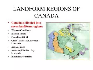
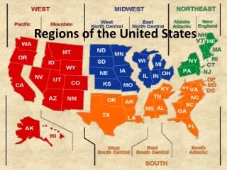
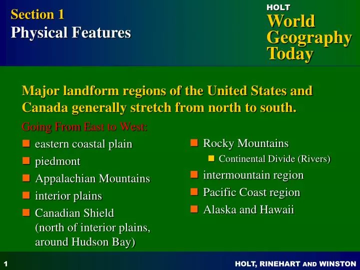
Going From E ast to West: eastern coastal plain piedmont Appalachian Mountains interior plains Canadian Shield (north of interior plains, around Hudson Bay). Rocky Mountains Continental Divide (Rivers) intermountain region Pacific Coast region Alaska and Hawaii.

E N D
Going From East to West: eastern coastal plain piedmont Appalachian Mountains interior plains Canadian Shield (north of interior plains, around Hudson Bay) Rocky Mountains Continental Divide (Rivers) intermountain region Pacific Coast region Alaska and Hawaii Section 1 Physical Features Major landform regions of the United States and Canada generally stretch from north to south.
CHAPTER 7 Natural Environments of North America Section 1: Physical Features Section 2: Climates and Biomes Section 3: Natural Resources
Section 1 Physical Features Bodies of water: • Major river systems (East and West) East Rivers: • Mississippi, Missouri, and Ohio Rivers Western rivers: • Colorado, Columbia, Fraser, Yukon • Major lakes • Great Lakes
Climates Of North America • Middle Latitude location, oceans, prevailing winds, mountains affect the climate of the United States • The Interior Plains/Great Plains has violent storms that produce natural hazards (Tornadoes, Thunderstorms)
Section 2Climates and Biomes Climates • tropical wet and dry—southern tip of Florida, parts of Hawaii • humid subtropical—most of southeastern U.S. • humid continental—northeastern U.S., southern and southeastern Canada • semi-arid—Great Plains, parts of intermountain region • highland—Rocky Mountains
Section 2 Climates and Biomes Climates (continued) • marine west coast—southeastern Alaska to northern California • Mediterranean—southern and central California • tropical humid—parts of Hawaii • tundra—far northern North America • subarctic—most of Canada and Alaska
Section 3 Natural Resources Farming, forest, and water resources: • Farming • abundant production of crops and livestock • Major Crops= Corn, Wheat, Soybeans, Cotton • Forests • US/Canada are leading producers of wood and paper • major U.S. forests in southeast and northwest • Water • plentiful supplies (Except SW U.S.) • irrigation and hydroelectric power • coastal waters rich in marine life (Alaska, Grand Banks)
Section 3 Natural Resources Energy resources are abundant in both the U.S. and Canada!!! • coal—good supply in both countries; U.S. has a large percentage of world total (25%) • oil and natural gas—also plentiful, but U.S. uses more oil than it produces • U.S. Oil in Texas, Gulf of Mexico, Alaska • Canada Oil is found mainly in Alberta
Section 3 Natural Resources Mineral resources are abundant in both the U.S. and Canada. • Canada is rich in nickel, zinc, and uranium—especially in the Canadian Shield—and also produces lead, copper, gold, and silver. • U.S. has valuable deposits of iron, copper, lead, zinc, gold, and silver. • -Nevada has major deposits of Gold and Silver